Monticello elevation
Monticello (Lombardy, Provincia di Lecco), Italy elevation is 373 meters and Monticello elevation in feet is 1224 ft above sea level [src 1]. Monticello is a seat of a third-order administrative division (feature code) with elevation that is 51 meters (167 ft) bigger than average city elevation in Italy.
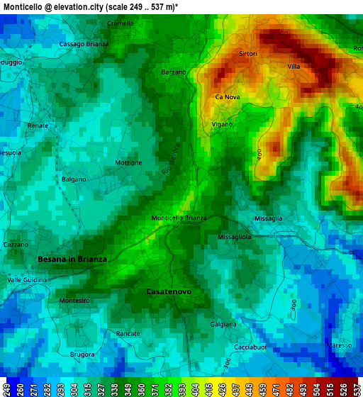
Below is the Elevation map of Monticello, which displays elevation range with different colors. Scale of the first map is from 249 to 537 m (817 to 1762 ft) with average elevation of 339.2 meters (=1113 ft) [note 1]
These maps also provides idea of topography and contour of this city, they are displayed at different zoom levels. More info about maps, scale and edge coordinates you can find below images.
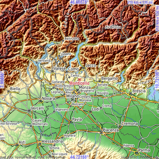
| \ | Map #1 | Topo.Map |
| Scale [m] | 249..537 m | × |
| Scale [ft] | 817..1762 ft | × |
| Average | 339.2 m = 1113 ft | × |
| Width | 6.82 km = 4.2 mi | 218.4 km = 135.7 mi |
| Height | 6.82 km = 4.2 mi | 218.3 km = 135.6 mi |
| ↑Max Latitude | 45.743117° | 46.68575° |
| Latitude at center | 45.71244° | 45.71244° |
| ↓Min Latitude | 45.681746° | 44.72188° |
| ← Min Longitude | 9.270865° | 7.90856° |
| Longitude center | 9.31481° | 9.31481° |
| →Max Longitude | 9.358755° | 10.72106° |
Nearby cities:
Cities around Monticello sort by population:
• Besana in Brianza elevation 347 m
1.9 km,  234°
234°
• Casatenovo 356 m
1.9 km,  183°
183°
• Missaglia 302 m
1.7 km,  112°
112°
• Barzanò 370 m
2.2 km,  357°
357°
• Rogoredo-Valaperta-Rimoldo 279 m
4.2 km,  160°
160°
• Cassago Brianza 323 m
3.3 km,  329°
329°
• Monticello Brianza 381 m
0.3 km,  168°
168°
• Renate 312 m
3 km,  296°
296°
• Viganò 394 m
1.6 km,  30°
30°
• Sirtori 461 m
3 km,  24°
24°
• Maresso 290 m
4.2 km,  130°
130°
• Cremella 360 m
3.1 km,  339°
339°
Multilingual:
 En español:
Monticello elevación 373 m.
 En France:
Monticello élévation 373 m.
 Auf Deutsch:
Monticello höhe über dem Meeresspiegel ist 373 m.

Sources and notes:
- [note 1] Map square and city borders are not equal. Map elevation data is calculated only from area inside that square.
- [src 1] Elevation data from geonames database provided with same terms of usage.
- [src 2] The elevation map of Monticello is generated using elevation data from NASA's 3 arcsec (90m) resolution SRTM data.
- [src 3] Base (background) map © OpenStreetMap contributors tiles are generated by Geofabrik and OpenTopoMap.
Copyright & License:
This Monticello Elevation Map is licensed under CC BY-SA. You may reuse any part from this page, if you give a proper credit by linking to this URL:
 More info on terms of use page.