Cremella elevation
Cremella (Lombardy, Provincia di Lecco), Italy elevation is 360 meters and Cremella elevation in feet is 1181 ft above sea level [src 1]. Cremella is a seat of a third-order administrative division (feature code) with elevation that is 38 meters (125 ft) bigger than average city elevation in Italy.
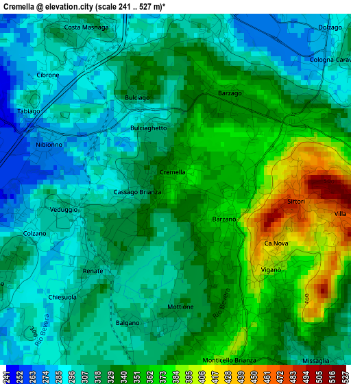
Below is the Elevation map of Cremella, which displays elevation range with different colors. Scale of the first map is from 241 to 527 m (791 to 1729 ft) with average elevation of 328.2 meters (=1077 ft) [note 1]
These maps also provides idea of topography and contour of this city, they are displayed at different zoom levels. More info about maps, scale and edge coordinates you can find below images.
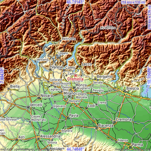
| \ | Map #1 | Topo.Map |
| Scale [m] | 241..527 m | × |
| Scale [ft] | 791..1729 ft | × |
| Average | 328.2 m = 1077 ft | × |
| Width | 6.82 km = 4.2 mi | 218.3 km = 135.6 mi |
| Height | 6.82 km = 4.2 mi | 218.2 km = 135.6 mi |
| ↑Max Latitude | 45.769242° | 46.71143° |
| Latitude at center | 45.73858° | 45.73858° |
| ↓Min Latitude | 45.707901° | 44.74848° |
| ← Min Longitude | 9.256695° | 7.89439° |
| Longitude center | 9.30064° | 9.30064° |
| →Max Longitude | 9.344585° | 10.70689° |
Nearby cities:
Cities around Cremella sort by population:
• Barzanò elevation 370 m
1.2 km,  123°
123°
• Veduggio Con Colzano 299 m
2.4 km,  257°
257°
• Cassago Brianza 323 m
0.6 km, 264°
• Renate 312 m
2.3 km,  225°
225°
• Monticello 373 m
3.1 km,  159°
159°
• Bulciago 286 m
1.8 km,  318°
318°
• Barzago 354 m
2.2 km,  29°
29°
• Viganò 394 m
2.4 km,  129°
129°
• Sirtori 461 m
2.4 km,  95°
95°
• Tabiago-Cibrone 293 m
3.3 km,  307°
307°
• Nibionno 275 m
2.6 km,  289°
289°
• Brongio 295 m
3.1 km,  17°
17°
Multilingual:
 En español:
Cremella elevación 360 m.
 En France:
Cremella élévation 360 m.
 Auf Deutsch:
Cremella höhe über dem Meeresspiegel ist 360 m.

Sources and notes:
- [note 1] Map square and city borders are not equal. Map elevation data is calculated only from area inside that square.
- [src 1] Elevation data from geonames database provided with same terms of usage.
- [src 2] The elevation map of Cremella is generated using elevation data from NASA's 3 arcsec (90m) resolution SRTM data.
- [src 3] Base (background) map © OpenStreetMap contributors tiles are generated by Geofabrik and OpenTopoMap.
Copyright & License:
This Cremella Elevation Map is licensed under CC BY-SA. You may reuse any part from this page, if you give a proper credit by linking to this URL:
 More info on terms of use page.