Brongio elevation
Brongio (Lombardy, Provincia di Lecco), Italy elevation is 295 meters and Brongio elevation in feet is 968 ft above sea level [src 1]. Brongio is a populated place (feature code) with elevation that is 27 meters (89 ft) smaller than average city elevation in Italy.
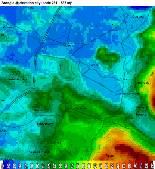
Below is the Elevation map of Brongio, which displays elevation range with different colors. Scale of the first map is from 231 to 537 m (758 to 1762 ft) with average elevation of 310.9 meters (=1020 ft) [note 1]
These maps also provides idea of topography and contour of this city, they are displayed at different zoom levels. More info about maps, scale and edge coordinates you can find below images.
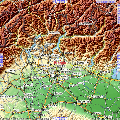
| \ | Map #1 | Topo.Map |
| Scale [m] | 231..537 m | × |
| Scale [ft] | 758..1762 ft | × |
| Average | 310.9 m = 1020 ft | × |
| Width | 6.82 km = 4.2 mi | 218.2 km = 135.6 mi |
| Height | 6.82 km = 4.2 mi | 218.1 km = 135.5 mi |
| ↑Max Latitude | 45.795998° | 46.73773° |
| Latitude at center | 45.76535° | 45.76535° |
| ↓Min Latitude | 45.734685° | 44.77572° |
| ← Min Longitude | 9.268565° | 7.90626° |
| Longitude center | 9.31251° | 9.31251° |
| →Max Longitude | 9.356455° | 10.71876° |
Nearby cities:
Cities around Brongio sort by population:
• Cassago Brianza elevation 323 m
3.4 km,  206°
206°
• Costa Masnaga 312 m
2.8 km,  279°
279°
• Bulciago 286 m
2.7 km,  232°
232°
• Molteno 271 m
1.6 km,  334°
334°
• Dolzago 285 m
2.1 km,  85°
85°
• Barzago 354 m
1.1 km,  173°
173°
• Castello di Brianza 307 m
2.6 km,  104°
104°
• Garbagnate Monastero 301 m
1.2 km,  316°
316°
• Sirone 274 m
1.1 km,  42°
42°
• Cremella 360 m
3.1 km,  197°
197°
• Cologna-Caraverio 306 m
2.8 km,  111°
111°
• Garbagnate 288 m
1.2 km,  296°
296°
Multilingual:
 En español:
Brongio elevación 295 m.
 En France:
Brongio élévation 295 m.


Sources and notes:
- [note 1] Map square and city borders are not equal. Map elevation data is calculated only from area inside that square.
- [src 1] Elevation data from geonames database provided with same terms of usage.
- [src 2] The elevation map of Brongio is generated using elevation data from NASA's 3 arcsec (90m) resolution SRTM data.
- [src 3] Base (background) map © OpenStreetMap contributors tiles are generated by Geofabrik and OpenTopoMap.
Copyright & License:
This Brongio Elevation Map is licensed under CC BY-SA. You may reuse any part from this page, if you give a proper credit by linking to this URL:
 More info on terms of use page.