Garbagnate Monastero elevation
Garbagnate Monastero (Lombardy, Provincia di Lecco), Italy elevation is 301 meters and Garbagnate Monastero elevation in feet is 988 ft above sea level [src 1]. Garbagnate Monastero is a seat of a third-order administrative division (feature code) with elevation that is 21 meters (69 ft) smaller than average city elevation in Italy.
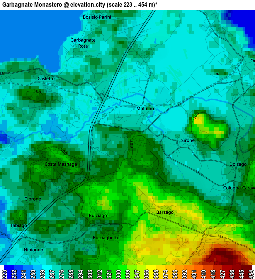
Below is the Elevation map of Garbagnate Monastero, which displays elevation range with different colors. Scale of the first map is from 223 to 454 m (732 to 1490 ft) with average elevation of 288.6 meters (=947 ft) [note 1]
These maps also provides idea of topography and contour of this city, they are displayed at different zoom levels. More info about maps, scale and edge coordinates you can find below images.
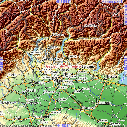
| \ | Map #1 | Topo.Map |
| Scale [m] | 223..454 m | × |
| Scale [ft] | 732..1490 ft | × |
| Average | 288.6 m = 947 ft | × |
| Width | 6.82 km = 4.2 mi | 218.1 km = 135.5 mi |
| Height | 6.82 km = 4.2 mi | 218.1 km = 135.5 mi |
| ↑Max Latitude | 45.804023° | 46.74561° |
| Latitude at center | 45.77338° | 45.77338° |
| ↓Min Latitude | 45.74272° | 44.7839° |
| ← Min Longitude | 9.257495° | 7.89519° |
| Longitude center | 9.30144° | 9.30144° |
| →Max Longitude | 9.345385° | 10.70769° |
Nearby cities:
Cities around Garbagnate Monastero sort by population:
• Costa Masnaga elevation 312 m
2 km,  257°
257°
• Bosisio Parini 273 m
3.2 km,  343°
343°
• Bulciago 286 m
2.8 km,  206°
206°
• Rogeno 294 m
2.3 km,  295°
295°
• Molteno 271 m
0.6 km,  19°
19°
• Dolzago 285 m
3 km,  103°
103°
• Barzago 354 m
2.2 km,  153°
153°
• Castello di Brianza 307 m
3.7 km,  114°
114°
• Sirone 274 m
1.6 km,  92°
92°
• Tabiago-Cibrone 293 m
3.3 km,  234°
234°
• Garbagnate 288 m
0.4 km, 213°
• Brongio 295 m
1.2 km,  136°
136°
Multilingual:
 En español:
Garbagnate Monastero elevación 301 m.
 En France:
Garbagnate Monastero élévation 301 m.
 Auf Deutsch:
Garbagnate Monastero höhe über dem Meeresspiegel ist 301 m.
 На русском:
Garbagnate Monastero высота над уровнем моря 301 м
Sources and notes:
- [note 1] Map square and city borders are not equal. Map elevation data is calculated only from area inside that square.
- [src 1] Elevation data from geonames database provided with same terms of usage.
- [src 2] The elevation map of Garbagnate Monastero is generated using elevation data from NASA's 3 arcsec (90m) resolution SRTM data.
- [src 3] Base (background) map © OpenStreetMap contributors tiles are generated by Geofabrik and OpenTopoMap.
Copyright & License:
This Garbagnate Monastero Elevation Map is licensed under CC BY-SA. You may reuse any part from this page, if you give a proper credit by linking to this URL:
 More info on terms of use page.