Cantagrillo-Casalguidi elevation
Cantagrillo-Casalguidi (Tuscany, Provincia di Pistoia), Italy elevation is 76 meters and Cantagrillo-Casalguidi elevation in feet is 249 ft above sea level [src 1]. Cantagrillo-Casalguidi is a populated place (feature code) with elevation that is 246 meters (807 ft) smaller than average city elevation in Italy.
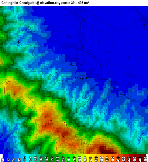
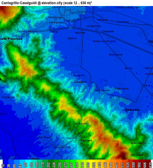
Below is the Elevation map of Cantagrillo-Casalguidi, which displays elevation range with different colors. Scale of the first map is from 39 to 498 m (128 to 1634 ft) with average elevation of 131.2 meters (=430 ft) [note 1]
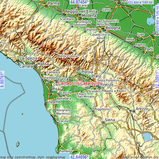
These maps also provides idea of topography and contour of this city, they are displayed at different zoom levels. More info about maps, scale and edge coordinates you can find below images.
| \ | Map #1 | Map #2 | Topo.Map |
| Scale [m] | 39..498 m | 12..630 m | × |
| Scale [ft] | 128..1634 ft | 39..2067 ft | × |
| Average | 131.2 m = 430 ft | 124.3 m = 408 ft | × |
| Width | 7.05 km = 4.4 mi | 14.09 km = 8.8 mi | 225.4 km = 140.1 mi |
| Height | 7.05 km = 4.4 mi | 14.09 km = 8.8 mi | 225.4 km = 140.1 mi |
| ↑Max Latitude | 43.901043° | 43.932699° | 44.87454° |
| Latitude at center | 43.86937° | 43.86937° | 43.86937° |
| ↓Min Latitude | 43.83768° | 43.805974° | 42.84696° |
| ← Min Longitude | 10.869915° | 10.825969° | 9.50761° |
| Longitude center | 10.91386° | 10.91386° | 10.91386° |
| →Max Longitude | 10.957805° | 11.001751° | 12.32011° |
Nearby cities:
Cities around Cantagrillo-Casalguidi sort by population:
• Pistoia elevation 63 m
6.9 km,  6°
6°
• Quarrata 48 m
5.7 km,  114°
114°
• Lamporecchio 35 m
7.5 km,  203°
203°
• San Rocco 25 m
6.7 km,  219°
219°
• Cintolese 24 m
7.5 km,  249°
249°
• Valenzatico 41 m
4.1 km,  93°
93°
• Vignole-Olmi 39 m
6.1 km, 92°
• Uggia-Pazzera-Bizzarrino 21 m
7.7 km,  239°
239°
• Barba 40 m
5.2 km,  73°
73°
• Stazione Masotti 74 m
6.6 km,  313°
313°
• Serravalle Pistoiese 176 m
7.7 km,  302°
302°
• Larciano 155 m
4.4 km,  205°
205°
Multilingual:
 En español:
Cantagrillo-Casalguidi elevación 76 m.
 En France:
Cantagrillo-Casalguidi élévation 76 m.
 Auf Deutsch:
Cantagrillo-Casalguidi höhe über dem Meeresspiegel ist 76 m.
 На русском:
Cantagrillo-Casalguidi высота над уровнем моря 76 м
Sources and notes:
- [note 1] Map square and city borders are not equal. Map elevation data is calculated only from area inside that square.
- [src 1] Elevation data from geonames database provided with same terms of usage.
- [src 2] The elevation map of Cantagrillo-Casalguidi is generated using elevation data from NASA's 3 arcsec (90m) resolution SRTM data.
- [src 3] Base (background) map © OpenStreetMap contributors tiles are generated by Geofabrik and OpenTopoMap.
Copyright & License:
This Cantagrillo-Casalguidi Elevation Map is licensed under CC BY-SA. You may reuse any part from this page, if you give a proper credit by linking to this URL:
 More info on terms of use page.