Levate elevation
Levate (Lombardy, Provincia di Bergamo), Italy elevation is 186 meters and Levate elevation in feet is 610 ft above sea level [src 1]. Levate is a seat of a third-order administrative division (feature code) with elevation that is 136 meters (446 ft) smaller than average city elevation in Italy.
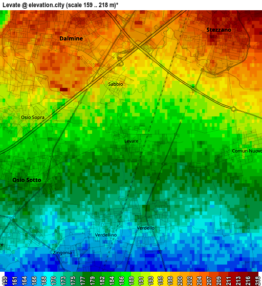
Below is the Elevation map of Levate, which displays elevation range with different colors. Scale of the first map is from 159 to 218 m (522 to 715 ft) with average elevation of 185.4 meters (=608 ft) [note 1]
These maps also provides idea of topography and contour of this city, they are displayed at different zoom levels. More info about maps, scale and edge coordinates you can find below images.
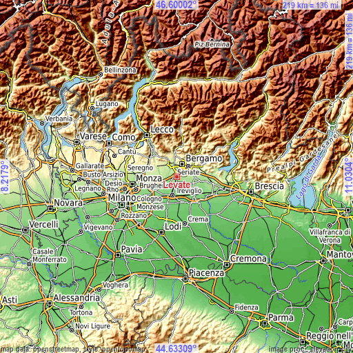
| \ | Map #1 | Topo.Map |
| Scale [m] | 159..218 m | × |
| Scale [ft] | 522..715 ft | × |
| Average | 185.4 m = 608 ft | × |
| Width | 6.83 km = 4.2 mi | 218.7 km = 135.9 mi |
| Height | 6.83 km = 4.2 mi | 218.7 km = 135.9 mi |
| ↑Max Latitude | 45.655905° | 46.60002° |
| Latitude at center | 45.62518° | 45.62518° |
| ↓Min Latitude | 45.594438° | 44.63309° |
| ← Min Longitude | 9.580205° | 8.2179° |
| Longitude center | 9.62415° | 9.62415° |
| →Max Longitude | 9.668095° | 11.0304° |
Nearby cities:
Cities around Levate sort by population:
• Dalmine elevation 205 m
3 km,  332°
332°
• Stezzano 211 m
3.5 km,  38°
38°
• Osio Sotto 181 m
2.9 km,  249°
249°
• Verdellino 164 m
3 km,  205°
205°
• Verdello 169 m
2.4 km,  171°
171°
• Zanica 210 m
5.1 km,  69°
69°
• Ciserano 160 m
4.5 km,  203°
203°
• Boltiere 172 m
4.5 km,  232°
232°
• Osio Sopra 191 m
3.1 km,  278°
278°
• Lallio 212 m
4.2 km,  5°
5°
• Comun Nuovo 189 m
3 km,  94°
94°
• Pognano 157 m
4.5 km,  164°
164°
Multilingual:
 En español:
Levate elevación 186 m.
 En France:
Levate élévation 186 m.


Sources and notes:
- [note 1] Map square and city borders are not equal. Map elevation data is calculated only from area inside that square.
- [src 1] Elevation data from geonames database provided with same terms of usage.
- [src 2] The elevation map of Levate is generated using elevation data from NASA's 3 arcsec (90m) resolution SRTM data.
- [src 3] Base (background) map © OpenStreetMap contributors tiles are generated by Geofabrik and OpenTopoMap.
Copyright & License:
This Levate Elevation Map is licensed under CC BY-SA. You may reuse any part from this page, if you give a proper credit by linking to this URL:
 More info on terms of use page.