Osio Sotto elevation
Osio Sotto (Lombardy, Provincia di Bergamo), Italy elevation is 181 meters and Osio Sotto elevation in feet is 594 ft above sea level [src 1]. Osio Sotto is a seat of a third-order administrative division (feature code) with elevation that is 141 meters (463 ft) smaller than average city elevation in Italy.
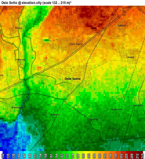
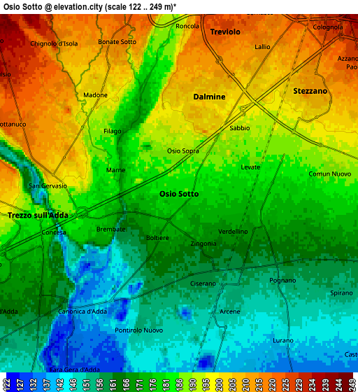
Below is the Elevation map of Osio Sotto, which displays elevation range with different colors. Scale of the first map is from 132 to 215 m (433 to 705 ft) with average elevation of 176.1 meters (=578 ft) [note 1]
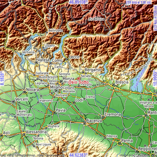
These maps also provides idea of topography and contour of this city, they are displayed at different zoom levels. More info about maps, scale and edge coordinates you can find below images.
| \ | Map #1 | Map #2 | Topo.Map |
| Scale [m] | 132..215 m | 122..249 m | × |
| Scale [ft] | 433..705 ft | 400..817 ft | × |
| Average | 176.1 m = 578 ft | 179.3 m = 588 ft | × |
| Width | 6.84 km = 4.3 mi | 13.67 km = 8.5 mi | 218.7 km = 135.9 mi |
| Height | 6.84 km = 4.3 mi | 13.67 km = 8.5 mi | 218.7 km = 135.9 mi |
| ↑Max Latitude | 45.64681° | 45.677523° | 46.59108° |
| Latitude at center | 45.61608° | 45.61608° | 45.61608° |
| ↓Min Latitude | 45.585333° | 45.55457° | 44.62383° |
| ← Min Longitude | 9.545105° | 9.501159° | 8.1828° |
| Longitude center | 9.58905° | 9.58905° | 9.58905° |
| →Max Longitude | 9.632995° | 9.676941° | 10.9953° |
Nearby cities:
Cities around Osio Sotto sort by population:
• Dalmine elevation 205 m
3.9 km,  19°
19°
• Capriate San Gervasio 189 m
4.6 km,  265°
265°
• Verdellino 164 m
2.2 km,  138°
138°
• Verdello 169 m
3.4 km,  114°
114°
• Brembate 172 m
3 km,  244°
244°
• Ciserano 160 m
3.3 km,  163°
163°
• Boltiere 172 m
1.9 km,  206°
206°
• Osio Sopra 191 m
1.5 km,  346°
346°
• Arcene 153 m
4.8 km, 155°
• Levate 186 m
2.9 km,  69°
69°
• Filago 181 m
3.5 km,  313°
313°
• Grignano 197 m
3.6 km, 273°
Multilingual:
 En español:
Osio Sotto elevación 181 m.
 En France:
Osio Sotto élévation 181 m.
 Auf Deutsch:
Osio Sotto höhe über dem Meeresspiegel ist 181 m.

Sources and notes:
- [note 1] Map square and city borders are not equal. Map elevation data is calculated only from area inside that square.
- [src 1] Elevation data from geonames database provided with same terms of usage.
- [src 2] The elevation map of Osio Sotto is generated using elevation data from NASA's 3 arcsec (90m) resolution SRTM data.
- [src 3] Base (background) map © OpenStreetMap contributors tiles are generated by Geofabrik and OpenTopoMap.
Copyright & License:
This Osio Sotto Elevation Map is licensed under CC BY-SA. You may reuse any part from this page, if you give a proper credit by linking to this URL:
 More info on terms of use page.