Artena elevation
Artena (Latium, Città metropolitana di Roma Capitale), Italy elevation is 297 meters and Artena elevation in feet is 974 ft above sea level [src 1]. Artena is a seat of a third-order administrative division (feature code) with elevation that is 25 meters (82 ft) smaller than average city elevation in Italy.
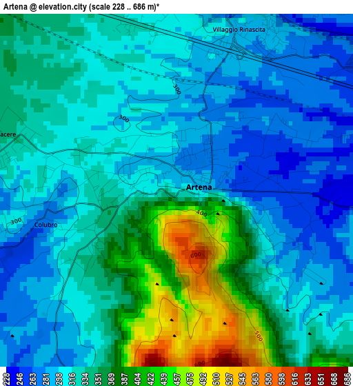
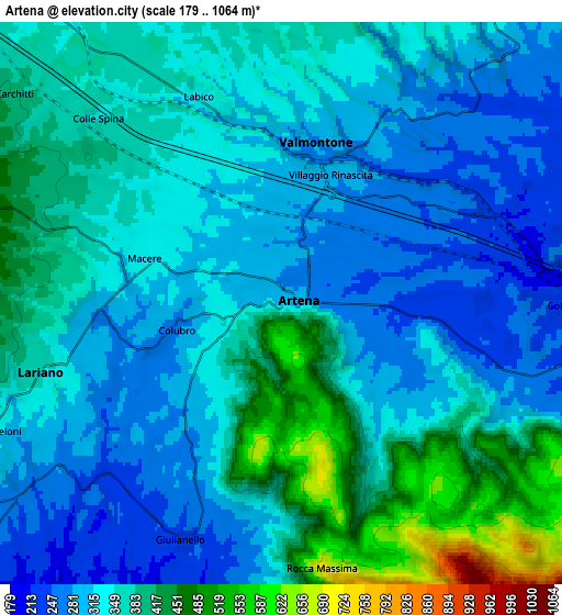
Below is the Elevation map of Artena, which displays elevation range with different colors. Scale of the first map is from 228 to 686 m (748 to 2251 ft) with average elevation of 331.6 meters (=1088 ft) [note 1]
These maps also provides idea of topography and contour of this city, they are displayed at different zoom levels. More info about maps, scale and edge coordinates you can find below images.
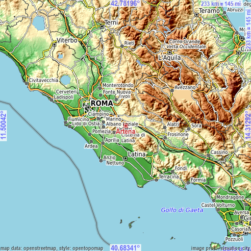
| \ | Map #1 | Map #2 | Topo.Map |
| Scale [m] | 228..686 m | 179..1064 m | × |
| Scale [ft] | 748..2251 ft | 587..3491 ft | × |
| Average | 331.6 m = 1088 ft | 348.2 m = 1142 ft | × |
| Width | 7.29 km = 4.5 mi | 14.58 km = 9.1 mi | 233.3 km = 145 mi |
| Height | 7.29 km = 4.5 mi | 14.58 km = 9.1 mi | 233.3 km = 145 mi |
| ↑Max Latitude | 41.774042° | 41.806807° | 42.78196° |
| Latitude at center | 41.74126° | 41.74126° | 41.74126° |
| ↓Min Latitude | 41.708461° | 41.675646° | 40.68341° |
| ← Min Longitude | 12.862725° | 12.818779° | 11.50042° |
| Longitude center | 12.90667° | 12.90667° | 12.90667° |
| →Max Longitude | 12.950615° | 12.994561° | 14.31292° |
Nearby cities:
Cities around Artena sort by population:
• Colleferro elevation 234 m
8.3 km,  100°
100°
• Valmontone 267 m
3.7 km,  15°
15°
• Lariano 338 m
7 km,  248°
248°
• Cave 372 m
8.9 km, 18°
• Labico 358 m
6.4 km,  332°
332°
• Giulianello 233 m
6.5 km,  200°
200°
• Carchitti 385 m
8.2 km,  308°
308°
• Macere 309 m
4.1 km,  281°
281°
• San Bartolomeo 385 m
8.1 km,  6°
6°
• Colubro 299 m
3.3 km,  258°
258°
• Colle Spina 370 m
6.7 km, 312°
• Rocca Massima 715 m
7 km,  170°
170°
Multilingual:
 En español:
Artena elevación 297 m.
 En France:
Artena élévation 297 m.


Sources and notes:
- [note 1] Map square and city borders are not equal. Map elevation data is calculated only from area inside that square.
- [src 1] Elevation data from geonames database provided with same terms of usage.
- [src 2] The elevation map of Artena is generated using elevation data from NASA's 3 arcsec (90m) resolution SRTM data.
- [src 3] Base (background) map © OpenStreetMap contributors tiles are generated by Geofabrik and OpenTopoMap.
Copyright & License:
This Artena Elevation Map is licensed under CC BY-SA. You may reuse any part from this page, if you give a proper credit by linking to this URL:
 More info on terms of use page.