Colleferro elevation
Colleferro (Latium, Città metropolitana di Roma Capitale), Italy elevation is 234 meters and Colleferro elevation in feet is 768 ft above sea level [src 1]. Colleferro is a seat of a third-order administrative division (feature code) with elevation that is 88 meters (289 ft) smaller than average city elevation in Italy.
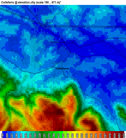
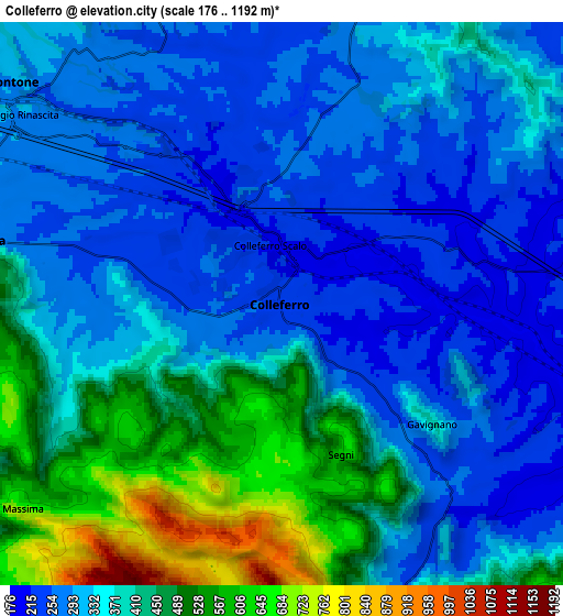
Below is the Elevation map of Colleferro, which displays elevation range with different colors. Scale of the first map is from 190 to 671 m (623 to 2201 ft) with average elevation of 298.8 meters (=980 ft) [note 1]
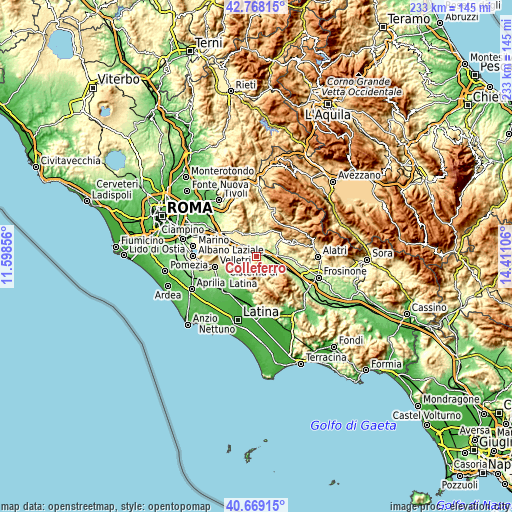
These maps also provides idea of topography and contour of this city, they are displayed at different zoom levels. More info about maps, scale and edge coordinates you can find below images.
| \ | Map #1 | Map #2 | Topo.Map |
| Scale [m] | 190..671 m | 176..1192 m | × |
| Scale [ft] | 623..2201 ft | 577..3911 ft | × |
| Average | 298.8 m = 980 ft | 361.9 m = 1187 ft | × |
| Width | 7.29 km = 4.5 mi | 14.59 km = 9.1 mi | 233.4 km = 145 mi |
| Height | 7.29 km = 4.5 mi | 14.59 km = 9.1 mi | 233.4 km = 145 mi |
| ↑Max Latitude | 41.760009° | 41.792781° | 42.76815° |
| Latitude at center | 41.72722° | 41.72722° | 41.72722° |
| ↓Min Latitude | 41.694414° | 41.661592° | 40.66915° |
| ← Min Longitude | 12.960865° | 12.916919° | 11.59856° |
| Longitude center | 13.00481° | 13.00481° | 13.00481° |
| →Max Longitude | 13.048755° | 13.092701° | 14.41106° |
Nearby cities:
Cities around Colleferro sort by population:
• Valmontone elevation 267 m
8.8 km,  305°
305°
• Artena 297 m
8.3 km,  280°
280°
• Cave 372 m
11.3 km,  331°
331°
• Segni 569 m
4.4 km,  164°
164°
• Paliano 367 m
8.3 km,  45°
45°
• Genazzano 315 m
11.5 km,  346°
346°
• Giulianello 233 m
11.4 km,  246°
246°
• Montelanico 305 m
9 km, 160°
• Colubro 299 m
11.4 km,  274°
274°
• Gavignano 377 m
4.9 km,  129°
129°
• Gorga 760 m
11.7 km, 133°
• Rocca Massima 715 m
8.8 km,  232°
232°
Multilingual:
 En español:
Colleferro elevación 234 m.
 En France:
Colleferro élévation 234 m.
 Auf Deutsch:
Colleferro höhe über dem Meeresspiegel ist 234 m.

Sources and notes:
- [note 1] Map square and city borders are not equal. Map elevation data is calculated only from area inside that square.
- [src 1] Elevation data from geonames database provided with same terms of usage.
- [src 2] The elevation map of Colleferro is generated using elevation data from NASA's 3 arcsec (90m) resolution SRTM data.
- [src 3] Base (background) map © OpenStreetMap contributors tiles are generated by Geofabrik and OpenTopoMap.
Copyright & License:
This Colleferro Elevation Map is licensed under CC BY-SA. You may reuse any part from this page, if you give a proper credit by linking to this URL:
 More info on terms of use page.