Valmontone elevation
Valmontone (Latium, Città metropolitana di Roma Capitale), Italy elevation is 267 meters and Valmontone elevation in feet is 876 ft above sea level [src 1]. Valmontone is a seat of a third-order administrative division (feature code) with elevation that is 55 meters (180 ft) smaller than average city elevation in Italy.
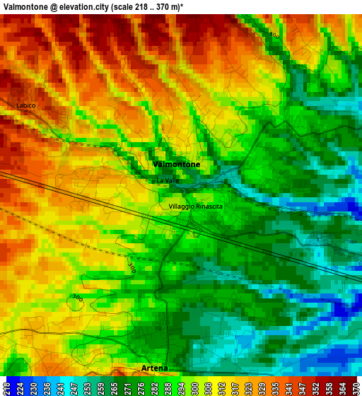
Below is the Elevation map of Valmontone, which displays elevation range with different colors. Scale of the first map is from 218 to 370 m (715 to 1214 ft) with average elevation of 296.3 meters (=972 ft) [note 1]
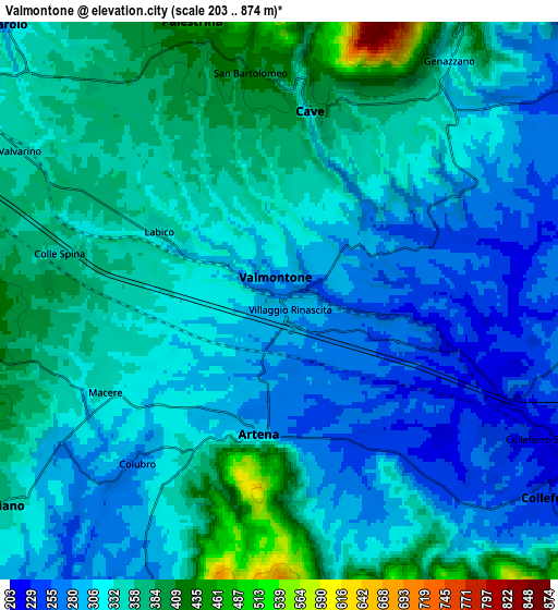
These maps also provides idea of topography and contour of this city, they are displayed at different zoom levels. More info about maps, scale and edge coordinates you can find below images.
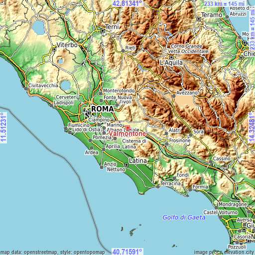
| \ | Map #1 | Map #2 | Topo.Map |
| Scale [m] | 218..370 m | 203..874 m | × |
| Scale [ft] | 715..1214 ft | 666..2867 ft | × |
| Average | 296.3 m = 972 ft | 327.4 m = 1074 ft | × |
| Width | 7.29 km = 4.5 mi | 14.58 km = 9.1 mi | 233.2 km = 144.9 mi |
| Height | 7.29 km = 4.5 mi | 14.58 km = 9.1 mi | 233.2 km = 144.9 mi |
| ↑Max Latitude | 41.805995° | 41.838744° | 42.81341° |
| Latitude at center | 41.77323° | 41.77323° | 41.77323° |
| ↓Min Latitude | 41.740448° | 41.707649° | 40.71591° |
| ← Min Longitude | 12.874615° | 12.830669° | 11.51231° |
| Longitude center | 12.91856° | 12.91856° | 12.91856° |
| →Max Longitude | 12.962505° | 13.006451° | 14.32481° |
Nearby cities:
Cities around Valmontone sort by population:
• Palestrina elevation 410 m
7.3 km,  335°
335°
• Artena 297 m
3.7 km,  195°
195°
• Cave 372 m
5.2 km,  20°
20°
• Genazzano 315 m
7.5 km,  35°
35°
• Labico 358 m
4.5 km,  298°
298°
• Carchitti 385 m
7.5 km,  281°
281°
• Macere 309 m
5.7 km,  241°
241°
• San Bartolomeo 385 m
4.5 km,  358°
358°
• Colubro 299 m
6 km,  225°
225°
• Colle Spina 370 m
6 km, 279°
• Castel San Pietro Romano 756 m
8.3 km,  346°
346°
• Rocca di Cave 905 m
8.4 km, 15°
Multilingual:
 En español:
Valmontone elevación 267 m.
 En France:
Valmontone élévation 267 m.
 Auf Deutsch:
Valmontone höhe über dem Meeresspiegel ist 267 m.

Sources and notes:
- [note 1] Map square and city borders are not equal. Map elevation data is calculated only from area inside that square.
- [src 1] Elevation data from geonames database provided with same terms of usage.
- [src 2] The elevation map of Valmontone is generated using elevation data from NASA's 3 arcsec (90m) resolution SRTM data.
- [src 3] Base (background) map © OpenStreetMap contributors tiles are generated by Geofabrik and OpenTopoMap.
Copyright & License:
This Valmontone Elevation Map is licensed under CC BY-SA. You may reuse any part from this page, if you give a proper credit by linking to this URL:
 More info on terms of use page.