Cori elevation
Cori (Latium, Provincia di Latina), Italy elevation is 274 meters and Cori elevation in feet is 899 ft above sea level [src 1]. Cori is a seat of a third-order administrative division (feature code) with elevation that is 48 meters (157 ft) smaller than average city elevation in Italy.
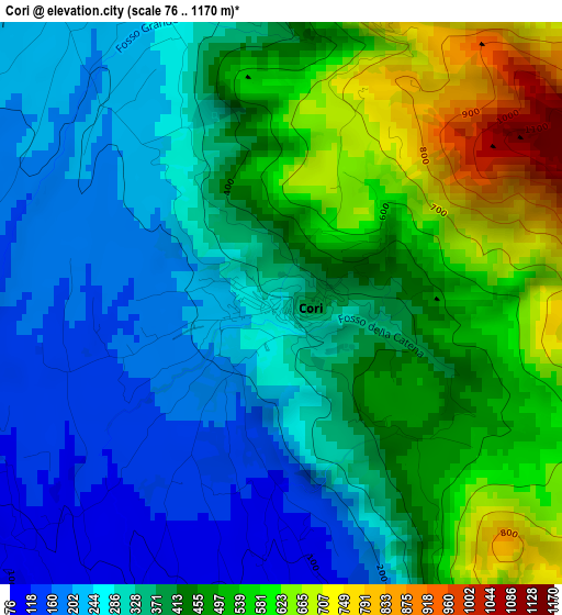
Below is the Elevation map of Cori, which displays elevation range with different colors. Scale of the first map is from 76 to 1170 m (249 to 3839 ft) with average elevation of 391.6 meters (=1285 ft) [note 1]
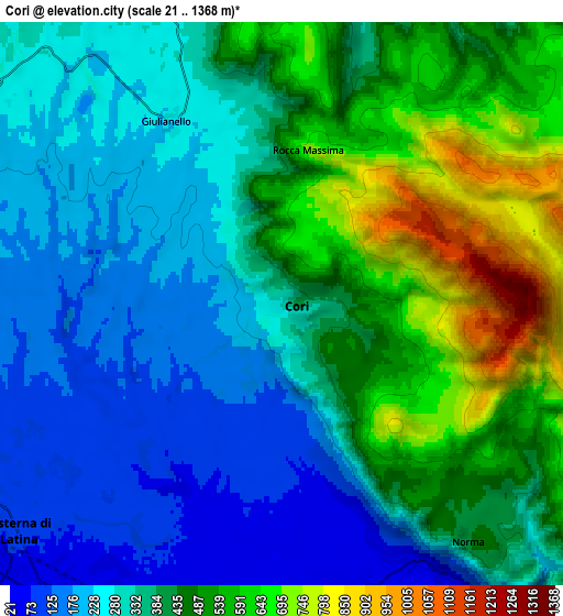
These maps also provides idea of topography and contour of this city, they are displayed at different zoom levels. More info about maps, scale and edge coordinates you can find below images.
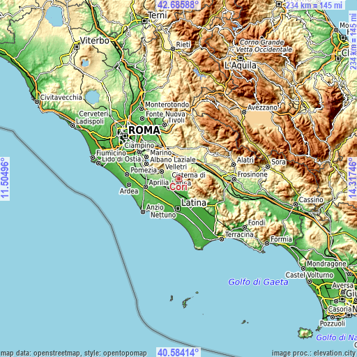
| \ | Map #1 | Map #2 | Topo.Map |
| Scale [m] | 76..1170 m | 21..1368 m | × |
| Scale [ft] | 249..3839 ft | 69..4488 ft | × |
| Average | 391.6 m = 1285 ft | 384.6 m = 1262 ft | × |
| Width | 7.3 km = 4.5 mi | 14.61 km = 9.1 mi | 233.7 km = 145.2 mi |
| Height | 7.3 km = 4.5 mi | 14.61 km = 9.1 mi | 233.7 km = 145.2 mi |
| ↑Max Latitude | 41.676412° | 41.709227° | 42.68588° |
| Latitude at center | 41.64358° | 41.64358° | 41.64358° |
| ↓Min Latitude | 41.610732° | 41.577866° | 40.58414° |
| ← Min Longitude | 12.867265° | 12.823319° | 11.50496° |
| Longitude center | 12.91121° | 12.91121° | 12.91121° |
| →Max Longitude | 12.955155° | 12.999101° | 14.31746° |
Nearby cities:
Cities around Cori sort by population:
• Cisterna di Latina elevation 85 m
9.1 km,  229°
229°
• Colleferro 234 m
12.1 km,  39°
39°
• Lariano 338 m
10.8 km,  320°
320°
• Artena 297 m
10.9 km,  358°
358°
• Segni 569 m
10.3 km,  60°
60°
• Norma 440 m
8.1 km,  142°
142°
• Giulianello 233 m
5.4 km,  330°
330°
• Carrara-Pontenuovo 17 m
12 km,  162°
162°
• Montelanico 305 m
10.8 km,  85°
85°
• Colubro 299 m
10.8 km,  340°
340°
• Sermoneta 238 m
12.1 km,  149°
149°
• Rocca Massima 715 m
4 km,  11°
11°
Multilingual:
 En español:
Cori elevación 274 m.
 En France:
Cori élévation 274 m.


Sources and notes:
- [note 1] Map square and city borders are not equal. Map elevation data is calculated only from area inside that square.
- [src 1] Elevation data from geonames database provided with same terms of usage.
- [src 2] The elevation map of Cori is generated using elevation data from NASA's 3 arcsec (90m) resolution SRTM data.
- [src 3] Base (background) map © OpenStreetMap contributors tiles are generated by Geofabrik and OpenTopoMap.
Copyright & License:
This Cori Elevation Map is licensed under CC BY-SA. You may reuse any part from this page, if you give a proper credit by linking to this URL:
 More info on terms of use page.