Firenzuola elevation
Firenzuola (Tuscany, Province of Florence), Italy elevation is 426 meters and Firenzuola elevation in feet is 1398 ft above sea level [src 1]. Firenzuola is a seat of a third-order administrative division (feature code) with elevation that is 104 meters (341 ft) bigger than average city elevation in Italy.
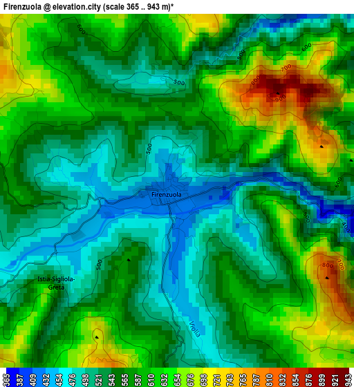
Below is the Elevation map of Firenzuola, which displays elevation range with different colors. Scale of the first map is from 365 to 943 m (1198 to 3094 ft) with average elevation of 571 meters (=1873 ft) [note 1]
These maps also provides idea of topography and contour of this city, they are displayed at different zoom levels. More info about maps, scale and edge coordinates you can find below images.
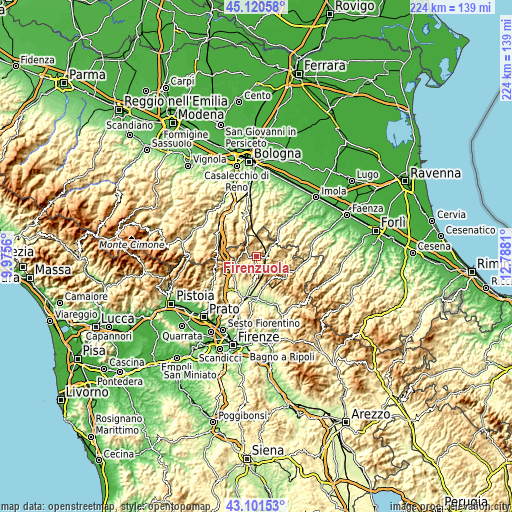
| \ | Map #1 | Topo.Map |
| Scale [m] | 365..943 m | × |
| Scale [ft] | 1198..3094 ft | × |
| Average | 571 m = 1873 ft | × |
| Width | 7.02 km = 4.4 mi | 224.5 km = 139.5 mi |
| Height | 7.02 km = 4.4 mi | 224.5 km = 139.5 mi |
| ↑Max Latitude | 44.151219° | 45.12058° |
| Latitude at center | 44.11968° | 44.11968° |
| ↓Min Latitude | 44.088124° | 43.10153° |
| ← Min Longitude | 11.337905° | 9.9756° |
| Longitude center | 11.38185° | 11.38185° |
| →Max Longitude | 11.425795° | 12.7881° |
Nearby cities:
Cities around Firenzuola sort by population:
• Barberino di Mugello elevation 290 m
17.7 km,  220°
220°
• Scarperia 287 m
14.2 km,  188°
188°
• San Piero a Sieve 215 m
18.1 km, 194°
• Castiglione dei Pepoli 703 m
17.9 km,  278°
278°
• Loiano 687 m
17 km,  345°
345°
• Monghidoro 840 m
12.4 km,  337°
337°
• Luco Mugello 305 m
13.3 km,  175°
175°
• Ronta 358 m
13.5 km,  163°
163°
• Galliano 301 m
13.4 km,  211°
211°
• Palazzuolo sul Senio 462 m
12.9 km,  93°
93°
• Castel del Rio 222 m
14.3 km,  43°
43°
• San Benedetto Val di Sambro 635 m
15.7 km,  311°
311°
Multilingual:
 En español:
Firenzuola elevación 426 m.
 En France:
Firenzuola élévation 426 m.
 Auf Deutsch:
Firenzuola höhe über dem Meeresspiegel ist 426 m.

Sources and notes:
- [note 1] Map square and city borders are not equal. Map elevation data is calculated only from area inside that square.
- [src 1] Elevation data from geonames database provided with same terms of usage.
- [src 2] The elevation map of Firenzuola is generated using elevation data from NASA's 3 arcsec (90m) resolution SRTM data.
- [src 3] Base (background) map © OpenStreetMap contributors tiles are generated by Geofabrik and OpenTopoMap.
Copyright & License:
This Firenzuola Elevation Map is licensed under CC BY-SA. You may reuse any part from this page, if you give a proper credit by linking to this URL:
 More info on terms of use page.