Groscavallo elevation
Groscavallo (Piedmont, Torino), Italy elevation is 1129 meters and Groscavallo elevation in feet is 3704 ft above sea level [src 1]. Groscavallo is a seat of a third-order administrative division (feature code) with elevation that is 807 meters (2648 ft) bigger than average city elevation in Italy.
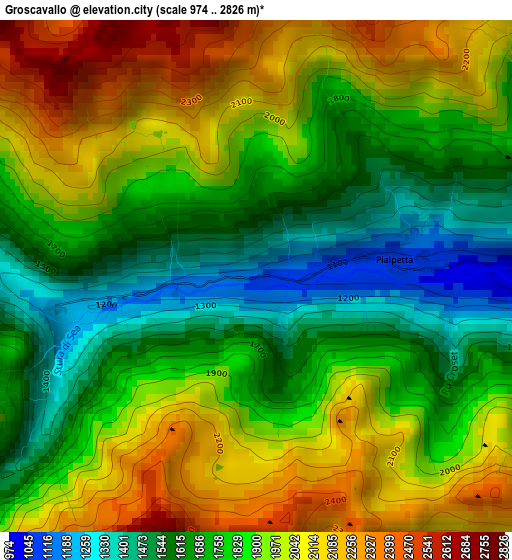
Below is the Elevation map of Groscavallo, which displays elevation range with different colors. Scale of the first map is from 974 to 2826 m (3196 to 9272 ft) with average elevation of 1849.4 meters (=6068 ft) [note 1]
These maps also provides idea of topography and contour of this city, they are displayed at different zoom levels. More info about maps, scale and edge coordinates you can find below images.
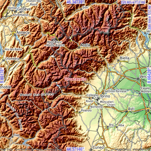
| \ | Map #1 | Topo.Map |
| Scale [m] | 974..2826 m | × |
| Scale [ft] | 3196..9272 ft | × |
| Average | 1849.4 m = 6068 ft | × |
| Width | 6.87 km = 4.3 mi | 219.7 km = 136.5 mi |
| Height | 6.87 km = 4.3 mi | 219.7 km = 136.5 mi |
| ↑Max Latitude | 45.398915° | 46.34739° |
| Latitude at center | 45.36805° | 45.36805° |
| ↓Min Latitude | 45.337168° | 44.37146° |
| ← Min Longitude | 7.214065° | 5.85176° |
| Longitude center | 7.25801° | 7.25801° |
| →Max Longitude | 7.301955° | 8.66426° |
Nearby cities:
Cities around Groscavallo sort by population:
• Mezzenile elevation 647 m
13.5 km,  127°
127°
• Cantoira 741 m
10.4 km,  107°
107°
• Pessinetto 610 m
15.3 km, 126°
• Ceres 701 m
11.9 km,  120°
120°
• Ala di Stura 1071 m
6.9 km,  148°
148°
• Chialamberto 858 m
6.7 km,  94°
94°
• Usseglio 1265 m
15.3 km,  191°
191°
• Lemie 955 m
15.7 km,  170°
170°
• Balme 1425 m
7.9 km,  202°
202°
• Noasca 1048 m
10.5 km,  25°
25°
• Ceresole Reale 1615 m
7.4 km,  345°
345°
• Monastero di Lanzo 809 m
16 km, 117°
Multilingual:
 En español:
Groscavallo elevación 1129 m.
 En France:
Groscavallo élévation 1129 m.
 Auf Deutsch:
Groscavallo höhe über dem Meeresspiegel ist 1129 m.

Sources and notes:
- [note 1] Map square and city borders are not equal. Map elevation data is calculated only from area inside that square.
- [src 1] Elevation data from geonames database provided with same terms of usage.
- [src 2] The elevation map of Groscavallo is generated using elevation data from NASA's 3 arcsec (90m) resolution SRTM data.
- [src 3] Base (background) map © OpenStreetMap contributors tiles are generated by Geofabrik and OpenTopoMap.
Copyright & License:
This Groscavallo Elevation Map is licensed under CC BY-SA. You may reuse any part from this page, if you give a proper credit by linking to this URL:
 More info on terms of use page.