Noasca elevation
Noasca (Piedmont, Torino), Italy elevation is 1048 meters and Noasca elevation in feet is 3438 ft above sea level [src 1]. Noasca is a seat of a third-order administrative division (feature code) with elevation that is 726 meters (2382 ft) bigger than average city elevation in Italy.
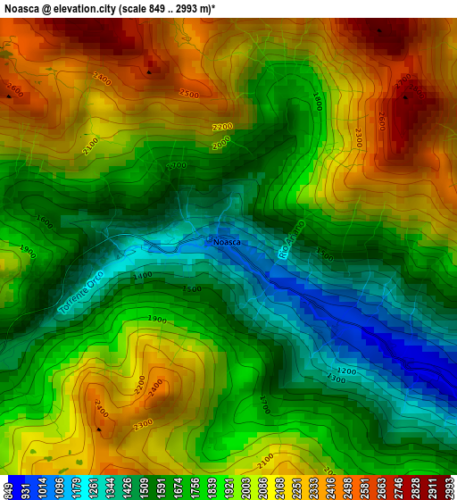
Below is the Elevation map of Noasca, which displays elevation range with different colors. Scale of the first map is from 849 to 2993 m (2785 to 9820 ft) with average elevation of 1878.7 meters (=6164 ft) [note 1]
These maps also provides idea of topography and contour of this city, they are displayed at different zoom levels. More info about maps, scale and edge coordinates you can find below images.
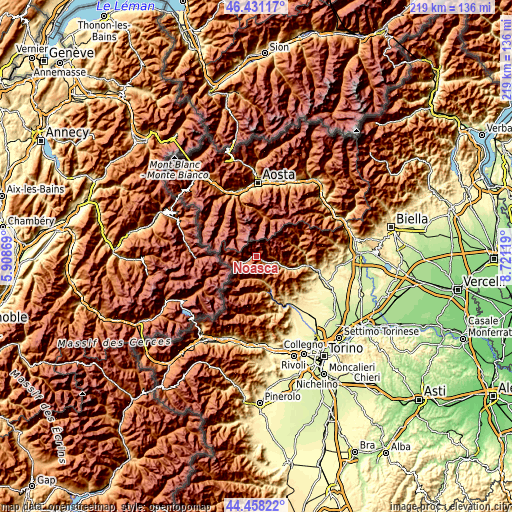
| \ | Map #1 | Topo.Map |
| Scale [m] | 849..2993 m | × |
| Scale [ft] | 2785..9820 ft | × |
| Average | 1878.7 m = 6164 ft | × |
| Width | 6.86 km = 4.3 mi | 219.4 km = 136.3 mi |
| Height | 6.86 km = 4.3 mi | 219.4 km = 136.3 mi |
| ↑Max Latitude | 45.484139° | 46.43117° |
| Latitude at center | 45.45332° | 45.45332° |
| ↓Min Latitude | 45.422484° | 44.45822° |
| ← Min Longitude | 7.270995° | 5.90869° |
| Longitude center | 7.31494° | 7.31494° |
| →Max Longitude | 7.358885° | 8.72119° |
Nearby cities:
Cities around Noasca sort by population:
• Sparone elevation 541 m
18.5 km,  103°
103°
• Cogne 1559 m
17.5 km,  11°
11°
• Locana 629 m
11.9 km,  111°
111°
• Cantoira 741 m
13.7 km,  156°
156°
• Ceres 701 m
16.6 km, 159°
• Ala di Stura 1071 m
15.4 km,  183°
183°
• Chialamberto 858 m
10.3 km,  167°
167°
• Valsavarenche 1552 m
17.4 km,  332°
332°
• Balme 1425 m
18.4 km,  203°
203°
• Ceresole Reale 1615 m
6.7 km,  249°
249°
• Ribordone 1026 m
14.8 km, 98°
• Groscavallo 1129 m
10.5 km,  205°
205°
Multilingual:
 En español:
Noasca elevación 1048 m.
 En France:
Noasca élévation 1048 m.


Sources and notes:
- [note 1] Map square and city borders are not equal. Map elevation data is calculated only from area inside that square.
- [src 1] Elevation data from geonames database provided with same terms of usage.
- [src 2] The elevation map of Noasca is generated using elevation data from NASA's 3 arcsec (90m) resolution SRTM data.
- [src 3] Base (background) map © OpenStreetMap contributors tiles are generated by Geofabrik and OpenTopoMap.
Copyright & License:
This Noasca Elevation Map is licensed under CC BY-SA. You may reuse any part from this page, if you give a proper credit by linking to this URL:
 More info on terms of use page.