Lauro elevation
Lauro (Campania, Provincia di Caserta), Italy elevation is 100 meters and Lauro elevation in feet is 328 ft above sea level [src 1]. Lauro is a populated place (feature code) with elevation that is 222 meters (728 ft) smaller than average city elevation in Italy.
Below is the Elevation map of Lauro, which displays elevation range with different colors. Scale of the first map is from 4 to 596 m (13 to 1955 ft) with average elevation of 105.2 meters (=345 ft) [note 1]
These maps also provides idea of topography and contour of this city, they are displayed at different zoom levels. More info about maps, scale and edge coordinates you can find below images.
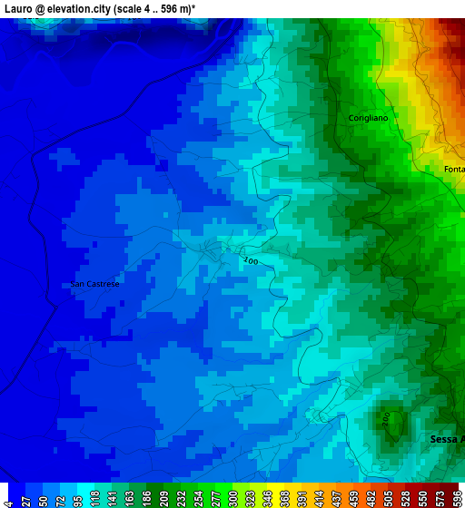
| \ | Map #1 | Topo.Map |
| Scale [m] | 4..596 m | × |
| Scale [ft] | 13..1955 ft | × |
| Average | 105.2 m = 345 ft | × |
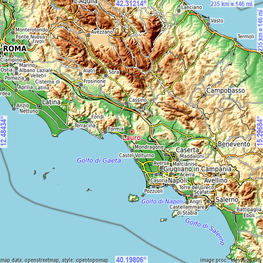
| Width | 7.35 km = 4.6 mi | 235.1 km = 146.1 mi |
| Height | 7.35 km = 4.6 mi | 235.1 km = 146.1 mi |
| ↑Max Latitude | 41.296675° | 42.31214° |
| Latitude at center | 41.26365° | 41.26365° |
| ↓Min Latitude | 41.230609° | 40.19806° |
| ← Min Longitude | 13.846645° | 12.48434° |
| Longitude center | 13.89059° | 13.89059° |
| →Max Longitude | 13.934535° | 15.29684° |
Nearby cities:
Cities around Lauro sort by population:
• Cellole elevation 21 m
7.4 km,  204°
204°
• Sessa Aurunca 201 m
4.2 km,  128°
128°
• Grunuovo-Campomaggiore San Luca 15 m
7.1 km,  277°
277°
• Castelforte 52 m
6 km,  303°
303°
• Roccamonfina 602 m
7.8 km,  70°
70°
• Carano 72 m
6.7 km,  166°
166°
• Piedimonte 40 m
8.3 km,  175°
175°
• Casanova 102 m
10 km,  142°
142°
• Cascano 217 m
7.4 km,  117°
117°
• San Castrese 42 m
2.2 km,  255°
255°
• San Clemente 367 m
10.1 km,  32°
32°
• Santi Cosma e Damiano 167 m
7.5 km, 303°
Multilingual:
 En español:
Lauro elevación 100 m.
 En France:
Lauro élévation 100 m.


Sources and notes:
- [note 1] Map square and city borders are not equal. Map elevation data is calculated only from area inside that square.
- [src 1] Elevation data from geonames database provided with same terms of usage.
- [src 2] The elevation map of Lauro is generated using elevation data from NASA's 3 arcsec (90m) resolution SRTM data.
- [src 3] Base (background) map © OpenStreetMap contributors tiles are generated by Geofabrik and OpenTopoMap.
Copyright & License:
This Lauro Elevation Map is licensed under CC BY-SA. You may reuse any part from this page, if you give a proper credit by linking to this URL:
 More info on terms of use page.