Marradi elevation
Marradi (Tuscany, Province of Florence), Italy elevation is 336 meters and Marradi elevation in feet is 1102 ft above sea level [src 1]. Marradi is a seat of a third-order administrative division (feature code) with elevation that is 14 meters (46 ft) bigger than average city elevation in Italy.
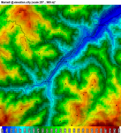
Below is the Elevation map of Marradi, which displays elevation range with different colors. Scale of the first map is from 257 to 969 m (843 to 3179 ft) with average elevation of 555.3 meters (=1822 ft) [note 1]
These maps also provides idea of topography and contour of this city, they are displayed at different zoom levels. More info about maps, scale and edge coordinates you can find below images.
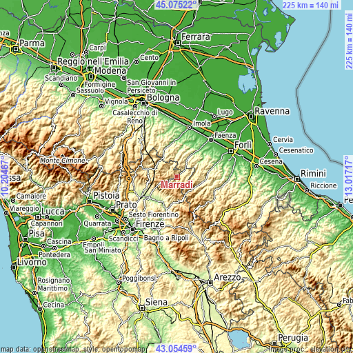
| \ | Map #1 | Topo.Map |
| Scale [m] | 257..969 m | × |
| Scale [ft] | 843..3179 ft | × |
| Average | 555.3 m = 1822 ft | × |
| Width | 7.02 km = 4.4 mi | 224.7 km = 139.6 mi |
| Height | 7.02 km = 4.4 mi | 224.7 km = 139.6 mi |
| ↑Max Latitude | 44.105094° | 45.07522° |
| Latitude at center | 44.07353° | 44.07353° |
| ↓Min Latitude | 44.041949° | 43.05459° |
| ← Min Longitude | 11.566975° | 10.20467° |
| Longitude center | 11.61092° | 11.61092° |
| →Max Longitude | 11.654865° | 13.01717° |
Nearby cities:
Cities around Marradi sort by population:
• Modigliana elevation 167 m
17.4 km,  56°
56°
• Casola Valsenio 200 m
16.8 km,  3°
3°
• Rocca San Casciano 213 m
18.6 km,  95°
95°
• Fognano 128 m
17.8 km,  34°
34°
• Ronta 358 m
16.5 km,  241°
241°
• Tredozio 346 m
10.4 km,  86°
86°
• Palazzuolo sul Senio 462 m
7 km,  308°
308°
• Portico e San Benedetto 316 m
14.6 km,  110°
110°
• Castel del Rio 222 m
17.7 km,  331°
331°
• Premilcuore 476 m
17.1 km,  127°
127°
• San Godenzo 396 m
16.5 km,  177°
177°
• Portico di Romagna 316 m
14.6 km, 110°
Multilingual:
 En español:
Marradi elevación 336 m.
 En France:
Marradi élévation 336 m.


Sources and notes:
- [note 1] Map square and city borders are not equal. Map elevation data is calculated only from area inside that square.
- [src 1] Elevation data from geonames database provided with same terms of usage.
- [src 2] The elevation map of Marradi is generated using elevation data from NASA's 3 arcsec (90m) resolution SRTM data.
- [src 3] Base (background) map © OpenStreetMap contributors tiles are generated by Geofabrik and OpenTopoMap.
Copyright & License:
This Marradi Elevation Map is licensed under CC BY-SA. You may reuse any part from this page, if you give a proper credit by linking to this URL:
 More info on terms of use page.