San Godenzo elevation
San Godenzo (Tuscany, Province of Florence), Italy elevation is 396 meters and San Godenzo elevation in feet is 1299 ft above sea level [src 1]. San Godenzo is a seat of a third-order administrative division (feature code) with elevation that is 74 meters (243 ft) bigger than average city elevation in Italy.
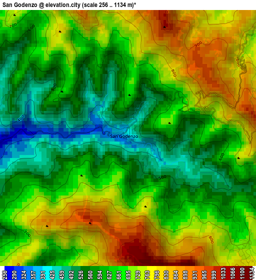
Below is the Elevation map of San Godenzo, which displays elevation range with different colors. Scale of the first map is from 256 to 1134 m (840 to 3720 ft) with average elevation of 669 meters (=2195 ft) [note 1]
These maps also provides idea of topography and contour of this city, they are displayed at different zoom levels. More info about maps, scale and edge coordinates you can find below images.
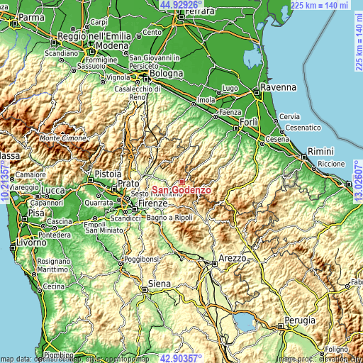
| \ | Map #1 | Topo.Map |
| Scale [m] | 256..1134 m | × |
| Scale [ft] | 840..3720 ft | × |
| Average | 669 m = 2195 ft | × |
| Width | 7.04 km = 4.4 mi | 225.2 km = 139.9 mi |
| Height | 7.04 km = 4.4 mi | 225.2 km = 139.9 mi |
| ↑Max Latitude | 43.956683° | 44.92926° |
| Latitude at center | 43.92504° | 43.92504° |
| ↓Min Latitude | 43.89338° | 42.90357° |
| ← Min Longitude | 11.575875° | 10.21357° |
| Longitude center | 11.61982° | 11.61982° |
| →Max Longitude | 11.663765° | 13.02607° |
Nearby cities:
Cities around San Godenzo sort by population:
• Rufina elevation 113 m
15.5 km,  223°
223°
• Vicchio 186 m
12.8 km,  274°
274°
• Dicomano 163 m
8.6 km,  245°
245°
• Stia 452 m
15.8 km,  153°
153°
• Pratovecchio 423 m
17.5 km, 151°
• Marradi 336 m
16.5 km,  357°
357°
• Montebonello 120 m
15 km,  225°
225°
• Londa 211 m
8.2 km,  213°
213°
• Ronta 358 m
17.6 km,  299°
299°
• Portico e San Benedetto 316 m
17.2 km,  48°
48°
• Premilcuore 476 m
14.4 km,  64°
64°
• Portico di Romagna 316 m
17.2 km, 48°
Multilingual:
 En español:
San Godenzo elevación 396 m.
 En France:
San Godenzo élévation 396 m.
 Auf Deutsch:
San Godenzo höhe über dem Meeresspiegel ist 396 m.

Sources and notes:
- [note 1] Map square and city borders are not equal. Map elevation data is calculated only from area inside that square.
- [src 1] Elevation data from geonames database provided with same terms of usage.
- [src 2] The elevation map of San Godenzo is generated using elevation data from NASA's 3 arcsec (90m) resolution SRTM data.
- [src 3] Base (background) map © OpenStreetMap contributors tiles are generated by Geofabrik and OpenTopoMap.
Copyright & License:
This San Godenzo Elevation Map is licensed under CC BY-SA. You may reuse any part from this page, if you give a proper credit by linking to this URL:
 More info on terms of use page.