Nocera Umbra elevation
Nocera Umbra (Umbria, Provincia di Perugia), Italy elevation is 498 meters and Nocera Umbra elevation in feet is 1634 ft above sea level [src 1]. Nocera Umbra is a seat of a third-order administrative division (feature code) with elevation that is 176 meters (577 ft) bigger than average city elevation in Italy.
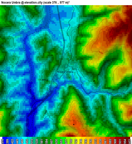
Below is the Elevation map of Nocera Umbra, which displays elevation range with different colors. Scale of the first map is from 376 to 977 m (1234 to 3205 ft) with average elevation of 576.2 meters (=1890 ft) [note 1]
These maps also provides idea of topography and contour of this city, they are displayed at different zoom levels. More info about maps, scale and edge coordinates you can find below images.
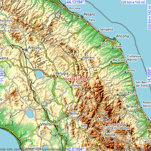
| \ | Map #1 | Topo.Map |
| Scale [m] | 376..977 m | × |
| Scale [ft] | 1234..3205 ft | × |
| Average | 576.2 m = 1890 ft | × |
| Width | 7.13 km = 4.4 mi | 228.3 km = 141.9 mi |
| Height | 7.13 km = 4.4 mi | 228.3 km = 141.9 mi |
| ↑Max Latitude | 43.146071° | 44.13194° |
| Latitude at center | 43.114° | 43.114° |
| ↓Min Latitude | 43.081912° | 42.07884° |
| ← Min Longitude | 12.745305° | 11.383° |
| Longitude center | 12.78925° | 12.78925° |
| →Max Longitude | 12.833195° | 14.1955° |
Nearby cities:
Cities around Nocera Umbra sort by population:
• Gualdo Tadino elevation 490 m
12.9 km,  356°
356°
• Spello 213 m
16.8 km,  216°
216°
• Assisi 410 m
14.6 km,  248°
248°
• Palazzo 234 m
18.4 km,  264°
264°
• Valfabbrica 289 m
16 km,  287°
287°
• Rivotorto 226 m
15.7 km,  240°
240°
• Capitan Loreto 212 m
15.8 km,  226°
226°
• Pioraco 470 m
16.9 km,  63°
63°
• Valtopina 365 m
7 km,  204°
204°
• Massa 464 m
14.2 km,  54°
54°
• Serravalle di Chienti 645 m
14 km,  109°
109°
• Sefro 513 m
13.5 km,  73°
73°
Multilingual:
 En español:
Nocera Umbra elevación 498 m.
 En France:
Nocera Umbra élévation 498 m.
 Auf Deutsch:
Nocera Umbra höhe über dem Meeresspiegel ist 498 m.

Sources and notes:
- [note 1] Map square and city borders are not equal. Map elevation data is calculated only from area inside that square.
- [src 1] Elevation data from geonames database provided with same terms of usage.
- [src 2] The elevation map of Nocera Umbra is generated using elevation data from NASA's 3 arcsec (90m) resolution SRTM data.
- [src 3] Base (background) map © OpenStreetMap contributors tiles are generated by Geofabrik and OpenTopoMap.
Copyright & License:
This Nocera Umbra Elevation Map is licensed under CC BY-SA. You may reuse any part from this page, if you give a proper credit by linking to this URL:
 More info on terms of use page.