Gualdo Tadino elevation
Gualdo Tadino (Umbria, Provincia di Perugia), Italy elevation is 490 meters and Gualdo Tadino elevation in feet is 1608 ft above sea level [src 1]. Gualdo Tadino is a seat of a third-order administrative division (feature code) with elevation that is 168 meters (551 ft) bigger than average city elevation in Italy.
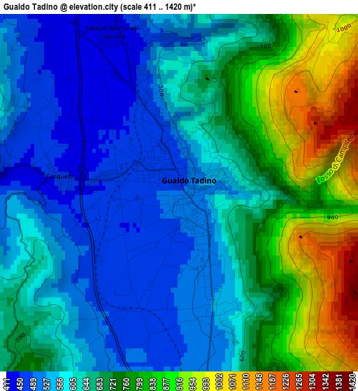
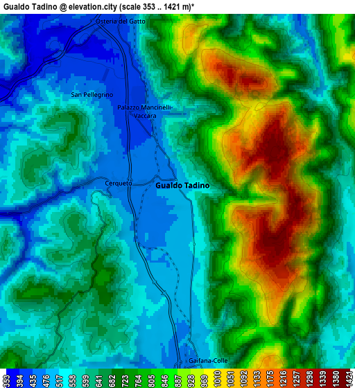
Below is the Elevation map of Gualdo Tadino, which displays elevation range with different colors. Scale of the first map is from 411 to 1420 m (1348 to 4659 ft) with average elevation of 663.9 meters (=2178 ft) [note 1]
These maps also provides idea of topography and contour of this city, they are displayed at different zoom levels. More info about maps, scale and edge coordinates you can find below images.
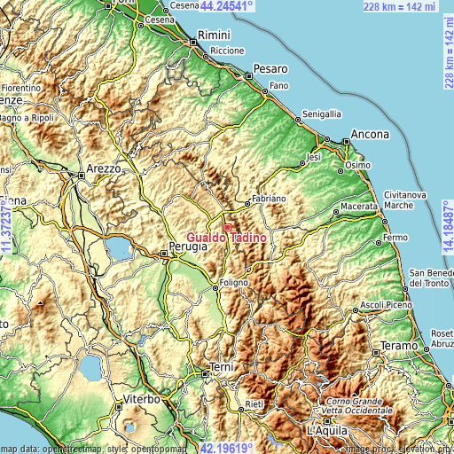
| \ | Map #1 | Map #2 | Topo.Map |
| Scale [m] | 411..1420 m | 353..1421 m | × |
| Scale [ft] | 1348..4659 ft | 1158..4662 ft | × |
| Average | 663.9 m = 2178 ft | 675.6 m = 2217 ft | × |
| Width | 7.12 km = 4.4 mi | 14.24 km = 8.8 mi | 227.9 km = 141.6 mi |
| Height | 7.12 km = 4.4 mi | 14.24 km = 8.8 mi | 227.8 km = 141.5 mi |
| ↑Max Latitude | 43.261421° | 43.293415° | 44.24541° |
| Latitude at center | 43.22941° | 43.22941° | 43.22941° |
| ↓Min Latitude | 43.197382° | 43.165338° | 42.19619° |
| ← Min Longitude | 12.734675° | 12.690729° | 11.37237° |
| Longitude center | 12.77862° | 12.77862° | 12.77862° |
| →Max Longitude | 12.822565° | 12.866511° | 14.18487° |
Nearby cities:
Cities around Gualdo Tadino sort by population:
• Fabriano elevation 315 m
15.9 km,  39°
39°
• Sigillo 486 m
11.7 km,  344°
344°
• Esanatoglia 446 m
14.1 km,  79°
79°
• Nocera Umbra 498 m
12.9 km,  176°
176°
• Valfabbrica 289 m
16.4 km,  240°
240°
• Osteria del Gatto 405 m
6.8 km, 336°
• Stazione di Padule 413 m
15.8 km,  303°
303°
• Pioraco 470 m
16.9 km,  108°
108°
• Massa 464 m
13.2 km, 110°
• Costacciaro 554 m
15.3 km, 339°
• Fossato di Vico 535 m
7.6 km,  349°
349°
• Sefro 513 m
16.5 km,  123°
123°
Multilingual:
 En español:
Gualdo Tadino elevación 490 m.
 En France:
Gualdo Tadino élévation 490 m.
 Auf Deutsch:
Gualdo Tadino höhe über dem Meeresspiegel ist 490 m.

Sources and notes:
- [note 1] Map square and city borders are not equal. Map elevation data is calculated only from area inside that square.
- [src 1] Elevation data from geonames database provided with same terms of usage.
- [src 2] The elevation map of Gualdo Tadino is generated using elevation data from NASA's 3 arcsec (90m) resolution SRTM data.
- [src 3] Base (background) map © OpenStreetMap contributors tiles are generated by Geofabrik and OpenTopoMap.
Copyright & License:
This Gualdo Tadino Elevation Map is licensed under CC BY-SA. You may reuse any part from this page, if you give a proper credit by linking to this URL:
 More info on terms of use page.