Umbertide elevation
Umbertide (Umbria, Provincia di Perugia), Italy elevation is 246 meters and Umbertide elevation in feet is 807 ft above sea level [src 1]. Umbertide is a seat of a third-order administrative division (feature code) with elevation that is 76 meters (249 ft) smaller than average city elevation in Italy.
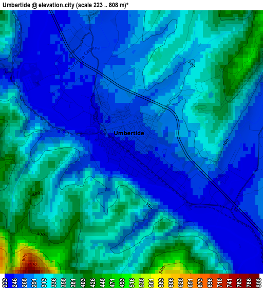
Below is the Elevation map of Umbertide, which displays elevation range with different colors. Scale of the first map is from 223 to 808 m (732 to 2651 ft) with average elevation of 309.4 meters (=1015 ft) [note 1]
These maps also provides idea of topography and contour of this city, they are displayed at different zoom levels. More info about maps, scale and edge coordinates you can find below images.
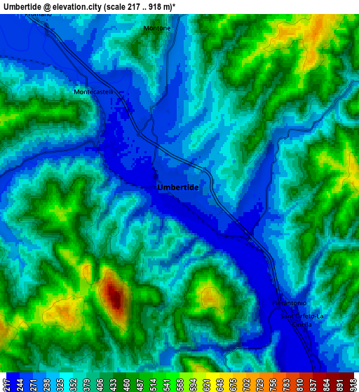
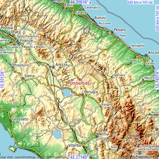
| \ | Map #1 | Map #2 | Topo.Map |
| Scale [m] | 223..808 m | 217..918 m | × |
| Scale [ft] | 732..2651 ft | 712..3012 ft | × |
| Average | 309.4 m = 1015 ft | 380.9 m = 1250 ft | × |
| Width | 7.11 km = 4.4 mi | 14.22 km = 8.8 mi | 227.6 km = 141.4 mi |
| Height | 7.11 km = 4.4 mi | 14.22 km = 8.8 mi | 227.6 km = 141.4 mi |
| ↑Max Latitude | 43.335382° | 43.367337° | 44.31816° |
| Latitude at center | 43.30341° | 43.30341° | 43.30341° |
| ↓Min Latitude | 43.271421° | 43.239416° | 42.27143° |
| ← Min Longitude | 12.293545° | 12.249599° | 10.93124° |
| Longitude center | 12.33749° | 12.33749° | 12.33749° |
| →Max Longitude | 12.381435° | 12.425381° | 13.74374° |
Nearby cities:
Cities around Umbertide sort by population:
• Gubbio elevation 487 m
19.7 km,  74°
74°
• Semonte-Casamorcia 439 m
17.2 km, 65°
• Mantignana 261 m
16.4 km,  193°
193°
• Ponte Pattoli 210 m
15.8 km,  152°
152°
• Trestina 262 m
10.7 km,  310°
310°
• Casa del Diavolo 237 m
15.7 km,  144°
144°
• Oscano 293 m
16.1 km,  179°
179°
• Pietralunga 548 m
16.5 km,  26°
26°
• San Secondo 267 m
14 km,  323°
323°
• Cipolleto 430 m
19.5 km,  83°
83°
• Montone 429 m
6.5 km,  349°
349°
• Lisciano Niccone 314 m
17 km,  248°
248°
Multilingual:
 En español:
Umbertide elevación 246 m.
 En France:
Umbertide élévation 246 m.
 Auf Deutsch:
Umbertide höhe über dem Meeresspiegel ist 246 m.

Sources and notes:
- [note 1] Map square and city borders are not equal. Map elevation data is calculated only from area inside that square.
- [src 1] Elevation data from geonames database provided with same terms of usage.
- [src 2] The elevation map of Umbertide is generated using elevation data from NASA's 3 arcsec (90m) resolution SRTM data.
- [src 3] Base (background) map © OpenStreetMap contributors tiles are generated by Geofabrik and OpenTopoMap.
Copyright & License:
This Umbertide Elevation Map is licensed under CC BY-SA. You may reuse any part from this page, if you give a proper credit by linking to this URL:
 More info on terms of use page.