Urbania elevation
Urbania (The Marches, Provincia di Pesaro e Urbino), Italy elevation is 280 meters and Urbania elevation in feet is 919 ft above sea level [src 1]. Urbania is a seat of a third-order administrative division (feature code) with elevation that is 42 meters (138 ft) smaller than average city elevation in Italy.
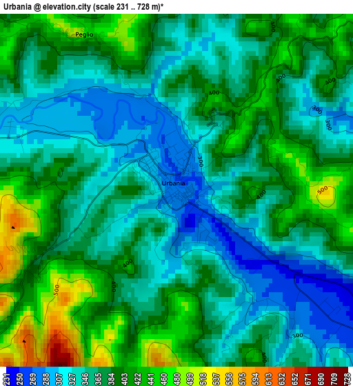
Below is the Elevation map of Urbania, which displays elevation range with different colors. Scale of the first map is from 231 to 728 m (758 to 2388 ft) with average elevation of 373.7 meters (=1226 ft) [note 1]
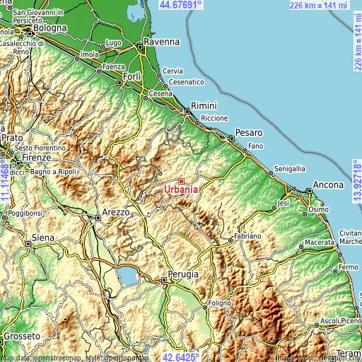
These maps also provides idea of topography and contour of this city, they are displayed at different zoom levels. More info about maps, scale and edge coordinates you can find below images.
| \ | Map #1 | Map #2 | Topo.Map |
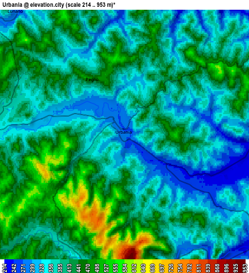
| Scale [m] | 231..728 m | 214..953 m | × |
| Scale [ft] | 758..2388 ft | 702..3127 ft | × |
| Average | 373.7 m = 1226 ft | 402.4 m = 1320 ft | × |
| Width | 7.07 km = 4.4 mi | 14.14 km = 8.8 mi | 226.2 km = 140.6 mi |
| Height | 7.07 km = 4.4 mi | 14.14 km = 8.8 mi | 226.2 km = 140.6 mi |
| ↑Max Latitude | 43.700099° | 43.731862° | 44.67691° |
| Latitude at center | 43.66832° | 43.66832° | 43.66832° |
| ↓Min Latitude | 43.636524° | 43.604711° | 42.6425° |
| ← Min Longitude | 12.476985° | 12.433039° | 11.11468° |
| Longitude center | 12.52093° | 12.52093° | 12.52093° |
| →Max Longitude | 12.564875° | 12.608821° | 13.92718° |
Nearby cities:
Cities around Urbania sort by population:
• Fermignano elevation 188 m
11.1 km,  75°
75°
• Urbino 447 m
11.3 km,  55°
55°
• Sant'Angelo in Vado 350 m
8.3 km,  267°
267°
• Acqualagna 205 m
13.3 km,  110°
110°
• Piobbico 338 m
9 km,  185°
185°
• Piandimeleto 325 m
10.9 km,  304°
304°
• Lunano 276 m
9.5 km,  318°
318°
• Apecchio 478 m
14.5 km,  213°
213°
• Mercatale 237 m
13.1 km,  347°
347°
• Sassocorvaro 342 m
12.8 km, 352°
• Belforte 346 m
12.9 km,  294°
294°
• Peglio 473 m
3.6 km,  329°
329°
Multilingual:
 En español:
Urbania elevación 280 m.
 En France:
Urbania élévation 280 m.


Sources and notes:
- [note 1] Map square and city borders are not equal. Map elevation data is calculated only from area inside that square.
- [src 1] Elevation data from geonames database provided with same terms of usage.
- [src 2] The elevation map of Urbania is generated using elevation data from NASA's 3 arcsec (90m) resolution SRTM data.
- [src 3] Base (background) map © OpenStreetMap contributors tiles are generated by Geofabrik and OpenTopoMap.
Copyright & License:
This Urbania Elevation Map is licensed under CC BY-SA. You may reuse any part from this page, if you give a proper credit by linking to this URL:
 More info on terms of use page.