Gela elevation
Gela (Sicily, Provincia di Caltanissetta), Italy elevation is 33 meters and Gela elevation in feet is 108 ft above sea level [src 1]. Gela is a seat of a third-order administrative division (feature code) with elevation that is 289 meters (948 ft) smaller than average city elevation in Italy.
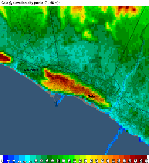
Below is the Elevation map of Gela, which displays elevation range with different colors. Scale of the first map is from -7 to 68 m (-23 to 223 ft) with average elevation of 19.2 meters (=63 ft) [note 1]
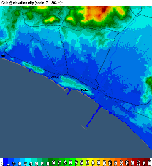
These maps also provides idea of topography and contour of this city, they are displayed at different zoom levels. More info about maps, scale and edge coordinates you can find below images.
| \ | Map #1 | Map #2 | Topo.Map |
| Scale [m] | -7..68 m | -7..303 m | × |
| Scale [ft] | -23..223 ft | -23..994 ft | × |
| Average | 19.2 m = 63 ft | 44 m = 144 ft | × |
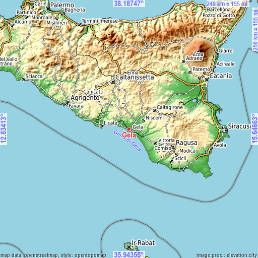
| Width | 7.8 km = 4.8 mi | 15.59 km = 9.7 mi | 249.5 km = 155 mi |
| Height | 7.8 km = 4.8 mi | 15.59 km = 9.7 mi | 249.5 km = 155 mi |
| ↑Max Latitude | 37.108864° | 37.143902° | 38.18747° |
| Latitude at center | 37.07381° | 37.07381° | 37.07381° |
| ↓Min Latitude | 37.03874° | 37.003653° | 35.94355° |
| ← Min Longitude | 14.196435° | 14.152489° | 12.83413° |
| Longitude center | 14.24038° | 14.24038° | 14.24038° |
| →Max Longitude | 14.284325° | 14.328271° | 15.64663° |
Nearby cities:
Cities around Gela sort by population:
• Vittoria elevation 171 m
28.9 km,  118°
118°
• Licata 14 m
26.9 km,  276°
276°
• Caltagirone 509 m
30.4 km,  53°
53°
• Niscemi 312 m
15.8 km,  59°
59°
• Mazzarino 541 m
25.5 km,  353°
353°
• Riesi 337 m
26.9 km,  328°
328°
• Acate 201 m
23.1 km,  104°
104°
• Butera 328 m
14 km,  338°
338°
• Scoglitti 30 m
26.3 km,  139°
139°
• Mazzarrone 297 m
28.5 km,  86°
86°
• San Michele di Ganzaria 463 m
28.3 km,  35°
35°
• San Cono 489 m
26.5 km,  25°
25°
Multilingual:
 En español:
Gela elevación 33 m.
 En France:
Gela élévation 33 m.


Sources and notes:
- [note 1] Map square and city borders are not equal. Map elevation data is calculated only from area inside that square.
- [src 1] Elevation data from geonames database provided with same terms of usage.
- [src 2] The elevation map of Gela is generated using elevation data from NASA's 3 arcsec (90m) resolution SRTM data.
- [src 3] Base (background) map © OpenStreetMap contributors tiles are generated by Geofabrik and OpenTopoMap.
Copyright & License:
This Gela Elevation Map is licensed under CC BY-SA. You may reuse any part from this page, if you give a proper credit by linking to this URL:
 More info on terms of use page.