Scoglitti elevation
Scoglitti (Sicily, Ragusa), Italy elevation is 30 meters and Scoglitti elevation in feet is 98 ft above sea level [src 1]. Scoglitti is a populated place (feature code) with elevation that is 292 meters (958 ft) smaller than average city elevation in Italy.
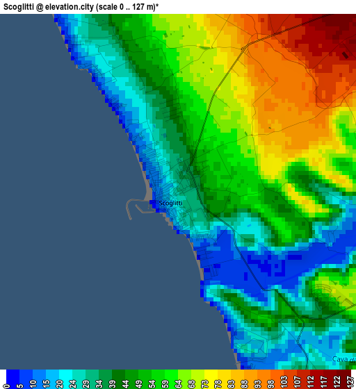
Below is the Elevation map of Scoglitti, which displays elevation range with different colors. Scale of the first map is from 0 to 127 m (0 to 417 ft) with average elevation of 51.5 meters (=169 ft) [note 1]
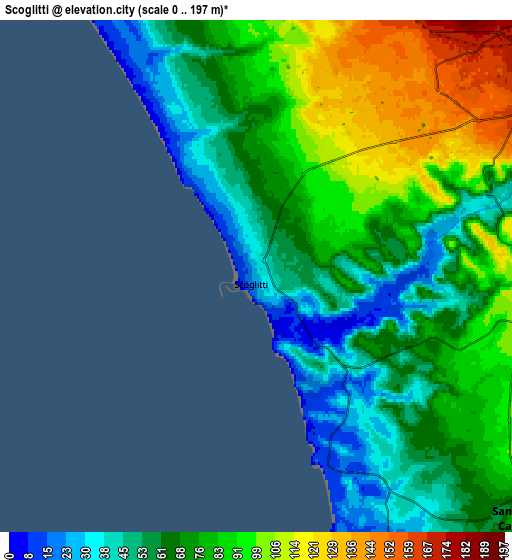
These maps also provides idea of topography and contour of this city, they are displayed at different zoom levels. More info about maps, scale and edge coordinates you can find below images.
| \ | Map #1 | Map #2 | Topo.Map |
| Scale [m] | 0..127 m | 0..197 m | × |
| Scale [ft] | 0..417 ft | 0..646 ft | × |
| Average | 51.5 m = 169 ft | 74.3 m = 244 ft | × |
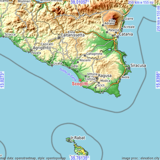
| Width | 7.82 km = 4.9 mi | 15.63 km = 9.7 mi | 250.1 km = 155.4 mi |
| Height | 7.82 km = 4.9 mi | 15.63 km = 9.7 mi | 250.1 km = 155.4 mi |
| ↑Max Latitude | 36.929377° | 36.964498° | 38.01057° |
| Latitude at center | 36.89424° | 36.89424° | 36.89424° |
| ↓Min Latitude | 36.859087° | 36.823918° | 35.76135° |
| ← Min Longitude | 14.389605° | 14.345659° | 13.0273° |
| Longitude center | 14.43355° | 14.43355° | 14.43355° |
| →Max Longitude | 14.477495° | 14.521441° | 15.8398° |
Nearby cities:
Cities around Scoglitti sort by population:
• Gela elevation 33 m
26.3 km,  319°
319°
• Ragusa 540 m
26.1 km,  82°
82°
• Vittoria 171 m
10.5 km,  52°
52°
• Comiso 204 m
16.6 km,  68°
68°
• Scicli 119 m
26.6 km,  115°
115°
• Acate 201 m
15.3 km,  20°
20°
• Santa Croce Camerina 93 m
11 km,  131°
131°
• Chiaramonte Gulfi 677 m
28.3 km,  57°
57°
• Mazzarrone 297 m
24.4 km,  27°
27°
• Marina di Ragusa 23 m
16.2 km,  138°
138°
• Donnalucata 7 m
23.6 km, 128°
• Pedalino 236 m
19.4 km,  42°
42°
Multilingual:
 En español:
Scoglitti elevación 30 m.
 En France:
Scoglitti élévation 30 m.
 Auf Deutsch:
Scoglitti höhe über dem Meeresspiegel ist 30 m.

Sources and notes:
- [note 1] Map square and city borders are not equal. Map elevation data is calculated only from area inside that square.
- [src 1] Elevation data from geonames database provided with same terms of usage.
- [src 2] The elevation map of Scoglitti is generated using elevation data from NASA's 3 arcsec (90m) resolution SRTM data.
- [src 3] Base (background) map © OpenStreetMap contributors tiles are generated by Geofabrik and OpenTopoMap.
Copyright & License:
This Scoglitti Elevation Map is licensed under CC BY-SA. You may reuse any part from this page, if you give a proper credit by linking to this URL:
 More info on terms of use page.