Acate elevation
Acate (Sicily, Ragusa), Italy elevation is 201 meters and Acate elevation in feet is 659 ft above sea level [src 1]. Acate is a seat of a third-order administrative division (feature code) with elevation that is 121 meters (397 ft) smaller than average city elevation in Italy.
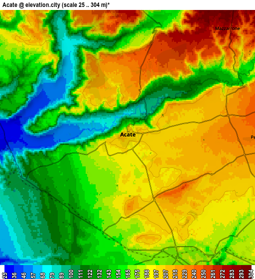
Below is the Elevation map of Acate, which displays elevation range with different colors. Scale of the first map is from 49 to 253 m (161 to 830 ft) with average elevation of 170 meters (=558 ft) [note 1]
These maps also provides idea of topography and contour of this city, they are displayed at different zoom levels. More info about maps, scale and edge coordinates you can find below images.

| \ | Map #1 | Map #2 | Topo.Map |
| Scale [m] | 49..253 m | 25..304 m | × |
| Scale [ft] | 161..830 ft | 82..997 ft | × |
| Average | 170 m = 558 ft | 168.7 m = 553 ft | × |
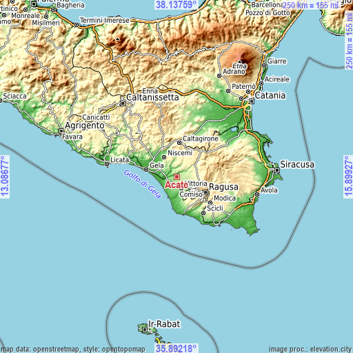
| Width | 7.8 km = 4.8 mi | 15.6 km = 9.7 mi | 249.7 km = 155.2 mi |
| Height | 7.8 km = 4.8 mi | 15.6 km = 9.7 mi | 249.7 km = 155.2 mi |
| ↑Max Latitude | 37.058257° | 37.093319° | 38.13759° |
| Latitude at center | 37.02318° | 37.02318° | 37.02318° |
| ↓Min Latitude | 36.988086° | 36.952976° | 35.89218° |
| ← Min Longitude | 14.449075° | 14.405129° | 13.08677° |
| Longitude center | 14.49302° | 14.49302° | 14.49302° |
| →Max Longitude | 14.536965° | 14.580911° | 15.89927° |
Nearby cities:
Cities around Acate sort by population:
• Gela elevation 33 m
23.1 km,  284°
284°
• Ragusa 540 m
23.2 km,  117°
117°
• Vittoria 171 m
8.5 km,  158°
158°
• Caltagirone 509 m
24 km,  4°
4°
• Niscemi 312 m
16.3 km,  327°
327°
• Comiso 204 m
13.1 km,  129°
129°
• Santa Croce Camerina 93 m
21.8 km,  172°
172°
• Chiaramonte Gulfi 677 m
18.7 km,  87°
87°
• Scoglitti 30 m
15.3 km,  200°
200°
• Mazzarrone 297 m
9.4 km,  39°
39°
• Licodia Eubea 585 m
24 km,  51°
51°
• Pedalino 236 m
7.8 km, 89°
Multilingual:
 En español:
Acate elevación 201 m.
 En France:
Acate élévation 201 m.


Sources and notes:
- [note 1] Map square and city borders are not equal. Map elevation data is calculated only from area inside that square.
- [src 1] Elevation data from geonames database provided with same terms of usage.
- [src 2] The elevation map of Acate is generated using elevation data from NASA's 3 arcsec (90m) resolution SRTM data.
- [src 3] Base (background) map © OpenStreetMap contributors tiles are generated by Geofabrik and OpenTopoMap.
Copyright & License:
This Acate Elevation Map is licensed under CC BY-SA. You may reuse any part from this page, if you give a proper credit by linking to this URL:
 More info on terms of use page.