Barkā Kānā elevation
Barkā Kānā (Jharkhand, Ramgarh), India elevation is 354 meters and Barkā Kānā elevation in feet is 1161 ft above sea level [src 1]. Barkā Kānā is a populated place (feature code) with elevation that is 61 meters (200 ft) bigger than average city elevation in India.
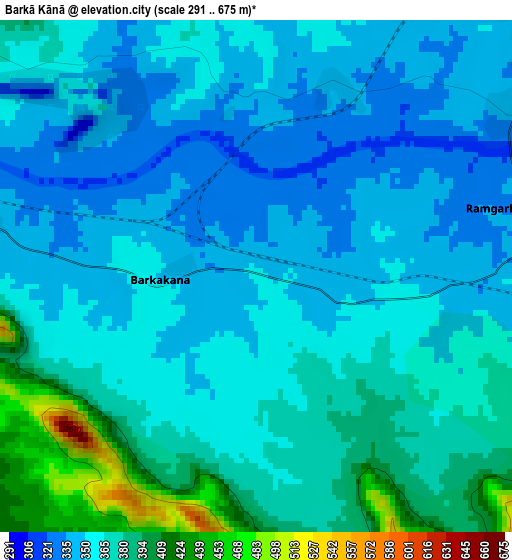
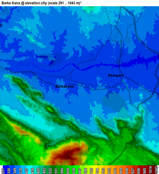
Below is the Elevation map of Barkā Kānā, which displays elevation range with different colors. Scale of the first map is from 291 to 675 m (955 to 2215 ft) with average elevation of 363.4 meters (=1192 ft) [note 1]
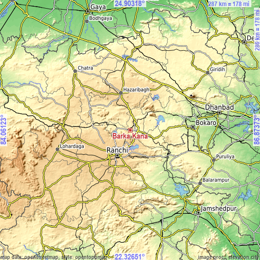
These maps also provides idea of topography and contour of this city, they are displayed at different zoom levels. More info about maps, scale and edge coordinates you can find below images.
| \ | Map #1 | Map #2 | Topo.Map |
| Scale [m] | 291..675 m | 291..1043 m | × |
| Scale [ft] | 955..2215 ft | 955..3422 ft | × |
| Average | 363.4 m = 1192 ft | 426.9 m = 1401 ft | × |
| Width | 8.95 km = 5.6 mi | 17.91 km = 11.1 mi | 286.5 km = 178 mi |
| Height | 8.95 km = 5.6 mi | 17.91 km = 11.1 mi | 286.5 km = 178 mi |
| ↑Max Latitude | 23.661437° | 23.701682° | 24.90318° |
| Latitude at center | 23.62118° | 23.62118° | 23.62118° |
| ↓Min Latitude | 23.58091° | 23.540629° | 22.32651° |
| ← Min Longitude | 85.423535° | 85.379589° | 84.06123° |
| Longitude center | 85.46748° | 85.46748° | 85.46748° |
| →Max Longitude | 85.511425° | 85.555371° | 86.87373° |
Nearby cities:
Cities around Barkā Kānā sort by population:
• Ranchi elevation 643 m
34.9 km,  207°
207°
• Bokāro 242 m
53.1 km,  69°
69°
• Hazāribāgh 621 m
42.7 km,  345°
345°
• Rāmgarh 339 m
5.6 km,  79°
79°
• Gumia 289 m
41.4 km,  61°
61°
• Būndu 325 m
52.7 km,  166°
166°
• Kuju 423 m
12.4 km,  20°
20°
• Jhalidā 298 m
59.2 km,  118°
118°
• Kānke 643 m
25.6 km,  215°
215°
• Muri 262 m
49 km, 124°
• Rāy 431 m
42.6 km,  279°
279°
• Sāruberā 345 m
58.1 km, 67°
Multilingual:
 En español:
Barkā Kānā elevación 354 m.
 En France:
Barkā Kānā élévation 354 m.
 Auf Deutsch:
Barkā Kānā höhe über dem Meeresspiegel ist 354 m.

Sources and notes:
- [note 1] Map square and city borders are not equal. Map elevation data is calculated only from area inside that square.
- [src 1] Elevation data from geonames database provided with same terms of usage.
- [src 2] The elevation map of Barkā Kānā is generated using elevation data from NASA's 3 arcsec (90m) resolution SRTM data.
- [src 3] Base (background) map © OpenStreetMap contributors tiles are generated by Geofabrik and OpenTopoMap.
Copyright & License:
This Barkā Kānā Elevation Map is licensed under CC BY-SA. You may reuse any part from this page, if you give a proper credit by linking to this URL:
 More info on terms of use page.