Būndu elevation
Būndu (Jharkhand, Rānchī), India elevation is 325 meters and Būndu elevation in feet is 1066 ft above sea level [src 1]. Būndu is a populated place (feature code) with elevation that is 32 meters (105 ft) bigger than average city elevation in India.
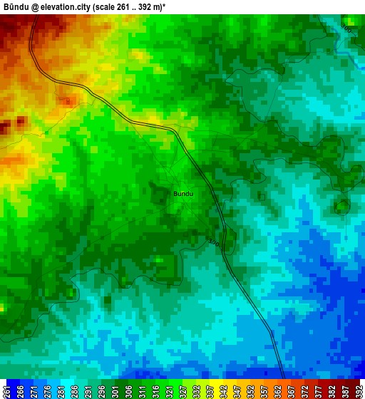
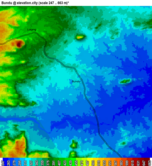
Below is the Elevation map of Būndu, which displays elevation range with different colors. Scale of the first map is from 261 to 392 m (856 to 1286 ft) with average elevation of 305.2 meters (=1001 ft) [note 1]
These maps also provides idea of topography and contour of this city, they are displayed at different zoom levels. More info about maps, scale and edge coordinates you can find below images.
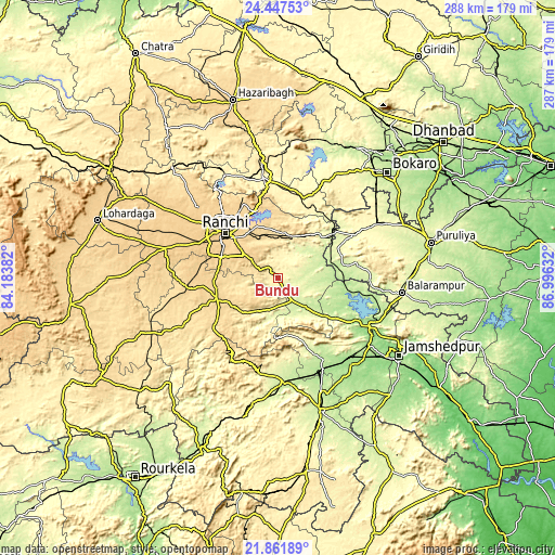
| \ | Map #1 | Map #2 | Topo.Map |
| Scale [m] | 261..392 m | 247..663 m | × |
| Scale [ft] | 856..1286 ft | 810..2175 ft | × |
| Average | 305.2 m = 1001 ft | 332.6 m = 1091 ft | × |
| Width | 8.98 km = 5.6 mi | 17.97 km = 11.2 mi | 287.5 km = 178.6 mi |
| Height | 8.98 km = 5.6 mi | 17.97 km = 11.2 mi | 287.5 km = 178.6 mi |
| ↑Max Latitude | 23.201347° | 23.241733° | 24.44753° |
| Latitude at center | 23.16095° | 23.16095° | 23.16095° |
| ↓Min Latitude | 23.12054° | 23.080119° | 21.86189° |
| ← Min Longitude | 85.546125° | 85.502179° | 84.18382° |
| Longitude center | 85.59007° | 85.59007° | 85.59007° |
| →Max Longitude | 85.634015° | 85.677961° | 86.99632° |
Nearby cities:
Cities around Būndu sort by population:
• Ranchi elevation 643 m
35.1 km,  305°
305°
• Rāmgarh 339 m
52.7 km,  352°
352°
• Chakradharpur 232 m
54.1 km,  175°
175°
• Khunti 650 m
33.3 km,  253°
253°
• Barkā Kānā 354 m
52.7 km, 346°
• Jhalidā 298 m
45.5 km,  60°
60°
• Kānke 643 m
41 km,  317°
317°
• Muri 262 m
36.3 km,  50°
50°
• Kharsāwān 202 m
48 km,  149°
149°
• Kāndra 182 m
58.5 km,  126°
126°
• Sini 193 m
54.7 km,  138°
138°
• Chāndil 182 m
52.5 km,  115°
115°
Multilingual:
 En español:
Būndu elevación 325 m.
 En France:
Būndu élévation 325 m.


Sources and notes:
- [note 1] Map square and city borders are not equal. Map elevation data is calculated only from area inside that square.
- [src 1] Elevation data from geonames database provided with same terms of usage.
- [src 2] The elevation map of Būndu is generated using elevation data from NASA's 3 arcsec (90m) resolution SRTM data.
- [src 3] Base (background) map © OpenStreetMap contributors tiles are generated by Geofabrik and OpenTopoMap.
Copyright & License:
This Būndu Elevation Map is licensed under CC BY-SA. You may reuse any part from this page, if you give a proper credit by linking to this URL:
 More info on terms of use page.