Beltangadi elevation
Beltangadi (Karnataka, Shimoga), India elevation is 652 meters and Beltangadi elevation in feet is 2139 ft above sea level [src 1]. Beltangadi is a populated place (feature code) with elevation that is 359 meters (1178 ft) bigger than average city elevation in India.
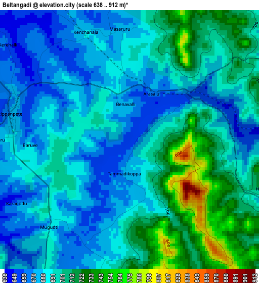
Below is the Elevation map of Beltangadi, which displays elevation range with different colors. Scale of the first map is from 638 to 912 m (2093 to 2992 ft) with average elevation of 692.6 meters (=2272 ft) [note 1]
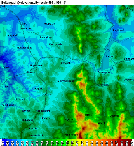
These maps also provides idea of topography and contour of this city, they are displayed at different zoom levels. More info about maps, scale and edge coordinates you can find below images.
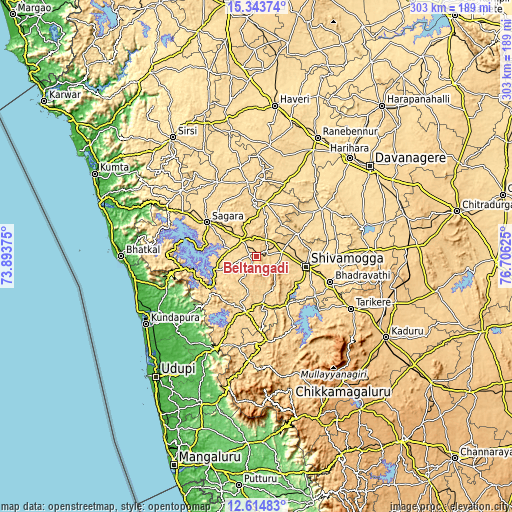
| \ | Map #1 | Map #2 | Topo.Map |
| Scale [m] | 638..912 m | 594..970 m | × |
| Scale [ft] | 2093..2992 ft | 1949..3182 ft | × |
| Average | 692.6 m = 2272 ft | 689.5 m = 2262 ft | × |
| Width | 9.48 km = 5.9 mi | 18.97 km = 11.8 mi | 303.4 km = 188.5 mi |
| Height | 9.48 km = 5.9 mi | 18.97 km = 11.8 mi | 303.5 km = 188.6 mi |
| ↑Max Latitude | 14.025969° | 14.0686° | 15.34374° |
| Latitude at center | 13.98333° | 13.98333° | 13.98333° |
| ↓Min Latitude | 13.940683° | 13.898028° | 12.61483° |
| ← Min Longitude | 75.256055° | 75.212109° | 73.89375° |
| Longitude center | 75.3° | 75.3° | 75.3° |
| →Max Longitude | 75.343945° | 75.387891° | 76.70625° |
Nearby cities:
Cities around Beltangadi sort by population:
• Shimoga elevation 590 m
29.5 km,  101°
101°
• Bhadrāvati 592 m
46.2 km,  108°
108°
• Sāgar 592 m
35.5 km,  304°
304°
• Shikārpur 615 m
32.4 km,  10°
10°
• Honnāli 562 m
46.9 km,  52°
52°
• Tīrthahalli 620 m
33.3 km,  190°
190°
• Nyāmti 605 m
35 km,  58°
58°
• Narasimharājapura 698 m
47.3 km,  151°
151°
• Sorab 590 m
49.6 km,  333°
333°
• Kumsi 667 m
13.4 km, 53°
• Hosanagara 589 m
26.5 km,  253°
253°
• Hosangadi 103 m
49 km,  229°
229°
Multilingual:
 En español:
Beltangadi elevación 652 m.
 En France:
Beltangadi élévation 652 m.
 Auf Deutsch:
Beltangadi höhe über dem Meeresspiegel ist 652 m.

Sources and notes:
- [note 1] Map square and city borders are not equal. Map elevation data is calculated only from area inside that square.
- [src 1] Elevation data from geonames database provided with same terms of usage.
- [src 2] The elevation map of Beltangadi is generated using elevation data from NASA's 3 arcsec (90m) resolution SRTM data.
- [src 3] Base (background) map © OpenStreetMap contributors tiles are generated by Geofabrik and OpenTopoMap.
Copyright & License:
This Beltangadi Elevation Map is licensed under CC BY-SA. You may reuse any part from this page, if you give a proper credit by linking to this URL:
 More info on terms of use page.