Narasimharājapura elevation
Narasimharājapura (Karnataka, Chikmagalur), India elevation is 698 meters and Narasimharājapura elevation in feet is 2290 ft above sea level [src 1]. Narasimharājapura is a populated place (feature code) with elevation that is 405 meters (1329 ft) bigger than average city elevation in India.
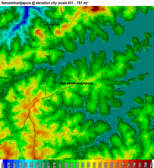
Below is the Elevation map of Narasimharājapura, which displays elevation range with different colors. Scale of the first map is from 631 to 761 m (2070 to 2497 ft) with average elevation of 682.6 meters (=2240 ft) [note 1]
These maps also provides idea of topography and contour of this city, they are displayed at different zoom levels. More info about maps, scale and edge coordinates you can find below images.
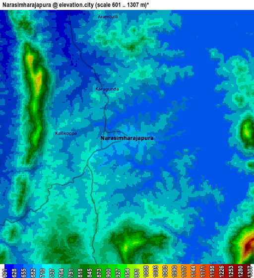
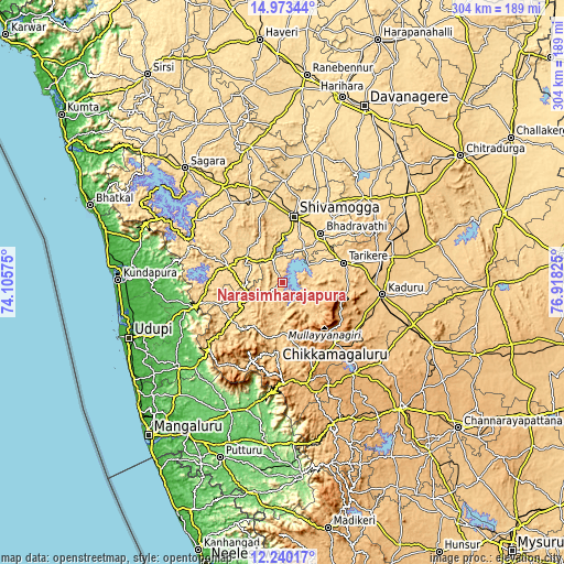
| \ | Map #1 | Map #2 | Topo.Map |
| Scale [m] | 631..761 m | 601..1307 m | × |
| Scale [ft] | 2070..2497 ft | 1972..4288 ft | × |
| Average | 682.6 m = 2240 ft | 704.6 m = 2312 ft | × |
| Width | 9.5 km = 5.9 mi | 19 km = 11.8 mi | 303.9 km = 188.8 mi |
| Height | 9.5 km = 5.9 mi | 19 km = 11.8 mi | 303.9 km = 188.8 mi |
| ↑Max Latitude | 13.653457° | 13.696157° | 14.97344° |
| Latitude at center | 13.61075° | 13.61075° | 13.61075° |
| ↓Min Latitude | 13.568035° | 13.525312° | 12.24017° |
| ← Min Longitude | 75.468055° | 75.424109° | 74.10575° |
| Longitude center | 75.512° | 75.512° | 75.512° |
| →Max Longitude | 75.555945° | 75.599891° | 76.91825° |
Nearby cities:
Cities around Narasimharājapura sort by population:
• Shimoga elevation 590 m
36.2 km,  9°
9°
• Bhadrāvati 592 m
33.7 km,  38°
38°
• Chikmagalūr 1042 m
42.8 km,  138°
138°
• Tarikere 685 m
34.4 km,  71°
71°
• Kadūr 774 m
54.4 km,  96°
96°
• Birūr 799 m
49.7 km,  91°
91°
• Someshwar 134 m
50 km,  254°
254°
• Tīrthahalli 620 m
30.1 km,  286°
286°
• Beltangadi 652 m
47.3 km,  331°
331°
• Kumsi 667 m
50.8 km,  346°
346°
• Koppa 778 m
18.4 km,  240°
240°
• Sringeri 644 m
35.4 km,  232°
232°
Multilingual:
 En español:
Narasimharājapura elevación 698 m.
 En France:
Narasimharājapura élévation 698 m.
 Auf Deutsch:
Narasimharājapura höhe über dem Meeresspiegel ist 698 m.

Sources and notes:
- [note 1] Map square and city borders are not equal. Map elevation data is calculated only from area inside that square.
- [src 1] Elevation data from geonames database provided with same terms of usage.
- [src 2] The elevation map of Narasimharājapura is generated using elevation data from NASA's 3 arcsec (90m) resolution SRTM data.
- [src 3] Base (background) map © OpenStreetMap contributors tiles are generated by Geofabrik and OpenTopoMap.
Copyright & License:
This Narasimharājapura Elevation Map is licensed under CC BY-SA. You may reuse any part from this page, if you give a proper credit by linking to this URL:
 More info on terms of use page.