Buddh Gaya elevation
Buddh Gaya (Bihar, Gayā), India elevation is 124 meters and Buddh Gaya elevation in feet is 407 ft above sea level [src 1]. Buddh Gaya is a populated place (feature code) with elevation that is 169 meters (554 ft) smaller than average city elevation in India.
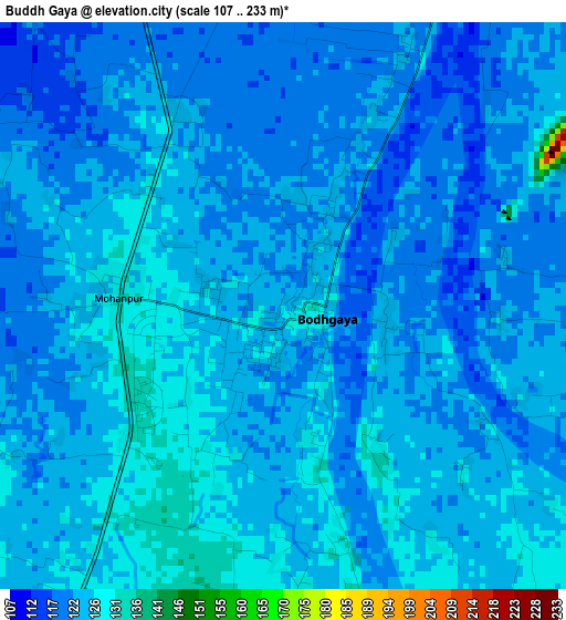
Below is the Elevation map of Buddh Gaya, which displays elevation range with different colors. Scale of the first map is from 107 to 233 m (351 to 764 ft) with average elevation of 123.2 meters (=404 ft) [note 1]
These maps also provides idea of topography and contour of this city, they are displayed at different zoom levels. More info about maps, scale and edge coordinates you can find below images.

| \ | Map #1 | Map #2 | Topo.Map |
| Scale [m] | 107..233 m | 102..307 m | × |
| Scale [ft] | 351..764 ft | 335..1007 ft | × |
| Average | 123.2 m = 404 ft | 125.5 m = 412 ft | × |
| Width | 8.88 km = 5.5 mi | 17.76 km = 11 mi | 284.1 km = 176.5 mi |
| Height | 8.88 km = 5.5 mi | 17.76 km = 11 mi | 284.1 km = 176.5 mi |
| ↑Max Latitude | 24.737999° | 24.777905° | 25.96906° |
| Latitude at center | 24.69808° | 24.69808° | 24.69808° |
| ↓Min Latitude | 24.658148° | 24.618204° | 23.414° |
| ← Min Longitude | 84.942955° | 84.899009° | 83.58065° |
| Longitude center | 84.9869° | 84.9869° | 84.9869° |
| →Max Longitude | 85.030845° | 85.074791° | 86.39315° |
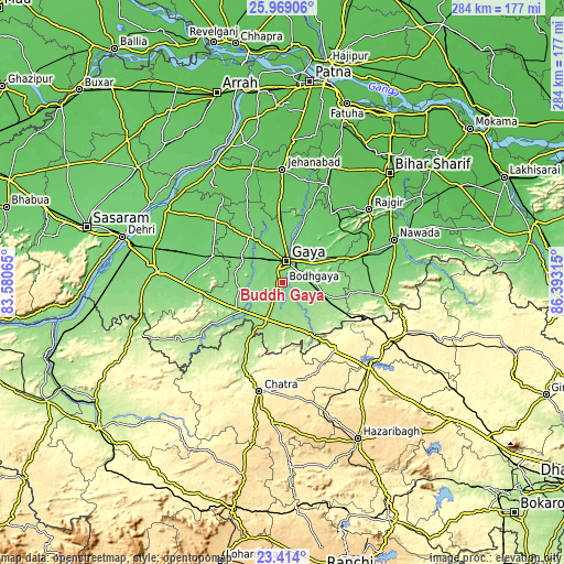
Nearby cities:
Cities around Buddh Gaya sort by population:
• Gaya elevation 117 m
11.1 km,  8°
8°
• Nawāda 93 m
60 km,  69°
69°
• Jahānābād 71 m
57.3 km,  0°
0°
• Bagaha 155 m
20.2 km,  158°
158°
• Chatrā 440 m
55.9 km,  192°
192°
• Rājgīr 85 m
57.1 km,  50°
50°
• Sherghāti 151 m
25 km,  232°
232°
• Islāmpur 73 m
53.9 km,  24°
24°
• Hisuā 101 m
46 km, 70°
• Rafiganj 106 m
38 km,  290°
290°
• Silao 70 m
61.8 km, 46°
• Tekāri 97 m
30.8 km,  331°
331°
Multilingual:
 En español:
Buddh Gaya elevación 124 m.
 En France:
Bodhgaya élévation 124 m.
 Auf Deutsch:
Bodhgaya höhe über dem Meeresspiegel ist 124 m.

Sources and notes:
- [note 1] Map square and city borders are not equal. Map elevation data is calculated only from area inside that square.
- [src 1] Elevation data from geonames database provided with same terms of usage.
- [src 2] The elevation map of Buddh Gaya is generated using elevation data from NASA's 3 arcsec (90m) resolution SRTM data.
- [src 3] Base (background) map © OpenStreetMap contributors tiles are generated by Geofabrik and OpenTopoMap.
Copyright & License:
This Buddh Gaya Elevation Map is licensed under CC BY-SA. You may reuse any part from this page, if you give a proper credit by linking to this URL:
 More info on terms of use page.