Jahānābād elevation
Jahānābād (Bihar, Jehanabad), India elevation is 71 meters and Jahānābād elevation in feet is 233 ft above sea level [src 1]. Jahānābād is a populated place (feature code) with elevation that is 222 meters (728 ft) smaller than average city elevation in India.
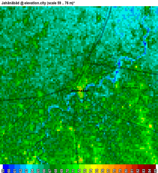
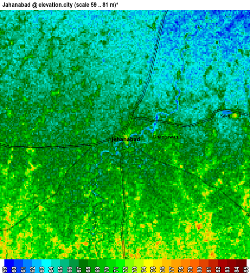
Below is the Elevation map of Jahānābād, which displays elevation range with different colors. Scale of the first map is from 59 to 76 m (194 to 249 ft) with average elevation of 66.6 meters (=219 ft) [note 1]
These maps also provides idea of topography and contour of this city, they are displayed at different zoom levels. More info about maps, scale and edge coordinates you can find below images.
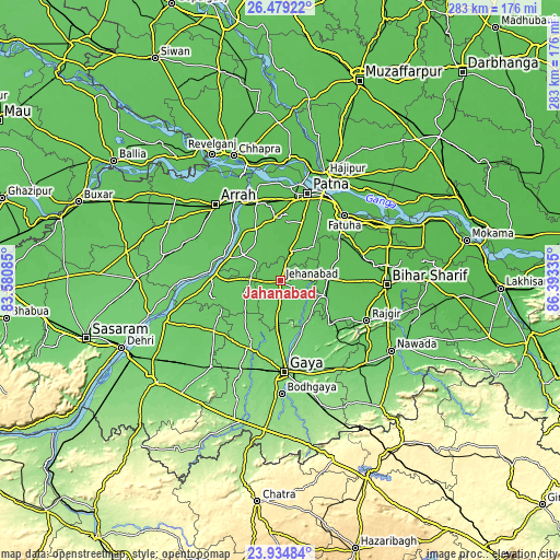
| \ | Map #1 | Map #2 | Topo.Map |
| Scale [m] | 59..76 m | 59..81 m | × |
| Scale [ft] | 194..249 ft | 194..266 ft | × |
| Average | 66.6 m = 219 ft | 66.9 m = 219 ft | × |
| Width | 8.84 km = 5.5 mi | 17.68 km = 11 mi | 282.9 km = 175.8 mi |
| Height | 8.84 km = 5.5 mi | 17.68 km = 11 mi | 282.9 km = 175.8 mi |
| ↑Max Latitude | 25.253432° | 25.293171° | 26.47922° |
| Latitude at center | 25.21368° | 25.21368° | 25.21368° |
| ↓Min Latitude | 25.173915° | 25.134137° | 23.93484° |
| ← Min Longitude | 84.943155° | 84.899209° | 83.58085° |
| Longitude center | 84.9871° | 84.9871° | 84.9871° |
| →Max Longitude | 85.031045° | 85.074991° | 86.39335° |
Nearby cities:
Cities around Jahānābād sort by population:
• Patna elevation 53 m
44.9 km,  19°
19°
• Gaya 117 m
46.4 km,  177°
177°
• Dinapore 59 m
47.5 km,  7°
7°
• Masaurhi Buzurg 62 m
16.3 km, 16°
• Khagaul 61 m
41 km, 8°
• Fatwa 55 m
45.9 km,  44°
44°
• Hilsa 60 m
31.8 km,  68°
68°
• Rājgīr 85 m
48.3 km,  115°
115°
• Islāmpur 73 m
23.5 km,  110°
110°
• Koelwār 64 m
45 km,  334°
334°
• Silao 70 m
46.7 km, 108°
• Tekāri 97 m
33.5 km,  205°
205°
Multilingual:
 En español:
Jahānābād elevación 71 m.
 En France:
Jahānābād élévation 71 m.
 Auf Deutsch:
Jahānābād höhe über dem Meeresspiegel ist 71 m.

Sources and notes:
- [note 1] Map square and city borders are not equal. Map elevation data is calculated only from area inside that square.
- [src 1] Elevation data from geonames database provided with same terms of usage.
- [src 2] The elevation map of Jahānābād is generated using elevation data from NASA's 3 arcsec (90m) resolution SRTM data.
- [src 3] Base (background) map © OpenStreetMap contributors tiles are generated by Geofabrik and OpenTopoMap.
Copyright & License:
This Jahānābād Elevation Map is licensed under CC BY-SA. You may reuse any part from this page, if you give a proper credit by linking to this URL:
 More info on terms of use page.