Dhanwār elevation
Dhanwār (Jharkhand, Girīdīh), India elevation is 355 meters and Dhanwār elevation in feet is 1165 ft above sea level [src 1]. Dhanwār is a populated place (feature code) with elevation that is 62 meters (203 ft) bigger than average city elevation in India.
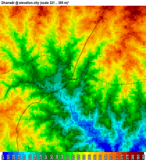
Below is the Elevation map of Dhanwār, which displays elevation range with different colors. Scale of the first map is from 321 to 385 m (1053 to 1263 ft) with average elevation of 353.1 meters (=1158 ft) [note 1]
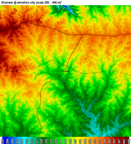
These maps also provides idea of topography and contour of this city, they are displayed at different zoom levels. More info about maps, scale and edge coordinates you can find below images.
| \ | Map #1 | Map #2 | Topo.Map |
| Scale [m] | 321..385 m | 290..406 m | × |
| Scale [ft] | 1053..1263 ft | 951..1332 ft | × |
| Average | 353.1 m = 1158 ft | 355.1 m = 1165 ft | × |
| Width | 8.9 km = 5.5 mi | 17.8 km = 11.1 mi | 284.7 km = 176.9 mi |
| Height | 8.9 km = 5.5 mi | 17.8 km = 11.1 mi | 284.8 km = 177 mi |
| ↑Max Latitude | 24.450751° | 24.490748° | 25.6847° |
| Latitude at center | 24.41074° | 24.41074° | 24.41074° |
| ↓Min Latitude | 24.370717° | 24.330681° | 23.12379° |
| ← Min Longitude | 85.937885° | 85.893939° | 84.57558° |
| Longitude center | 85.98183° | 85.98183° | 85.98183° |
| →Max Longitude | 86.025775° | 86.069721° | 87.38808° |
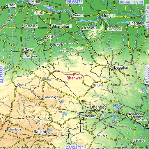
Nearby cities:
Cities around Dhanwār sort by population:
• Jamūī elevation 88 m
62.4 km,  23°
23°
• Jumri Tilaiyā 398 m
45.9 km,  273°
273°
• Gīrīdīh 305 m
41.5 km,  126°
126°
• Jhā-Jhā 139 m
56.7 km,  45°
45°
• Gomoh 247 m
62.2 km,  163°
163°
• Barki Saria 335 m
27.7 km,  199°
199°
• Kodarmā 390 m
39.8 km,  279°
279°
• Jasidih 272 m
68.2 km,  80°
80°
• patamda 390 m
58.6 km,  257°
257°
• Hesla 370 m
40 km, 195°
• Topchānchi 302 m
60.5 km, 158°
• Sāruberā 345 m
65.9 km,  178°
178°
Multilingual:
 En español:
Dhanwār elevación 355 m.
 En France:
Dhanwār élévation 355 m.


Sources and notes:
- [note 1] Map square and city borders are not equal. Map elevation data is calculated only from area inside that square.
- [src 1] Elevation data from geonames database provided with same terms of usage.
- [src 2] The elevation map of Dhanwār is generated using elevation data from NASA's 3 arcsec (90m) resolution SRTM data.
- [src 3] Base (background) map © OpenStreetMap contributors tiles are generated by Geofabrik and OpenTopoMap.
Copyright & License:
This Dhanwār Elevation Map is licensed under CC BY-SA. You may reuse any part from this page, if you give a proper credit by linking to this URL:
 More info on terms of use page.