Hesla elevation
Hesla (Jharkhand, Girīdīh), India elevation is 370 meters and Hesla elevation in feet is 1214 ft above sea level [src 1]. Hesla is a populated place (feature code) with elevation that is 77 meters (253 ft) bigger than average city elevation in India.
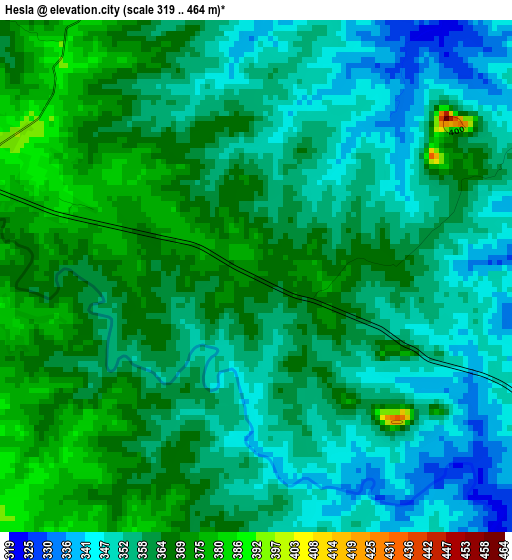
Below is the Elevation map of Hesla, which displays elevation range with different colors. Scale of the first map is from 319 to 464 m (1047 to 1522 ft) with average elevation of 359 meters (=1178 ft) [note 1]
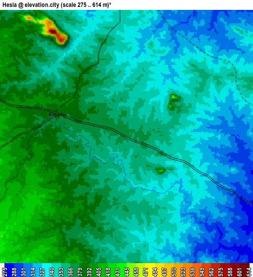
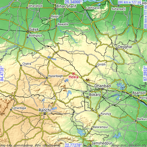
These maps also provides idea of topography and contour of this city, they are displayed at different zoom levels. More info about maps, scale and edge coordinates you can find below images.
| \ | Map #1 | Map #2 | Topo.Map |
| Scale [m] | 319..464 m | 275..614 m | × |
| Scale [ft] | 1047..1522 ft | 902..2014 ft | × |
| Average | 359 m = 1178 ft | 355.9 m = 1168 ft | × |
| Width | 8.92 km = 5.5 mi | 17.85 km = 11.1 mi | 285.5 km = 177.4 mi |
| Height | 8.92 km = 5.5 mi | 17.85 km = 11.1 mi | 285.5 km = 177.4 mi |
| ↑Max Latitude | 24.10325° | 24.143358° | 25.34066° |
| Latitude at center | 24.06313° | 24.06313° | 24.06313° |
| ↓Min Latitude | 24.022997° | 23.982852° | 22.77275° |
| ← Min Longitude | 85.835105° | 85.791159° | 84.4728° |
| Longitude center | 85.87905° | 85.87905° | 85.87905° |
| →Max Longitude | 85.922995° | 85.966941° | 87.2853° |
Nearby cities:
Cities around Hesla sort by population:
• Bokāro elevation 242 m
31.7 km,  165°
165°
• Gīrīdīh 305 m
45.7 km,  72°
72°
• Kātrās 199 m
51.8 km,  124°
124°
• Gumia 289 m
30 km,  190°
190°
• Gomoh 247 m
34.8 km,  127°
127°
• Barki Saria 335 m
12.6 km,  4°
4°
• Dugda 213 m
46.2 km,  139°
139°
• Kuju 423 m
53.1 km,  224°
224°
• Malkera 186 m
52 km, 126°
• Dhanwār 355 m
40 km,  15°
15°
• Topchānchi 302 m
36.9 km, 118°
• Sāruberā 345 m
29.7 km,  156°
156°
Multilingual:
 En español:
Hesla elevación 370 m.
 En France:
Hesla élévation 370 m.


Sources and notes:
- [note 1] Map square and city borders are not equal. Map elevation data is calculated only from area inside that square.
- [src 1] Elevation data from geonames database provided with same terms of usage.
- [src 2] The elevation map of Hesla is generated using elevation data from NASA's 3 arcsec (90m) resolution SRTM data.
- [src 3] Base (background) map © OpenStreetMap contributors tiles are generated by Geofabrik and OpenTopoMap.
Copyright & License:
This Hesla Elevation Map is licensed under CC BY-SA. You may reuse any part from this page, if you give a proper credit by linking to this URL:
 More info on terms of use page.