Nārnaul elevation
Nārnaul (Haryana, Mahendragarh), India elevation is 311 meters and Nārnaul elevation in feet is 1020 ft above sea level [src 1]. Nārnaul is a populated place (feature code) with elevation that is 18 meters (59 ft) bigger than average city elevation in India.
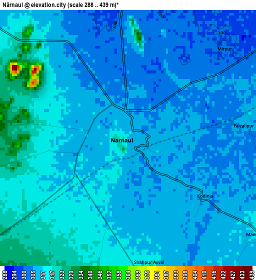
Below is the Elevation map of Nārnaul, which displays elevation range with different colors. Scale of the first map is from 288 to 439 m (945 to 1440 ft) with average elevation of 310.1 meters (=1017 ft) [note 1]
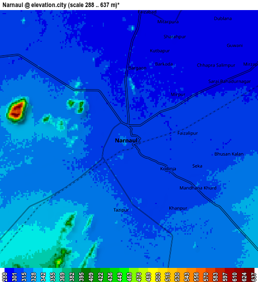
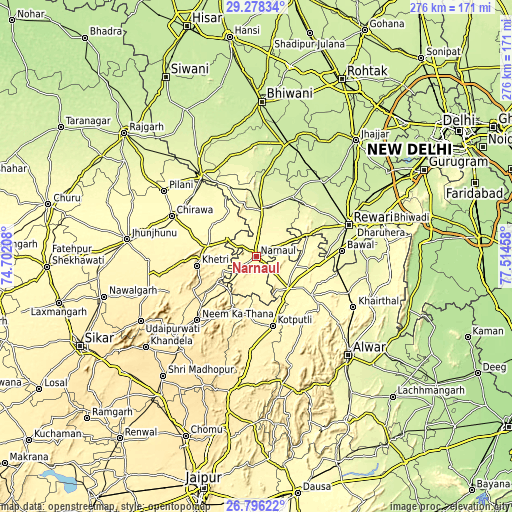
These maps also provides idea of topography and contour of this city, they are displayed at different zoom levels. More info about maps, scale and edge coordinates you can find below images.
| \ | Map #1 | Map #2 | Topo.Map |
| Scale [m] | 288..439 m | 288..637 m | × |
| Scale [ft] | 945..1440 ft | 945..2090 ft | × |
| Average | 310.1 m = 1017 ft | 315 m = 1033 ft | × |
| Width | 8.63 km = 5.4 mi | 17.25 km = 10.7 mi | 276 km = 171.5 mi |
| Height | 8.62 km = 5.4 mi | 17.25 km = 10.7 mi | 276 km = 171.5 mi |
| ↑Max Latitude | 28.083218° | 28.121983° | 29.27834° |
| Latitude at center | 28.04444° | 28.04444° | 28.04444° |
| ↓Min Latitude | 28.005648° | 27.966841° | 26.79622° |
| ← Min Longitude | 76.064385° | 76.020439° | 74.70208° |
| Longitude center | 76.10833° | 76.10833° | 76.10833° |
| →Max Longitude | 76.152275° | 76.196221° | 77.51458° |
Nearby cities:
Cities around Nārnaul sort by population:
• Kotputli elevation 361 m
39.1 km,  166°
166°
• Chidawa 316 m
50.7 km,  295°
295°
• Neem ka Thana 458 m
46.3 km,  223°
223°
• Behror 325 m
24.3 km,  135°
135°
• Mahendragarh 276 m
25.4 km,  9°
9°
• Sūrajgarh 298 m
47.2 km,  308°
308°
• Khetri 398 m
32 km,  261°
261°
• Bāwal 266 m
46.7 km,  86°
86°
• Lohāru 275 m
52 km,  325°
325°
• Mandāwar 312 m
47.8 km,  114°
114°
• Kanīna Khās 255 m
37.5 km,  31°
31°
• Ateli Mandi 290 m
16.1 km,  67°
67°
Multilingual:
 En español:
Nārnaul elevación 311 m.
 En France:
Nārnaul élévation 311 m.


Sources and notes:
- [note 1] Map square and city borders are not equal. Map elevation data is calculated only from area inside that square.
- [src 1] Elevation data from geonames database provided with same terms of usage.
- [src 2] The elevation map of Nārnaul is generated using elevation data from NASA's 3 arcsec (90m) resolution SRTM data.
- [src 3] Base (background) map © OpenStreetMap contributors tiles are generated by Geofabrik and OpenTopoMap.
Copyright & License:
This Nārnaul Elevation Map is licensed under CC BY-SA. You may reuse any part from this page, if you give a proper credit by linking to this URL:
 More info on terms of use page.