Kanīna Khās elevation
Kanīna Khās (Haryana, Mahendragarh), India elevation is 255 meters and Kanīna Khās elevation in feet is 837 ft above sea level [src 1]. Kanīna Khās is a populated place (feature code) with elevation that is 38 meters (125 ft) smaller than average city elevation in India.
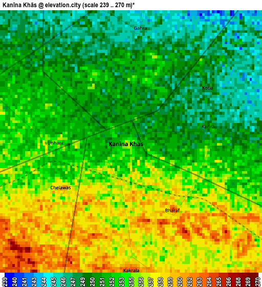
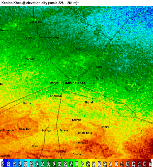
Below is the Elevation map of Kanīna Khās, which displays elevation range with different colors. Scale of the first map is from 239 to 270 m (784 to 886 ft) with average elevation of 252.9 meters (=830 ft) [note 1]
These maps also provides idea of topography and contour of this city, they are displayed at different zoom levels. More info about maps, scale and edge coordinates you can find below images.
| \ | Map #1 | Map #2 | Topo.Map |
| Scale [m] | 239..270 m | 228..281 m | × |
| Scale [ft] | 784..886 ft | 748..922 ft | × |
| Average | 252.9 m = 830 ft | 253.2 m = 831 ft | × |
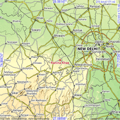
| Width | 8.6 km = 5.3 mi | 17.2 km = 10.7 mi | 275.2 km = 171 mi |
| Height | 8.6 km = 5.3 mi | 17.2 km = 10.7 mi | 275.3 km = 171.1 mi |
| ↑Max Latitude | 28.369605° | 28.408265° | 29.56147° |
| Latitude at center | 28.33093° | 28.33093° | 28.33093° |
| ↓Min Latitude | 28.292241° | 28.253539° | 27.08598° |
| ← Min Longitude | 76.267045° | 76.223099° | 74.90474° |
| Longitude center | 76.31099° | 76.31099° | 76.31099° |
| →Max Longitude | 76.354935° | 76.398881° | 77.71724° |
Nearby cities:
Cities around Kanīna Khās sort by population:
• Rewāri elevation 259 m
33.5 km,  115°
115°
• Nārnaul 311 m
37.5 km,  211°
211°
• Charkhi Dādri 225 m
29.2 km,  352°
352°
• Jhajjar 224 m
45.6 km,  47°
47°
• Behror 325 m
49.3 km,  183°
183°
• Mahendragarh 276 m
17 km,  246°
246°
• Dhāruhera 255 m
49.6 km,  106°
106°
• Pataudi 235 m
45.8 km,  90°
90°
• Beri Khās 226 m
48.7 km,  32°
32°
• Bāwal 266 m
39.3 km,  137°
137°
• Lohāru 275 m
50.4 km,  282°
282°
• Ateli Mandi 290 m
26.1 km,  191°
191°
Multilingual:
 En español:
Kanīna Khās elevación 255 m.
 En France:
Kanīna Khās élévation 255 m.
 Auf Deutsch:
Kanīna Khās höhe über dem Meeresspiegel ist 255 m.

Sources and notes:
- [note 1] Map square and city borders are not equal. Map elevation data is calculated only from area inside that square.
- [src 1] Elevation data from geonames database provided with same terms of usage.
- [src 2] The elevation map of Kanīna Khās is generated using elevation data from NASA's 3 arcsec (90m) resolution SRTM data.
- [src 3] Base (background) map © OpenStreetMap contributors tiles are generated by Geofabrik and OpenTopoMap.
Copyright & License:
This Kanīna Khās Elevation Map is licensed under CC BY-SA. You may reuse any part from this page, if you give a proper credit by linking to this URL:
 More info on terms of use page.