Khetri elevation
Khetri (Rajasthan, Jhunjhunūn), India elevation is 398 meters and Khetri elevation in feet is 1306 ft above sea level [src 1]. Khetri is a populated place (feature code) with elevation that is 105 meters (344 ft) bigger than average city elevation in India.
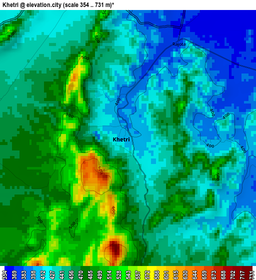
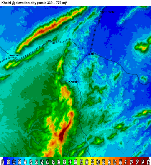
Below is the Elevation map of Khetri, which displays elevation range with different colors. Scale of the first map is from 354 to 731 m (1161 to 2398 ft) with average elevation of 451.8 meters (=1482 ft) [note 1]
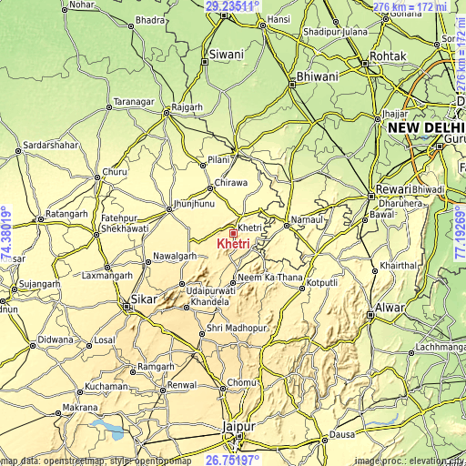
These maps also provides idea of topography and contour of this city, they are displayed at different zoom levels. More info about maps, scale and edge coordinates you can find below images.
| \ | Map #1 | Map #2 | Topo.Map |
| Scale [m] | 354..731 m | 339..779 m | × |
| Scale [ft] | 1161..2398 ft | 1112..2556 ft | × |
| Average | 451.8 m = 1482 ft | 436.7 m = 1433 ft | × |
| Width | 8.63 km = 5.4 mi | 17.26 km = 10.7 mi | 276.1 km = 171.6 mi |
| Height | 8.63 km = 5.4 mi | 17.26 km = 10.7 mi | 276.1 km = 171.6 mi |
| ↑Max Latitude | 28.039484° | 28.078264° | 29.23511° |
| Latitude at center | 28.00069° | 28.00069° | 28.00069° |
| ↓Min Latitude | 27.961882° | 27.92306° | 26.75197° |
| ← Min Longitude | 75.742495° | 75.698549° | 74.38019° |
| Longitude center | 75.78644° | 75.78644° | 75.78644° |
| →Max Longitude | 75.830385° | 75.874331° | 77.19269° |
Nearby cities:
Cities around Khetri sort by population:
• Jhunjhunūn elevation 343 m
40.6 km,  290°
290°
• Nārnaul 311 m
32 km,  81°
81°
• Chidawa 316 m
30.2 km,  331°
331°
• Neem ka Thana 458 m
29 km,  179°
179°
• Udaipur 446 m
43.7 km,  225°
225°
• Pilāni 296 m
44.5 km,  336°
336°
• Behror 325 m
50.2 km,  104°
104°
• Mahendragarh 276 m
46.7 km,  50°
50°
• Sūrajgarh 298 m
34.8 km,  351°
351°
• Bagar 328 m
35 km,  306°
306°
• Lohāru 275 m
47.8 km,  2°
2°
• Ateli Mandi 290 m
47.8 km, 76°
Multilingual:
 En español:
Khetri elevación 398 m.
 En France:
Khetri élévation 398 m.


Sources and notes:
- [note 1] Map square and city borders are not equal. Map elevation data is calculated only from area inside that square.
- [src 1] Elevation data from geonames database provided with same terms of usage.
- [src 2] The elevation map of Khetri is generated using elevation data from NASA's 3 arcsec (90m) resolution SRTM data.
- [src 3] Base (background) map © OpenStreetMap contributors tiles are generated by Geofabrik and OpenTopoMap.
Copyright & License:
This Khetri Elevation Map is licensed under CC BY-SA. You may reuse any part from this page, if you give a proper credit by linking to this URL:
 More info on terms of use page.