Osmanabad elevation
Osmanabad (Maharashtra), India elevation is 665 meters and Osmanabad elevation in feet is 2182 ft above sea level [src 1]. Osmanabad is a seat of a third-order administrative division (feature code) with elevation that is 372 meters (1220 ft) bigger than average city elevation in India.
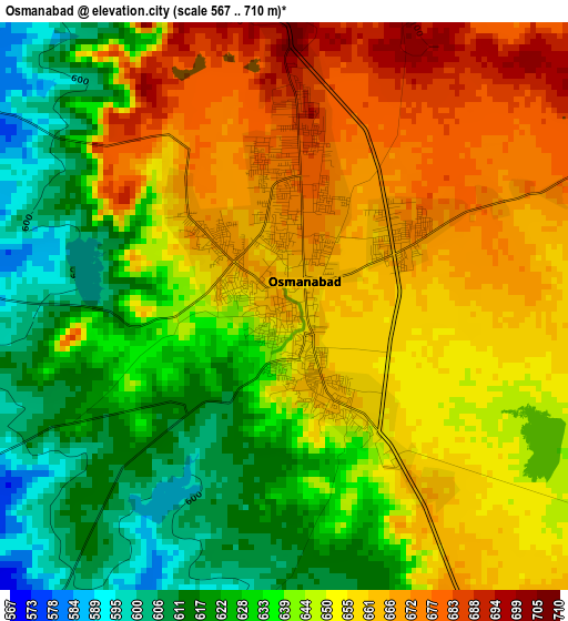
Below is the Elevation map of Osmanabad, which displays elevation range with different colors. Scale of the first map is from 567 to 710 m (1860 to 2329 ft) with average elevation of 645 meters (=2116 ft) [note 1]
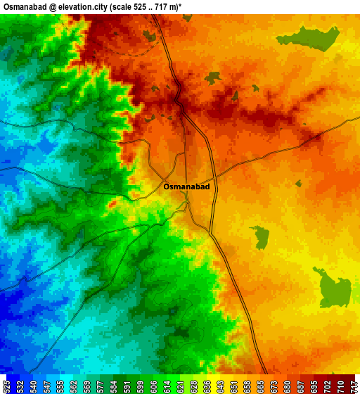
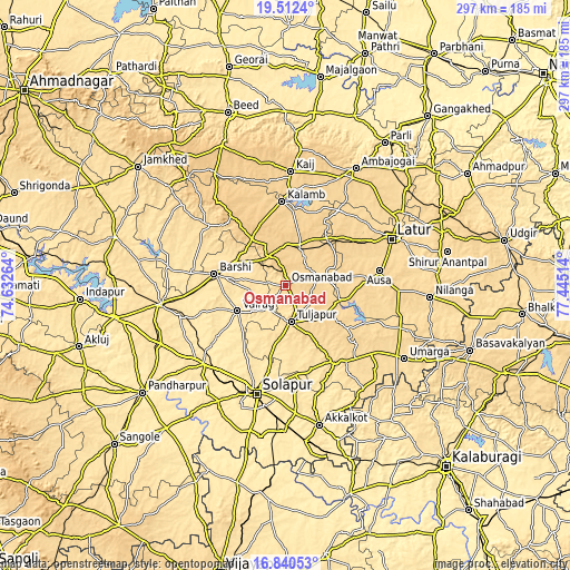
These maps also provides idea of topography and contour of this city, they are displayed at different zoom levels. More info about maps, scale and edge coordinates you can find below images.
| \ | Map #1 | Map #2 | Topo.Map |
| Scale [m] | 567..710 m | 525..717 m | × |
| Scale [ft] | 1860..2329 ft | 1722..2352 ft | × |
| Average | 645 m = 2116 ft | 628.5 m = 2062 ft | × |
| Width | 9.28 km = 5.8 mi | 18.57 km = 11.5 mi | 297.1 km = 184.6 mi |
| Height | 9.28 km = 5.8 mi | 18.57 km = 11.5 mi | 297.1 km = 184.6 mi |
| ↑Max Latitude | 18.223326° | 18.265062° | 19.5124° |
| Latitude at center | 18.18158° | 18.18158° | 18.18158° |
| ↓Min Latitude | 18.139824° | 18.098058° | 16.84053° |
| ← Min Longitude | 75.994945° | 75.950999° | 74.63264° |
| Longitude center | 76.03889° | 76.03889° | 76.03889° |
| →Max Longitude | 76.082835° | 76.126781° | 77.44514° |
Nearby cities:
Cities around Osmanabad sort by population:
• Solāpur elevation 473 m
58.3 km,  193°
193°
• Latur 638 m
60.8 km,  66°
66°
• Bārsi 518 m
37 km,  279°
279°
• Ambājogāi 633 m
71.4 km,  30°
30°
• Tuljāpur 647 m
19.6 km,  170°
170°
• Ausa 637 m
49.2 km,  81°
81°
• Kurduvādi 516 m
66.6 km,  261°
261°
• Dhārūr 737 m
71.4 km,  5°
5°
• Bhūm 592 m
50.6 km,  307°
307°
• Moram 586 m
63.2 km,  133°
133°
• Naldurg 568 m
48 km,  147°
147°
• Kāti 515 m
29.2 km,  212°
212°
Multilingual:
 En español:
Osmanabad elevación 665 m.
 En France:
Osmanabad élévation 665 m.
 Auf Deutsch:
Osmanabad höhe über dem Meeresspiegel ist 665 m.

Sources and notes:
- [note 1] Map square and city borders are not equal. Map elevation data is calculated only from area inside that square.
- [src 1] Elevation data from geonames database provided with same terms of usage.
- [src 2] The elevation map of Osmanabad is generated using elevation data from NASA's 3 arcsec (90m) resolution SRTM data.
- [src 3] Base (background) map © OpenStreetMap contributors tiles are generated by Geofabrik and OpenTopoMap.
Copyright & License:
This Osmanabad Elevation Map is licensed under CC BY-SA. You may reuse any part from this page, if you give a proper credit by linking to this URL:
 More info on terms of use page.