Bhūm elevation
Bhūm (Maharashtra, Osmanabad), India elevation is 592 meters and Bhūm elevation in feet is 1942 ft above sea level [src 1]. Bhūm is a populated place (feature code) with elevation that is 299 meters (981 ft) bigger than average city elevation in India.
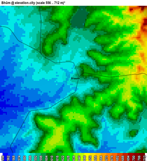
Below is the Elevation map of Bhūm, which displays elevation range with different colors. Scale of the first map is from 556 to 712 m (1824 to 2336 ft) with average elevation of 601.3 meters (=1973 ft) [note 1]
These maps also provides idea of topography and contour of this city, they are displayed at different zoom levels. More info about maps, scale and edge coordinates you can find below images.
| \ | Map #1 | Map #2 | Topo.Map |
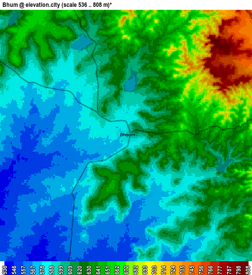
| Scale [m] | 556..712 m | 536..808 m | × |
| Scale [ft] | 1824..2336 ft | 1759..2651 ft | × |
| Average | 601.3 m = 1973 ft | 612.4 m = 2009 ft | × |
| Width | 9.27 km = 5.8 mi | 18.54 km = 11.5 mi | 296.6 km = 184.3 mi |
| Height | 9.27 km = 5.8 mi | 18.54 km = 11.5 mi | 296.6 km = 184.3 mi |
| ↑Max Latitude | 18.500759° | 18.542428° | 19.78769° |
| Latitude at center | 18.45908° | 18.45908° | 18.45908° |
| ↓Min Latitude | 18.417391° | 18.375691° | 17.12011° |
| ← Min Longitude | 75.614825° | 75.570879° | 74.25252° |
| Longitude center | 75.65877° | 75.65877° | 75.65877° |
| →Max Longitude | 75.702715° | 75.746661° | 77.06502° |
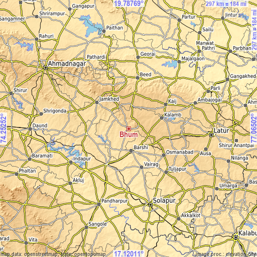
Nearby cities:
Cities around Bhūm sort by population:
• Solāpur elevation 473 m
91.5 km,  163°
163°
• Bārsi 518 m
25.2 km,  171°
171°
• Osmanabad 665 m
50.6 km,  127°
127°
• Ambājogāi 633 m
82.5 km,  68°
68°
• Tuljāpur 647 m
66.3 km,  139°
139°
• Ausa 637 m
91.8 km,  104°
104°
• Gevrai 465 m
90 km,  6°
6°
• Kurduvādi 516 m
48.1 km,  212°
212°
• Karmāla 559 m
49.4 km,  263°
263°
• Dhārūr 737 m
62.2 km,  49°
49°
• Kāti 515 m
60.4 km, 156°
• Beed 512 m
59.8 km, 9°
Multilingual:
 En español:
Bhūm elevación 592 m.
 En France:
Bhūm élévation 592 m.


Sources and notes:
- [note 1] Map square and city borders are not equal. Map elevation data is calculated only from area inside that square.
- [src 1] Elevation data from geonames database provided with same terms of usage.
- [src 2] The elevation map of Bhūm is generated using elevation data from NASA's 3 arcsec (90m) resolution SRTM data.
- [src 3] Base (background) map © OpenStreetMap contributors tiles are generated by Geofabrik and OpenTopoMap.
Copyright & License:
This Bhūm Elevation Map is licensed under CC BY-SA. You may reuse any part from this page, if you give a proper credit by linking to this URL:
 More info on terms of use page.