Pināhat elevation
Pināhat (Uttar Pradesh, Āgra), India elevation is 159 meters and Pināhat elevation in feet is 522 ft above sea level [src 1]. Pināhat is a populated place (feature code) with elevation that is 134 meters (440 ft) smaller than average city elevation in India.
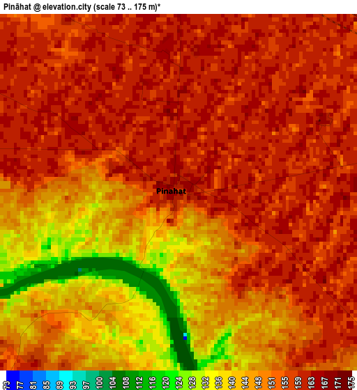
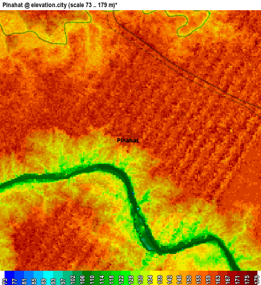
Below is the Elevation map of Pināhat, which displays elevation range with different colors. Scale of the first map is from 73 to 175 m (240 to 574 ft) with average elevation of 153 meters (=502 ft) [note 1]
These maps also provides idea of topography and contour of this city, they are displayed at different zoom levels. More info about maps, scale and edge coordinates you can find below images.
| \ | Map #1 | Map #2 | Topo.Map |
| Scale [m] | 73..175 m | 73..179 m | × |
| Scale [ft] | 240..574 ft | 240..587 ft | × |
| Average | 153 m = 502 ft | 152.3 m = 500 ft | × |
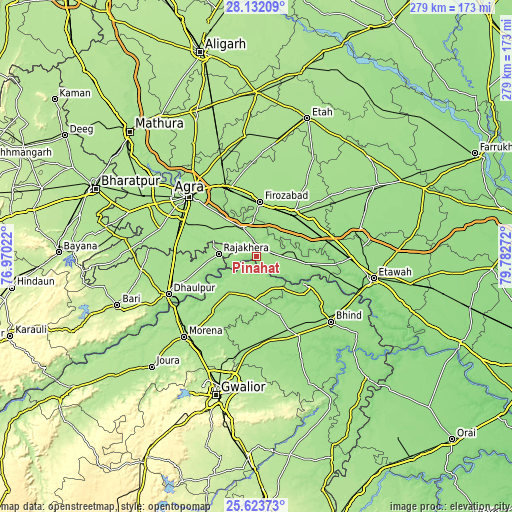
| Width | 8.72 km = 5.4 mi | 17.43 km = 10.8 mi | 278.9 km = 173.3 mi |
| Height | 8.72 km = 5.4 mi | 17.43 km = 10.8 mi | 278.9 km = 173.3 mi |
| ↑Max Latitude | 26.924059° | 26.963234° | 28.13209° |
| Latitude at center | 26.88487° | 26.88487° | 26.88487° |
| ↓Min Latitude | 26.845668° | 26.806452° | 25.62373° |
| ← Min Longitude | 78.332525° | 78.288579° | 76.97022° |
| Longitude center | 78.37647° | 78.37647° | 78.37647° |
| →Max Longitude | 78.420415° | 78.464361° | 79.78272° |
Nearby cities:
Cities around Pināhat sort by population:
• Fīrozābād elevation 169 m
29.7 km,  4°
4°
• Shikohābād 165 m
32.4 km,  40°
40°
• Tūndla 167 m
39.2 km,  339°
339°
• Ambāh 176 m
25 km,  216°
216°
• Porsa 170 m
23.4 km,  181°
181°
• Shamsābād 170 m
29.1 km,  300°
300°
• Rājākhera 169 m
20.4 km,  274°
274°
• Sirsāganj 165 m
36.2 km,  58°
58°
• Itimādpur 167 m
42.8 km, 335°
• Fatehābād 169 m
17.4 km, 335°
• Bāh 160 m
21.6 km,  94°
94°
• Jasrāna 168 m
47.6 km,  34°
34°
Multilingual:
 En español:
Pināhat elevación 159 m.
 En France:
Pināhat élévation 159 m.


Sources and notes:
- [note 1] Map square and city borders are not equal. Map elevation data is calculated only from area inside that square.
- [src 1] Elevation data from geonames database provided with same terms of usage.
- [src 2] The elevation map of Pināhat is generated using elevation data from NASA's 3 arcsec (90m) resolution SRTM data.
- [src 3] Base (background) map © OpenStreetMap contributors tiles are generated by Geofabrik and OpenTopoMap.
Copyright & License:
This Pināhat Elevation Map is licensed under CC BY-SA. You may reuse any part from this page, if you give a proper credit by linking to this URL:
 More info on terms of use page.