Tūndla elevation
Tūndla (Uttar Pradesh, Firozabad), India elevation is 167 meters and Tūndla elevation in feet is 548 ft above sea level [src 1]. Tūndla is a populated place (feature code) with elevation that is 126 meters (413 ft) smaller than average city elevation in India.
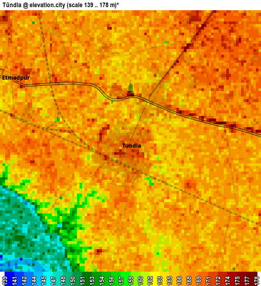
Below is the Elevation map of Tūndla, which displays elevation range with different colors. Scale of the first map is from 139 to 178 m (456 to 584 ft) with average elevation of 164.9 meters (=541 ft) [note 1]
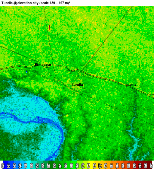
These maps also provides idea of topography and contour of this city, they are displayed at different zoom levels. More info about maps, scale and edge coordinates you can find below images.
| \ | Map #1 | Map #2 | Topo.Map |
| Scale [m] | 139..178 m | 139..197 m | × |
| Scale [ft] | 456..584 ft | 456..646 ft | × |
| Average | 164.9 m = 541 ft | 163.4 m = 536 ft | × |
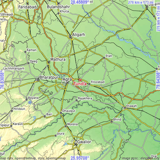
| Width | 8.69 km = 5.4 mi | 17.38 km = 10.8 mi | 278.1 km = 172.8 mi |
| Height | 8.69 km = 5.4 mi | 17.38 km = 10.8 mi | 278.1 km = 172.8 mi |
| ↑Max Latitude | 27.253674° | 27.292734° | 28.45809° |
| Latitude at center | 27.2146° | 27.2146° | 27.2146° |
| ↓Min Latitude | 27.175513° | 27.136411° | 25.95708° |
| ← Min Longitude | 78.192885° | 78.148939° | 76.83058° |
| Longitude center | 78.23683° | 78.23683° | 78.23683° |
| →Max Longitude | 78.280775° | 78.324721° | 79.64308° |
Nearby cities:
Cities around Tūndla sort by population:
• Agra elevation 166 m
22 km,  260°
260°
• Fīrozābād 169 m
17.4 km,  113°
113°
• Shikohābād 165 m
36.6 km, 108°
• Jalesar 179 m
29.5 km,  12°
12°
• Sadābād 171 m
31.7 km,  321°
321°
• Shamsābād 170 m
24.6 km,  207°
207°
• Rājākhera 169 m
35.8 km,  190°
190°
• Itimādpur 167 m
4.5 km,  301°
301°
• Fatehābād 169 m
21.9 km,  162°
162°
• Pināhat 159 m
39.2 km, 159°
• Pharihā 171 m
26.2 km,  62°
62°
• Dayāl Bāgh 168 m
22.3 km,  271°
271°
Multilingual:
 En español:
Tūndla elevación 167 m.
 En France:
Tūndla élévation 167 m.


Sources and notes:
- [note 1] Map square and city borders are not equal. Map elevation data is calculated only from area inside that square.
- [src 1] Elevation data from geonames database provided with same terms of usage.
- [src 2] The elevation map of Tūndla is generated using elevation data from NASA's 3 arcsec (90m) resolution SRTM data.
- [src 3] Base (background) map © OpenStreetMap contributors tiles are generated by Geofabrik and OpenTopoMap.
Copyright & License:
This Tūndla Elevation Map is licensed under CC BY-SA. You may reuse any part from this page, if you give a proper credit by linking to this URL:
 More info on terms of use page.