Shamsābād elevation
Shamsābād (Uttar Pradesh, Āgra), India elevation is 170 meters and Shamsābād elevation in feet is 558 ft above sea level [src 1]. Shamsābād is a populated place (feature code) with elevation that is 123 meters (404 ft) smaller than average city elevation in India.
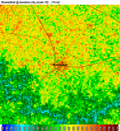
Below is the Elevation map of Shamsābād, which displays elevation range with different colors. Scale of the first map is from 152 to 174 m (499 to 571 ft) with average elevation of 164.9 meters (=541 ft) [note 1]
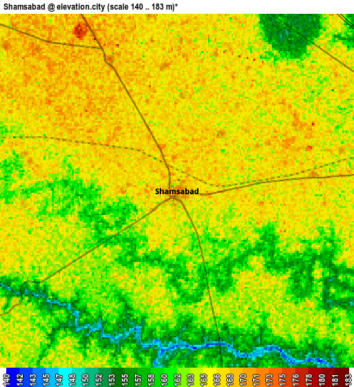
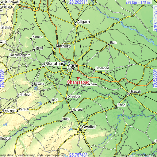
These maps also provides idea of topography and contour of this city, they are displayed at different zoom levels. More info about maps, scale and edge coordinates you can find below images.
| \ | Map #1 | Map #2 | Topo.Map |
| Scale [m] | 152..174 m | 140..183 m | × |
| Scale [ft] | 499..571 ft | 459..600 ft | × |
| Average | 164.9 m = 541 ft | 163.8 m = 537 ft | × |
| Width | 8.71 km = 5.4 mi | 17.41 km = 10.8 mi | 278.6 km = 173.1 mi |
| Height | 8.71 km = 5.4 mi | 17.41 km = 10.8 mi | 278.6 km = 173.1 mi |
| ↑Max Latitude | 27.056323° | 27.095452° | 28.26291° |
| Latitude at center | 27.01718° | 27.01718° | 27.01718° |
| ↓Min Latitude | 26.978024° | 26.938854° | 25.75748° |
| ← Min Longitude | 78.079635° | 78.035689° | 76.71733° |
| Longitude center | 78.12358° | 78.12358° | 78.12358° |
| →Max Longitude | 78.167525° | 78.211471° | 79.52983° |
Nearby cities:
Cities around Shamsābād sort by population:
• Agra elevation 166 m
21.3 km,  330°
330°
• Fīrozābād 169 m
31 km,  61°
61°
• Tūndla 167 m
24.6 km,  27°
27°
• Ambāh 176 m
36.3 km,  163°
163°
• Rājākhera 169 m
14.1 km, 160°
• Itimādpur 167 m
25.4 km,  16°
16°
• Fatehābād 169 m
17.8 km,  86°
86°
• Kiraoli 177 m
36.1 km,  291°
291°
• Achhnera 176 m
40.5 km,  296°
296°
• Khairāgarh 171 m
31.3 km,  254°
254°
• Pināhat 159 m
29.1 km,  120°
120°
• Dayāl Bāgh 168 m
25.3 km, 333°
Multilingual:
 En español:
Shamsābād elevación 170 m.
 En France:
Shamsābād élévation 170 m.
 Auf Deutsch:
Shamsābād höhe über dem Meeresspiegel ist 170 m.

Sources and notes:
- [note 1] Map square and city borders are not equal. Map elevation data is calculated only from area inside that square.
- [src 1] Elevation data from geonames database provided with same terms of usage.
- [src 2] The elevation map of Shamsābād is generated using elevation data from NASA's 3 arcsec (90m) resolution SRTM data.
- [src 3] Base (background) map © OpenStreetMap contributors tiles are generated by Geofabrik and OpenTopoMap.
Copyright & License:
This Shamsābād Elevation Map is licensed under CC BY-SA. You may reuse any part from this page, if you give a proper credit by linking to this URL:
 More info on terms of use page.