Sikandarābād elevation
Sikandarābād (Uttar Pradesh, Bulandshahr), India elevation is 209 meters and Sikandarābād elevation in feet is 686 ft above sea level [src 1]. Sikandarābād is a populated place (feature code) with elevation that is 84 meters (276 ft) smaller than average city elevation in India.
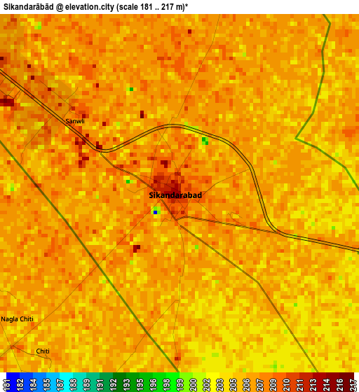
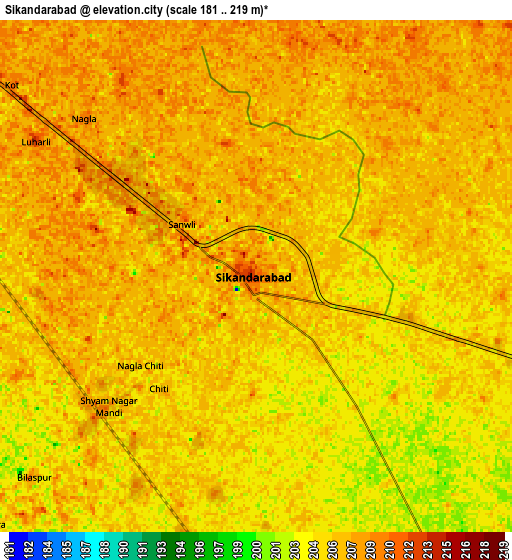
Below is the Elevation map of Sikandarābād, which displays elevation range with different colors. Scale of the first map is from 181 to 217 m (594 to 712 ft) with average elevation of 205.9 meters (=676 ft) [note 1]
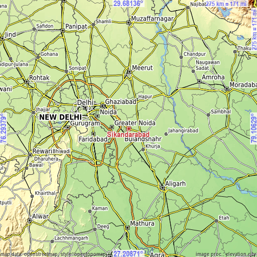
These maps also provides idea of topography and contour of this city, they are displayed at different zoom levels. More info about maps, scale and edge coordinates you can find below images.
| \ | Map #1 | Map #2 | Topo.Map |
| Scale [m] | 181..217 m | 181..219 m | × |
| Scale [ft] | 594..712 ft | 594..719 ft | × |
| Average | 205.9 m = 676 ft | 205.8 m = 675 ft | × |
| Width | 8.59 km = 5.3 mi | 17.18 km = 10.7 mi | 274.9 km = 170.8 mi |
| Height | 8.59 km = 5.3 mi | 17.18 km = 10.7 mi | 274.9 km = 170.8 mi |
| ↑Max Latitude | 28.49089° | 28.529506° | 29.68136° |
| Latitude at center | 28.45226° | 28.45226° | 28.45226° |
| ↓Min Latitude | 28.413616° | 28.374957° | 27.20871° |
| ← Min Longitude | 77.656095° | 77.612149° | 76.29379° |
| Longitude center | 77.70004° | 77.70004° | 77.70004° |
| →Max Longitude | 77.743985° | 77.787931° | 79.10629° |
Nearby cities:
Cities around Sikandarābād sort by population:
• Greater Noida elevation 212 m
16.8 km,  286°
286°
• Bulandshahr 210 m
16.3 km,  109°
109°
• Khurja 205 m
26.8 km,  145°
145°
• Pilkhua 220 m
29.3 km,  351°
351°
• Dādri 214 m
18.1 km,  308°
308°
• Gulāothi 211 m
17.8 km,  30°
30°
• Dāsna 221 m
30.4 km,  325°
325°
• Saidpur 215 m
27 km,  49°
49°
• Rabūpura 200 m
24.3 km,  203°
203°
• Dankaur 207 m
18.1 km,  231°
231°
• Jahāngīrpur 199 m
30.4 km,  179°
179°
• Bīlāspur 207 m
10 km, 227°
Multilingual:
 En español:
Sikandarābād elevación 209 m.
 En France:
Sikandarābād élévation 209 m.
 Auf Deutsch:
Sikandarābād höhe über dem Meeresspiegel ist 209 m.

Sources and notes:
- [note 1] Map square and city borders are not equal. Map elevation data is calculated only from area inside that square.
- [src 1] Elevation data from geonames database provided with same terms of usage.
- [src 2] The elevation map of Sikandarābād is generated using elevation data from NASA's 3 arcsec (90m) resolution SRTM data.
- [src 3] Base (background) map © OpenStreetMap contributors tiles are generated by Geofabrik and OpenTopoMap.
Copyright & License:
This Sikandarābād Elevation Map is licensed under CC BY-SA. You may reuse any part from this page, if you give a proper credit by linking to this URL:
 More info on terms of use page.