Saidpur elevation
Saidpur (Uttar Pradesh, Bulandshahr), India elevation is 215 meters and Saidpur elevation in feet is 705 ft above sea level [src 1]. Saidpur is a populated place (feature code) with elevation that is 78 meters (256 ft) smaller than average city elevation in India.
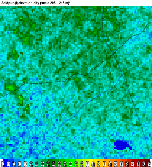
Below is the Elevation map of Saidpur, which displays elevation range with different colors. Scale of the first map is from 205 to 218 m (673 to 715 ft) with average elevation of 210.3 meters (=690 ft) [note 1]
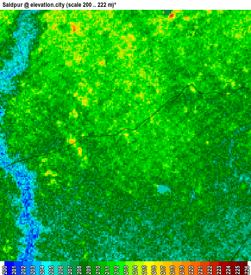
These maps also provides idea of topography and contour of this city, they are displayed at different zoom levels. More info about maps, scale and edge coordinates you can find below images.
| \ | Map #1 | Map #2 | Topo.Map |
| Scale [m] | 205..218 m | 200..222 m | × |
| Scale [ft] | 673..715 ft | 656..728 ft | × |
| Average | 210.3 m = 690 ft | 209.3 m = 687 ft | × |
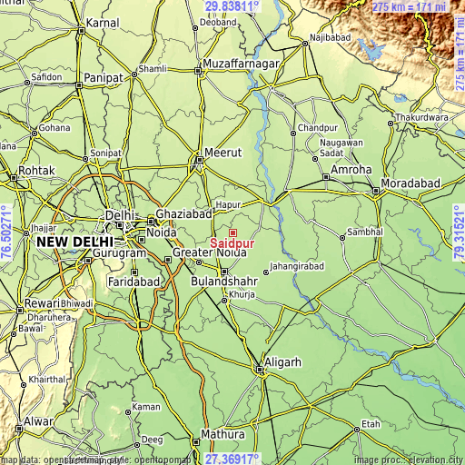
| Width | 8.58 km = 5.3 mi | 17.16 km = 10.7 mi | 274.5 km = 170.6 mi |
| Height | 8.58 km = 5.3 mi | 17.16 km = 10.7 mi | 274.5 km = 170.6 mi |
| ↑Max Latitude | 28.649462° | 28.68802° | 29.83811° |
| Latitude at center | 28.61089° | 28.61089° | 28.61089° |
| ↓Min Latitude | 28.572304° | 28.533703° | 27.36917° |
| ← Min Longitude | 77.865015° | 77.821069° | 76.50271° |
| Longitude center | 77.90896° | 77.90896° | 77.90896° |
| →Max Longitude | 77.952905° | 77.996851° | 79.31521° |
Nearby cities:
Cities around Saidpur sort by population:
• Hāpur elevation 219 m
18.2 km,  316°
316°
• Bulandshahr 210 m
23.6 km,  192°
192°
• Pilkhua 220 m
27.2 km,  294°
294°
• Sikandarābād 209 m
27 km,  229°
229°
• Jahāngīrābād 206 m
29.9 km,  139°
139°
• Gulāothi 211 m
11.6 km,  258°
258°
• Garhmuktesar 215 m
27.2 km,  43°
43°
• Kithor 226 m
28.6 km,  5°
5°
• Khānpur 211 m
17.5 km,  119°
119°
• Kharkhauda 225 m
29.9 km,  326°
326°
• Farīdnagar 219 m
32.5 km,  302°
302°
• Babugarh 216 m
13.9 km, 334°
Multilingual:
 En español:
Saidpur elevación 215 m.
 En France:
Saidpur élévation 215 m.


Sources and notes:
- [note 1] Map square and city borders are not equal. Map elevation data is calculated only from area inside that square.
- [src 1] Elevation data from geonames database provided with same terms of usage.
- [src 2] The elevation map of Saidpur is generated using elevation data from NASA's 3 arcsec (90m) resolution SRTM data.
- [src 3] Base (background) map © OpenStreetMap contributors tiles are generated by Geofabrik and OpenTopoMap.
Copyright & License:
This Saidpur Elevation Map is licensed under CC BY-SA. You may reuse any part from this page, if you give a proper credit by linking to this URL:
 More info on terms of use page.