Kithor elevation
Kithor (Uttar Pradesh, Meerut), India elevation is 226 meters and Kithor elevation in feet is 741 ft above sea level [src 1]. Kithor is a populated place (feature code) with elevation that is 67 meters (220 ft) smaller than average city elevation in India.
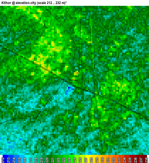
Below is the Elevation map of Kithor, which displays elevation range with different colors. Scale of the first map is from 212 to 232 m (696 to 761 ft) with average elevation of 220.1 meters (=722 ft) [note 1]
These maps also provides idea of topography and contour of this city, they are displayed at different zoom levels. More info about maps, scale and edge coordinates you can find below images.
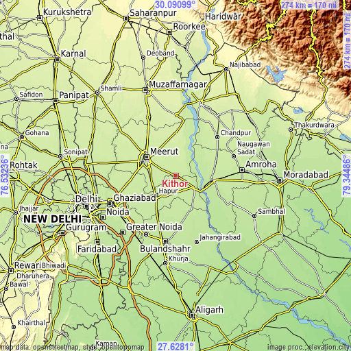
| \ | Map #1 | Map #2 | Topo.Map |
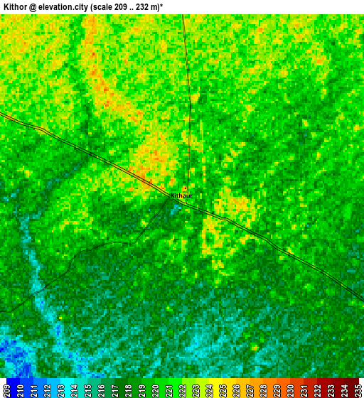
| Scale [m] | 212..232 m | 209..232 m | × |
| Scale [ft] | 696..761 ft | 686..761 ft | × |
| Average | 220.1 m = 722 ft | 219.3 m = 719 ft | × |
| Width | 8.56 km = 5.3 mi | 17.12 km = 10.6 mi | 273.8 km = 170.1 mi |
| Height | 8.56 km = 5.3 mi | 17.12 km = 10.6 mi | 273.9 km = 170.2 mi |
| ↑Max Latitude | 28.905318° | 28.943781° | 30.09099° |
| Latitude at center | 28.86684° | 28.86684° | 28.86684° |
| ↓Min Latitude | 28.828348° | 28.789842° | 27.6281° |
| ← Min Longitude | 77.894665° | 77.850719° | 76.53236° |
| Longitude center | 77.93861° | 77.93861° | 77.93861° |
| →Max Longitude | 77.982555° | 78.026501° | 79.34486° |
Nearby cities:
Cities around Kithor sort by population:
• Meerut elevation 228 m
25.9 km,  299°
299°
• Hāpur 219 m
21.7 km,  225°
225°
• Mawāna 235 m
26.3 km,  356°
356°
• Gajraula 213 m
29.4 km,  94°
94°
• Garhmuktesar 215 m
18.2 km,  119°
119°
• Bachhraon 216 m
29.6 km,  76°
76°
• Lāwar Khās 240 m
31.3 km,  330°
330°
• Parīchhatgarh 232 m
12.4 km, 358°
• Saidpur 215 m
28.6 km,  185°
185°
• Kharkhauda 225 m
19.5 km,  260°
260°
• Farīdnagar 219 m
32 km,  250°
250°
• Babugarh 216 m
18.3 km,  209°
209°
Multilingual:
 En español:
Kithor elevación 226 m.
 En France:
Kithor élévation 226 m.


Sources and notes:
- [note 1] Map square and city borders are not equal. Map elevation data is calculated only from area inside that square.
- [src 1] Elevation data from geonames database provided with same terms of usage.
- [src 2] The elevation map of Kithor is generated using elevation data from NASA's 3 arcsec (90m) resolution SRTM data.
- [src 3] Base (background) map © OpenStreetMap contributors tiles are generated by Geofabrik and OpenTopoMap.
Copyright & License:
This Kithor Elevation Map is licensed under CC BY-SA. You may reuse any part from this page, if you give a proper credit by linking to this URL:
 More info on terms of use page.