Parīchhatgarh elevation
Parīchhatgarh (Uttar Pradesh, Meerut), India elevation is 232 meters and Parīchhatgarh elevation in feet is 761 ft above sea level [src 1]. Parīchhatgarh is a populated place (feature code) with elevation that is 61 meters (200 ft) smaller than average city elevation in India.
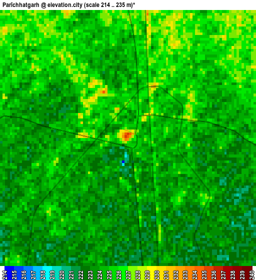
Below is the Elevation map of Parīchhatgarh, which displays elevation range with different colors. Scale of the first map is from 214 to 235 m (702 to 771 ft) with average elevation of 224.1 meters (=735 ft) [note 1]
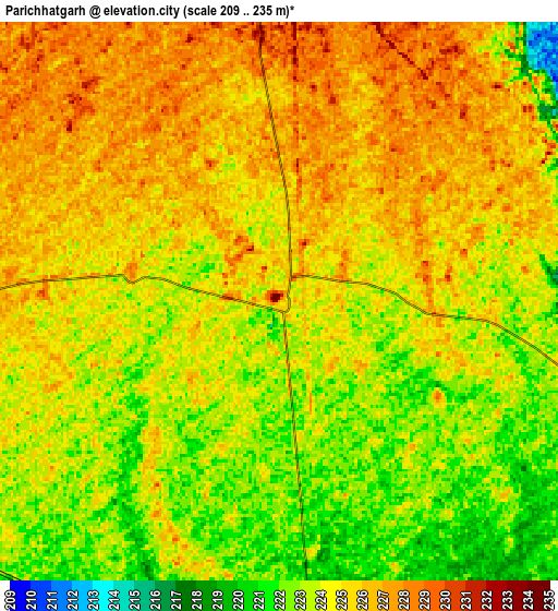
These maps also provides idea of topography and contour of this city, they are displayed at different zoom levels. More info about maps, scale and edge coordinates you can find below images.
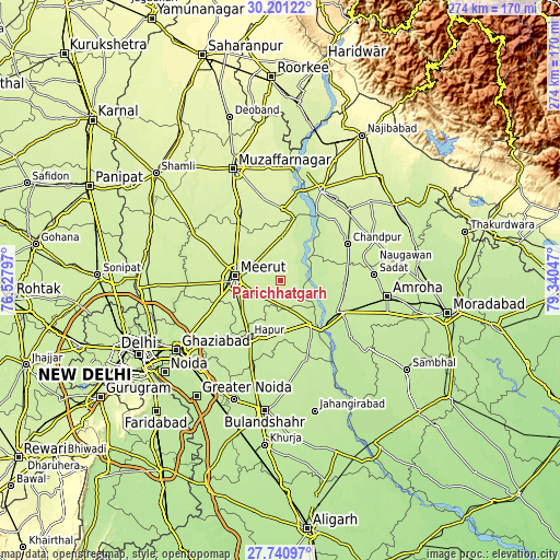
| \ | Map #1 | Map #2 | Topo.Map |
| Scale [m] | 214..235 m | 209..235 m | × |
| Scale [ft] | 702..771 ft | 686..771 ft | × |
| Average | 224.1 m = 735 ft | 224.2 m = 736 ft | × |
| Width | 8.55 km = 5.3 mi | 17.1 km = 10.6 mi | 273.6 km = 170 mi |
| Height | 8.55 km = 5.3 mi | 17.1 km = 10.6 mi | 273.6 km = 170 mi |
| ↑Max Latitude | 29.016846° | 29.055268° | 30.20122° |
| Latitude at center | 28.97841° | 28.97841° | 28.97841° |
| ↓Min Latitude | 28.939959° | 28.901495° | 27.74097° |
| ← Min Longitude | 77.890275° | 77.846329° | 76.52797° |
| Longitude center | 77.93422° | 77.93422° | 77.93422° |
| →Max Longitude | 77.978165° | 78.022111° | 79.34047° |
Nearby cities:
Cities around Parīchhatgarh sort by population:
• Meerut elevation 228 m
22.2 km,  270°
270°
• Mawāna 235 m
13.9 km,  355°
355°
• Garhmuktesar 215 m
26.8 km,  142°
142°
• Bachhraon 216 m
29.8 km,  101°
101°
• Kithor 226 m
12.4 km,  178°
178°
• Hastināpur 221 m
21.5 km,  19°
19°
• Lāwar Khās 240 m
21.2 km,  314°
314°
• Phalauda 238 m
25.4 km,  336°
336°
• Kharkhauda 225 m
24.5 km,  229°
229°
• Bahsūma 236 m
25 km,  8°
8°
• Daurāla 232 m
26.9 km,  303°
303°
• Babugarh 216 m
29.6 km,  196°
196°
Multilingual:
 En español:
Parīchhatgarh elevación 232 m.
 En France:
Parīchhatgarh élévation 232 m.
 Auf Deutsch:
Parīchhatgarh höhe über dem Meeresspiegel ist 232 m.

Sources and notes:
- [note 1] Map square and city borders are not equal. Map elevation data is calculated only from area inside that square.
- [src 1] Elevation data from geonames database provided with same terms of usage.
- [src 2] The elevation map of Parīchhatgarh is generated using elevation data from NASA's 3 arcsec (90m) resolution SRTM data.
- [src 3] Base (background) map © OpenStreetMap contributors tiles are generated by Geofabrik and OpenTopoMap.
Copyright & License:
This Parīchhatgarh Elevation Map is licensed under CC BY-SA. You may reuse any part from this page, if you give a proper credit by linking to this URL:
 More info on terms of use page.