Jahāngīrpur elevation
Jahāngīrpur (Uttar Pradesh, Bulandshahr), India elevation is 199 meters and Jahāngīrpur elevation in feet is 653 ft above sea level [src 1]. Jahāngīrpur is a populated place (feature code) with elevation that is 94 meters (308 ft) smaller than average city elevation in India.
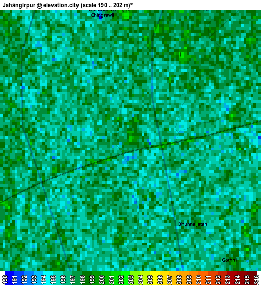
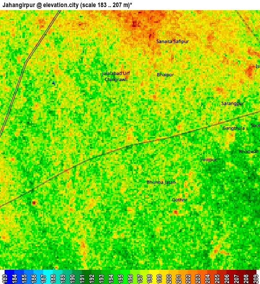
Below is the Elevation map of Jahāngīrpur, which displays elevation range with different colors. Scale of the first map is from 190 to 202 m (623 to 663 ft) with average elevation of 196.3 meters (=644 ft) [note 1]
These maps also provides idea of topography and contour of this city, they are displayed at different zoom levels. More info about maps, scale and edge coordinates you can find below images.
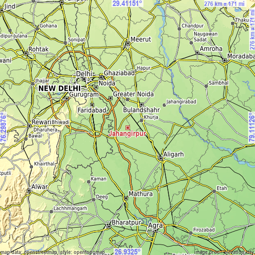
| \ | Map #1 | Map #2 | Topo.Map |
| Scale [m] | 190..202 m | 183..207 m | × |
| Scale [ft] | 623..663 ft | 600..679 ft | × |
| Average | 196.3 m = 644 ft | 196.4 m = 644 ft | × |
| Width | 8.61 km = 5.3 mi | 17.23 km = 10.7 mi | 275.6 km = 171.2 mi |
| Height | 8.61 km = 5.3 mi | 17.23 km = 10.7 mi | 275.6 km = 171.2 mi |
| ↑Max Latitude | 28.21792° | 28.256635° | 29.41151° |
| Latitude at center | 28.17919° | 28.17919° | 28.17919° |
| ↓Min Latitude | 28.140446° | 28.101689° | 26.9325° |
| ← Min Longitude | 77.661065° | 77.617119° | 76.29876° |
| Longitude center | 77.70501° | 77.70501° | 77.70501° |
| →Max Longitude | 77.748955° | 77.792901° | 79.11126° |
Nearby cities:
Cities around Jahāngīrpur sort by population:
• Bulandshahr elevation 210 m
29.1 km,  30°
30°
• Khurja 205 m
16.9 km,  60°
60°
• Sikandarābād 209 m
30.4 km,  359°
359°
• Shikārpūr 202 m
32.3 km,  69°
69°
• Khair 194 m
29.6 km,  152°
152°
• Jewar 200 m
15.8 km,  246°
246°
• Pahāsu 196 m
35.2 km,  91°
91°
• Rabūpura 200 m
12.9 km,  308°
308°
• Dankaur 207 m
24.1 km,  322°
322°
• Hasanpur 194 m
31.1 km,  221°
221°
• Bīlāspur 207 m
24.9 km,  341°
341°
• Bājna 191 m
31.4 km,  184°
184°
Multilingual:
 En español:
Jahāngīrpur elevación 199 m.
 En France:
Jahāngīrpur élévation 199 m.
 Auf Deutsch:
Jahāngīrpur höhe über dem Meeresspiegel ist 199 m.

Sources and notes:
- [note 1] Map square and city borders are not equal. Map elevation data is calculated only from area inside that square.
- [src 1] Elevation data from geonames database provided with same terms of usage.
- [src 2] The elevation map of Jahāngīrpur is generated using elevation data from NASA's 3 arcsec (90m) resolution SRTM data.
- [src 3] Base (background) map © OpenStreetMap contributors tiles are generated by Geofabrik and OpenTopoMap.
Copyright & License:
This Jahāngīrpur Elevation Map is licensed under CC BY-SA. You may reuse any part from this page, if you give a proper credit by linking to this URL:
 More info on terms of use page.