Pahāsu elevation
Pahāsu (Uttar Pradesh, Bulandshahr), India elevation is 196 meters and Pahāsu elevation in feet is 643 ft above sea level [src 1]. Pahāsu is a populated place (feature code) with elevation that is 97 meters (318 ft) smaller than average city elevation in India.
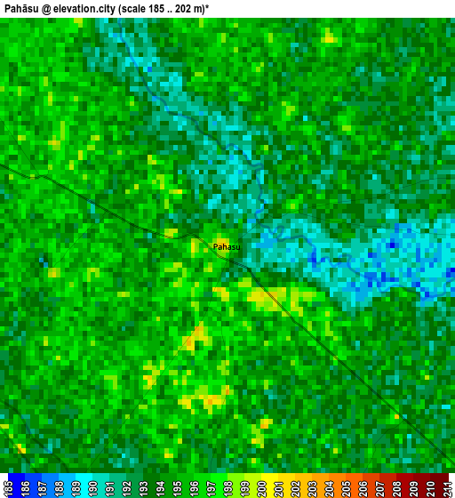
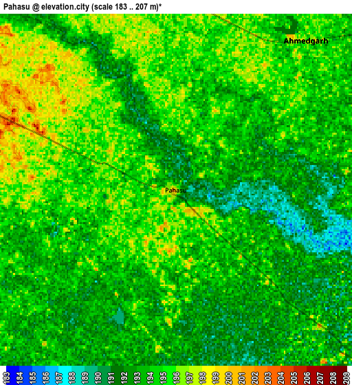
Below is the Elevation map of Pahāsu, which displays elevation range with different colors. Scale of the first map is from 185 to 202 m (607 to 663 ft) with average elevation of 193.8 meters (=636 ft) [note 1]
These maps also provides idea of topography and contour of this city, they are displayed at different zoom levels. More info about maps, scale and edge coordinates you can find below images.
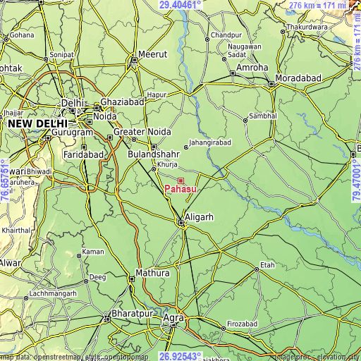
| \ | Map #1 | Map #2 | Topo.Map |
| Scale [m] | 185..202 m | 183..207 m | × |
| Scale [ft] | 607..663 ft | 600..679 ft | × |
| Average | 193.8 m = 636 ft | 193.7 m = 635 ft | × |
| Width | 8.61 km = 5.3 mi | 17.23 km = 10.7 mi | 275.7 km = 171.3 mi |
| Height | 8.61 km = 5.3 mi | 17.23 km = 10.7 mi | 275.7 km = 171.3 mi |
| ↑Max Latitude | 28.210932° | 28.24965° | 29.40461° |
| Latitude at center | 28.1722° | 28.1722° | 28.1722° |
| ↓Min Latitude | 28.133454° | 28.094694° | 26.92543° |
| ← Min Longitude | 78.019815° | 77.975869° | 76.65751° |
| Longitude center | 78.06376° | 78.06376° | 78.06376° |
| →Max Longitude | 78.107705° | 78.151651° | 79.47001° |
Nearby cities:
Cities around Pahāsu sort by population:
• Alīgarh elevation 189 m
32.3 km,  178°
178°
• Bulandshahr 210 m
32.7 km,  321°
321°
• Khurja 205 m
22.3 km,  293°
293°
• Jahāngīrābād 206 m
26.3 km,  9°
9°
• Atraulī 194 m
26.9 km,  126°
126°
• Dibai 199 m
19.8 km,  78°
78°
• Shikārpūr 202 m
13 km,  338°
338°
• Khair 194 m
33.6 km,  220°
220°
• Anūpshahr 197 m
28.8 km,  44°
44°
• Naraura 182 m
31.9 km, 84°
• Babrāla 184 m
35 km,  73°
73°
• Harduāganj 189 m
27 km,  160°
160°
Multilingual:
 En español:
Pahāsu elevación 196 m.
 En France:
Pahāsu élévation 196 m.


Sources and notes:
- [note 1] Map square and city borders are not equal. Map elevation data is calculated only from area inside that square.
- [src 1] Elevation data from geonames database provided with same terms of usage.
- [src 2] The elevation map of Pahāsu is generated using elevation data from NASA's 3 arcsec (90m) resolution SRTM data.
- [src 3] Base (background) map © OpenStreetMap contributors tiles are generated by Geofabrik and OpenTopoMap.
Copyright & License:
This Pahāsu Elevation Map is licensed under CC BY-SA. You may reuse any part from this page, if you give a proper credit by linking to this URL:
 More info on terms of use page.