San Luis Jilotepeque elevation
San Luis Jilotepeque (Jalapa), Guatemala elevation is 853 meters and San Luis Jilotepeque elevation in feet is 2799 ft above sea level [src 1]. San Luis Jilotepeque is a seat of a second-order administrative division (feature code) with elevation that is 414 meters (1358 ft) smaller than average city elevation in Guatemala.
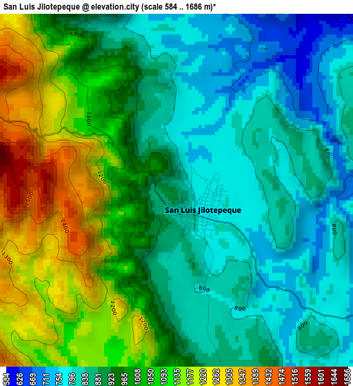
Below is the Elevation map of San Luis Jilotepeque, which displays elevation range with different colors. Scale of the first map is from 584 to 1686 m (1916 to 5531 ft) with average elevation of 956.9 meters (=3139 ft) [note 1]
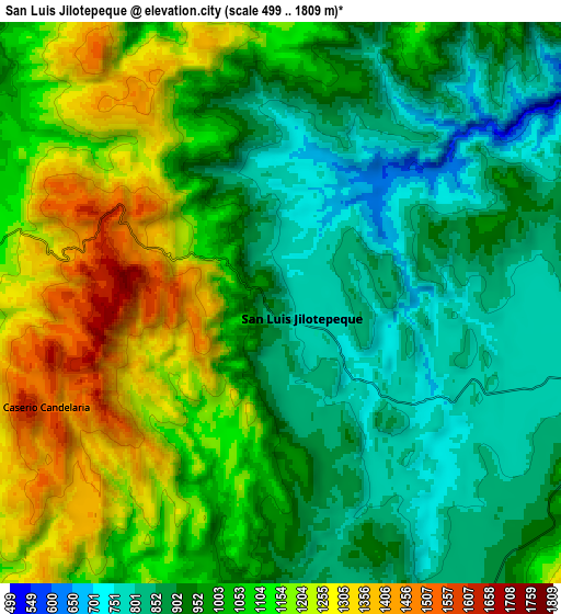
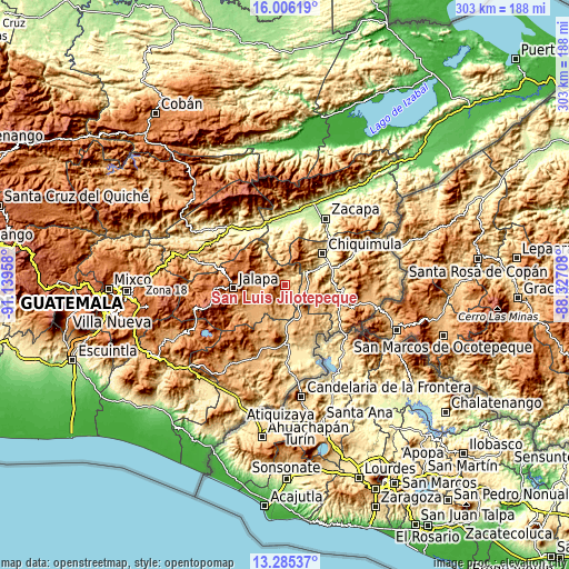
These maps also provides idea of topography and contour of this city, they are displayed at different zoom levels. More info about maps, scale and edge coordinates you can find below images.
| \ | Map #1 | Map #2 | Topo.Map |
| Scale [m] | 584..1686 m | 499..1809 m | × |
| Scale [ft] | 1916..5531 ft | 1637..5935 ft | × |
| Average | 956.9 m = 3139 ft | 1022.5 m = 3355 ft | × |
| Width | 9.45 km = 5.9 mi | 18.91 km = 11.8 mi | 302.5 km = 188 mi |
| Height | 9.45 km = 5.9 mi | 18.91 km = 11.8 mi | 302.6 km = 188 mi |
| ↑Max Latitude | 14.692512° | 14.735017° | 16.00619° |
| Latitude at center | 14.65° | 14.65° | 14.65° |
| ↓Min Latitude | 14.607479° | 14.56495° | 13.28537° |
| ← Min Longitude | -89.777275° | -89.821221° | -91.13958° |
| Longitude center | -89.73333° | -89.73333° | -89.73333° |
| →Max Longitude | -89.689385° | -89.645439° | -88.32708° |
Nearby cities:
Cities around San Luis Jilotepeque sort by population:
• Jalapa elevation 1373 m
27.5 km,  266°
266°
• Chiquimula 425 m
26.2 km,  50°
50°
• Santa Catarina Mita 752 m
22.3 km,  184°
184°
• Monjas 956 m
22 km,  220°
220°
• Ipala 833 m
13.1 km,  106°
106°
• Quezaltepeque 700 m
31.3 km,  92°
92°
• San Pedro Pinula 1090 m
12.7 km,  278°
278°
• Agua Blanca 892 m
18.9 km,  151°
151°
• San Manuel Chaparrón 919 m
15.3 km,  193°
193°
• San José La Arada 442 m
17.8 km,  65°
65°
• San Jacinto 534 m
25.2 km, 85°
• San Diego 705 m
15.8 km,  340°
340°
Multilingual:
 En español:
San Luis Jilotepeque elevación 853 m.
 En France:
San Luis Jilotepeque élévation 853 m.
 Auf Deutsch:
San Luis Jilotepeque höhe über dem Meeresspiegel ist 853 m.
 На русском:
San Luis Jilotepeque высота над уровнем моря 853 м
Sources and notes:
- [note 1] Map square and city borders are not equal. Map elevation data is calculated only from area inside that square.
- [src 1] Elevation data from geonames database provided with same terms of usage.
- [src 2] The elevation map of San Luis Jilotepeque is generated using elevation data from NASA's 3 arcsec (90m) resolution SRTM data.
- [src 3] Base (background) map © OpenStreetMap contributors tiles are generated by Geofabrik and OpenTopoMap.
Copyright & License:
This San Luis Jilotepeque Elevation Map is licensed under CC BY-SA. You may reuse any part from this page, if you give a proper credit by linking to this URL:
 More info on terms of use page.