Ynysybwl elevation
Ynysybwl (Wales, Rhondda Cynon Taf), United Kingdom elevation is 142 meters and Ynysybwl elevation in feet is 466 ft above sea level [src 1]. Ynysybwl is a populated place (feature code) with elevation that is 70 meters (230 ft) bigger than average city elevation in United Kingdom.
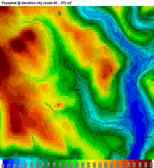
Below is the Elevation map of Ynysybwl, which displays elevation range with different colors. Scale of the first map is from 60 to 372 m (197 to 1220 ft) with average elevation of 211 meters (=692 ft) [note 1]
These maps also provides idea of topography and contour of this city, they are displayed at different zoom levels. More info about maps, scale and edge coordinates you can find below images.
| \ | Map #1 | Topo.Map |
| Scale [m] | 60..372 m | × |
| Scale [ft] | 197..1220 ft | × |
| Average | 211 m = 692 ft | × |
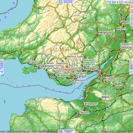
| Width | 6.06 km = 3.8 mi | 194.1 km = 120.6 mi |
| Height | 6.06 km = 3.8 mi | 194.1 km = 120.6 mi |
| ↑Max Latitude | 51.666485° | 52.50358° |
| Latitude at center | 51.63922° | 51.63922° |
| ↓Min Latitude | 51.611939° | 50.75807° |
| ← Min Longitude | -3.404305° | -4.76661° |
| Longitude center | -3.36036° | -3.36036° |
| →Max Longitude | -3.316415° | -1.95411° |
Nearby cities:
Cities around Ynysybwl sort by population:
• Tonypandy elevation 154 m
6.8 km,  253°
253°
• Rhondda 256 m
6.5 km,  289°
289°
• Pontypridd 68 m
4.3 km,  163°
163°
• Gelligaer 233 m
7.7 km,  68°
68°
• Nelson 149 m
5.5 km, 73°
• Treharris 159 m
4.6 km,  52°
52°
• Mountain Ash 116 m
5.1 km,  344°
344°
• Ferndale 236 m
6.5 km, 291°
• Abercynon 84 m
2.4 km, 73°
• Aberfan 131 m
5.7 km,  13°
13°
• Llwynypia 142 m
6.2 km,  263°
263°
• Porth 147 m
4.2 km,  225°
225°
Multilingual:
 En español:
Ynysybwl elevación 142 m.
 En France:
Ynysybwl élévation 142 m.
 Auf Deutsch:
Ynysybwl höhe über dem Meeresspiegel ist 142 m.

Sources and notes:
- [note 1] Map square and city borders are not equal. Map elevation data is calculated only from area inside that square.
- [src 1] Elevation data from geonames database provided with same terms of usage.
- [src 2] The elevation map of Ynysybwl is generated using elevation data from NASA's 3 arcsec (90m) resolution SRTM data.
- [src 3] Base (background) map © OpenStreetMap contributors tiles are generated by Geofabrik and OpenTopoMap.
Copyright & License:
This Ynysybwl Elevation Map is licensed under CC BY-SA. You may reuse any part from this page, if you give a proper credit by linking to this URL:
 More info on terms of use page.