Tonypandy elevation
Tonypandy (Wales, Rhondda Cynon Taf), United Kingdom elevation is 154 meters and Tonypandy elevation in feet is 505 ft above sea level [src 1]. Tonypandy is a populated place (feature code) with elevation that is 82 meters (269 ft) bigger than average city elevation in United Kingdom.
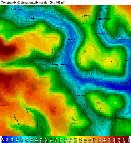
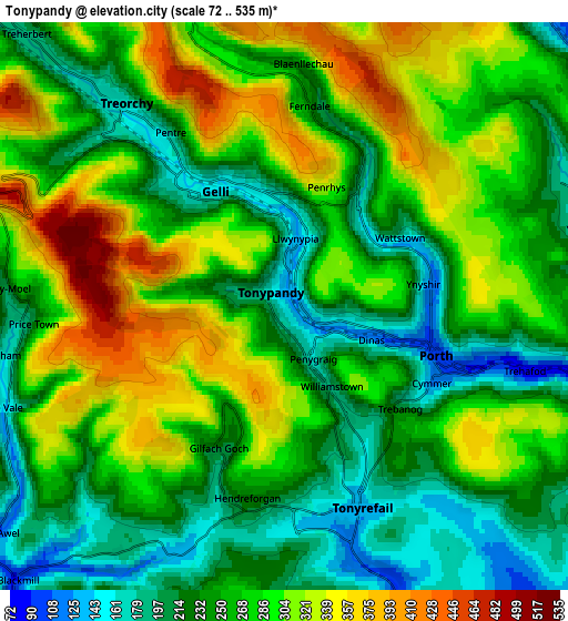
Below is the Elevation map of Tonypandy, which displays elevation range with different colors. Scale of the first map is from 100 to 466 m (328 to 1529 ft) with average elevation of 261.8 meters (=859 ft) [note 1]
These maps also provides idea of topography and contour of this city, they are displayed at different zoom levels. More info about maps, scale and edge coordinates you can find below images.
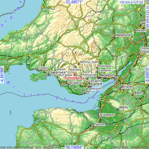
| \ | Map #1 | Map #2 | Topo.Map |
| Scale [m] | 100..466 m | 72..535 m | × |
| Scale [ft] | 328..1529 ft | 236..1755 ft | × |
| Average | 261.8 m = 859 ft | 268 m = 879 ft | × |
| Width | 6.07 km = 3.8 mi | 12.13 km = 7.5 mi | 194.2 km = 120.7 mi |
| Height | 6.07 km = 3.8 mi | 12.13 km = 7.5 mi | 194.1 km = 120.6 mi |
| ↑Max Latitude | 51.649295° | 51.676554° | 52.48671° |
| Latitude at center | 51.62202° | 51.62202° | 51.62202° |
| ↓Min Latitude | 51.594729° | 51.567421° | 50.74054° |
| ← Min Longitude | -3.499385° | -3.543331° | -4.86169° |
| Longitude center | -3.45544° | -3.45544° | -3.45544° |
| →Max Longitude | -3.411495° | -3.367549° | -2.04919° |
Nearby cities:
Cities around Tonypandy sort by population:
• Rhondda elevation 256 m
4.1 km,  6°
6°
• Tonyrefail 143 m
4.6 km,  157°
157°
• Treorchy 161 m
5.4 km,  320°
320°
• Ferndale 236 m
4.3 km, 7°
• Pentre 165 m
4.4 km,  325°
325°
• Gilfach Goch 208 m
3.5 km,  200°
200°
• Ogmore Vale 148 m
6.4 km,  249°
249°
• Price Town 183 m
5.6 km,  265°
265°
• Llwynypia 142 m
1.3 km,  16°
16°
• Maerdy 307 m
6.3 km,  340°
340°
• Porth 147 m
3.7 km,  105°
105°
• Clydach Vale 249 m
1.8 km,  286°
286°
Multilingual:
 En español:
Tonypandy elevación 154 m.
 En France:
Tonypandy élévation 154 m.
 Auf Deutsch:
Tonypandy höhe über dem Meeresspiegel ist 154 m.

Sources and notes:
- [note 1] Map square and city borders are not equal. Map elevation data is calculated only from area inside that square.
- [src 1] Elevation data from geonames database provided with same terms of usage.
- [src 2] The elevation map of Tonypandy is generated using elevation data from NASA's 3 arcsec (90m) resolution SRTM data.
- [src 3] Base (background) map © OpenStreetMap contributors tiles are generated by Geofabrik and OpenTopoMap.
Copyright & License:
This Tonypandy Elevation Map is licensed under CC BY-SA. You may reuse any part from this page, if you give a proper credit by linking to this URL:
 More info on terms of use page.