Gelligaer elevation
Gelligaer (Wales, Caerphilly County Borough), United Kingdom elevation is 233 meters and Gelligaer elevation in feet is 764 ft above sea level [src 1]. Gelligaer is a seat of a third-order administrative division (feature code) with elevation that is 161 meters (528 ft) bigger than average city elevation in United Kingdom.
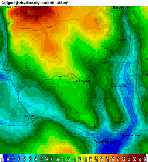
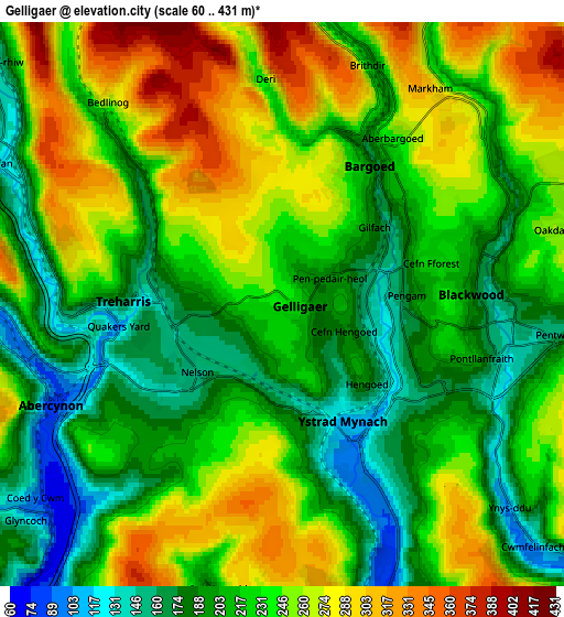
Below is the Elevation map of Gelligaer, which displays elevation range with different colors. Scale of the first map is from 99 to 363 m (325 to 1191 ft) with average elevation of 203.2 meters (=667 ft) [note 1]
These maps also provides idea of topography and contour of this city, they are displayed at different zoom levels. More info about maps, scale and edge coordinates you can find below images.
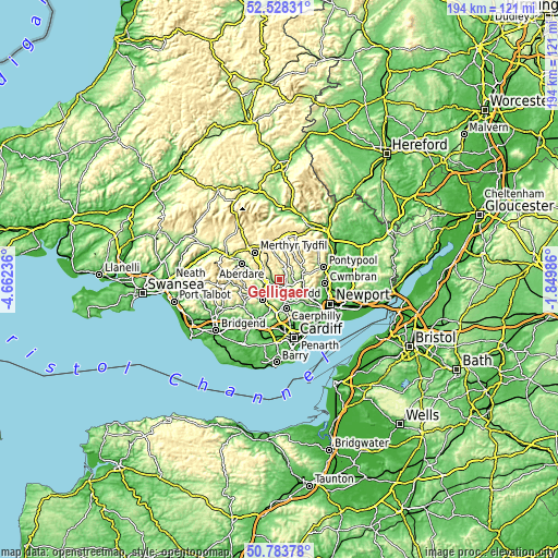
| \ | Map #1 | Map #2 | Topo.Map |
| Scale [m] | 99..363 m | 60..431 m | × |
| Scale [ft] | 325..1191 ft | 197..1414 ft | × |
| Average | 203.2 m = 667 ft | 229.1 m = 752 ft | × |
| Width | 6.06 km = 3.8 mi | 12.12 km = 7.5 mi | 194 km = 120.5 mi |
| Height | 6.06 km = 3.8 mi | 12.12 km = 7.5 mi | 194 km = 120.5 mi |
| ↑Max Latitude | 51.69169° | 51.718923° | 52.52831° |
| Latitude at center | 51.66444° | 51.66444° | 51.66444° |
| ↓Min Latitude | 51.637174° | 51.609892° | 50.78378° |
| ← Min Longitude | -3.300055° | -3.344001° | -4.66236° |
| Longitude center | -3.25611° | -3.25611° | -3.25611° |
| →Max Longitude | -3.212165° | -3.168219° | -1.84986° |
Nearby cities:
Cities around Gelligaer sort by population:
• Blackwood elevation 227 m
3.4 km,  83°
83°
• Bargoed 231 m
2.6 km,  36°
36°
• Nelson 149 m
2.3 km,  237°
237°
• Treharris 159 m
3.5 km,  270°
270°
• Abercynon 84 m
5.3 km,  246°
246°
• Hengoed 205 m
2.3 km,  131°
131°
• New Tredegar 217 m
6.3 km,  9°
9°
• Bedlinog 275 m
5.9 km,  318°
318°
• Deri 234 m
4.9 km,  354°
354°
• Maesycwmmer 102 m
3.6 km,  153°
153°
• Ystrad Mynach 115 m
2.8 km, 150°
• Pengam 134 m
2 km,  87°
87°
Multilingual:
 En español:
Gelligaer elevación 233 m.
 En France:
Gelligaer élévation 233 m.
 Auf Deutsch:
Gelligaer höhe über dem Meeresspiegel ist 233 m.

Sources and notes:
- [note 1] Map square and city borders are not equal. Map elevation data is calculated only from area inside that square.
- [src 1] Elevation data from geonames database provided with same terms of usage.
- [src 2] The elevation map of Gelligaer is generated using elevation data from NASA's 3 arcsec (90m) resolution SRTM data.
- [src 3] Base (background) map © OpenStreetMap contributors tiles are generated by Geofabrik and OpenTopoMap.
Copyright & License:
This Gelligaer Elevation Map is licensed under CC BY-SA. You may reuse any part from this page, if you give a proper credit by linking to this URL:
 More info on terms of use page.